
| Memorials | : | 0 |
| Location | : | Fulbourn, South Cambridgeshire District, England |
| Coordinate | : | 52.1793500, 0.2232800 |
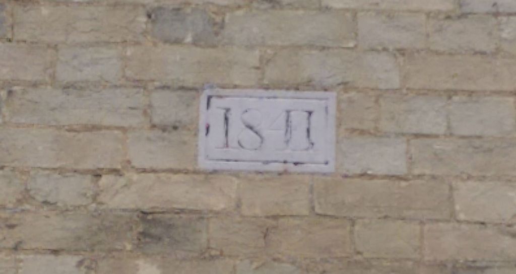
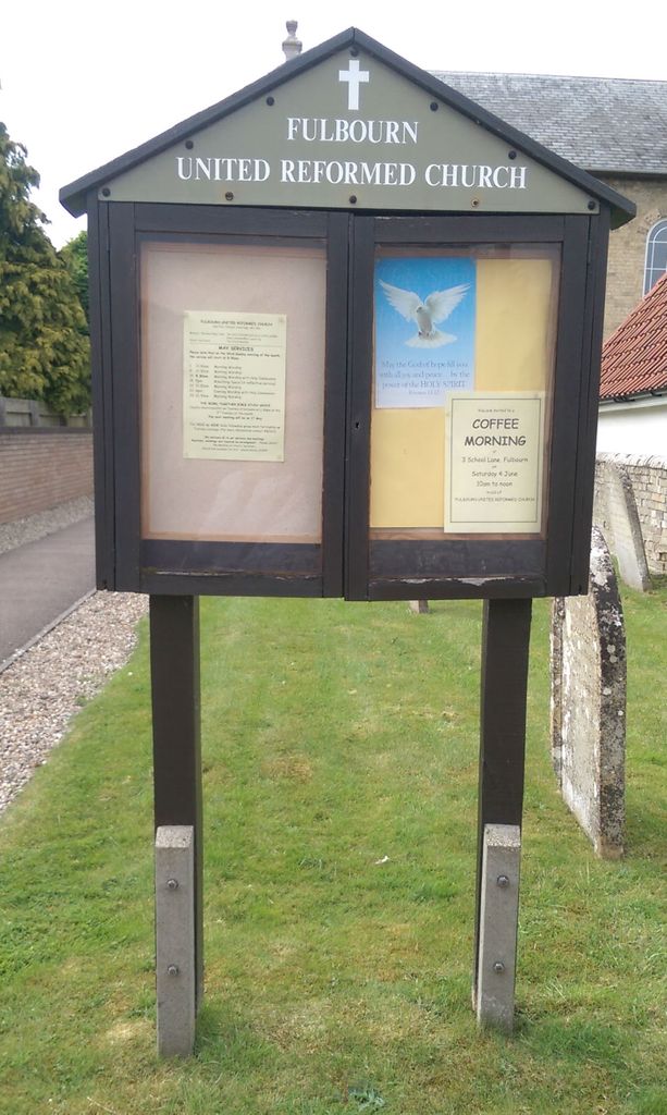
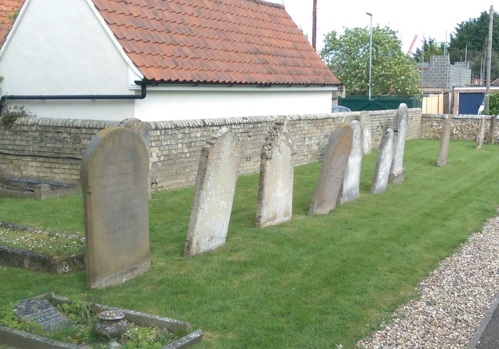
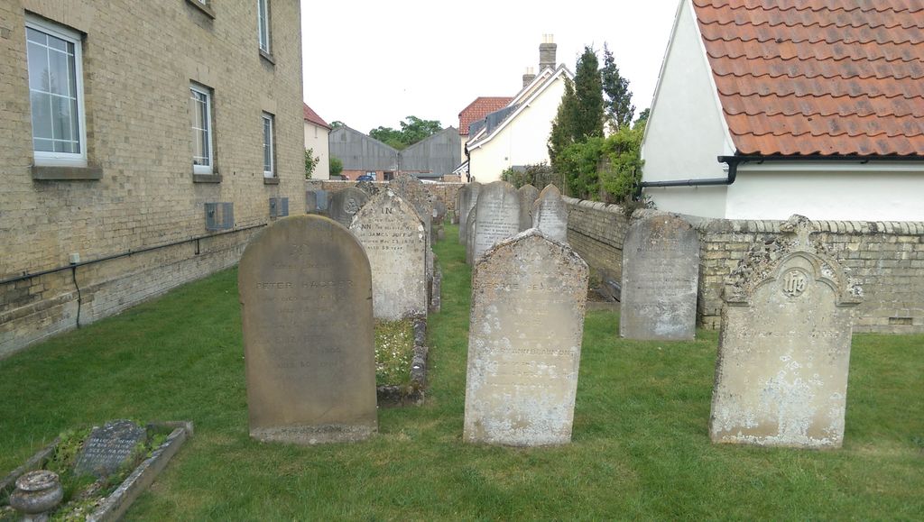
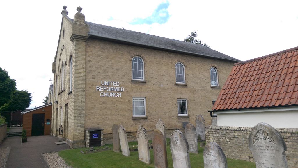
| Description | : | The church is situated approximately 5 miles from the centre of Cambridge in the village of Fulbourn. The original church was built in 1810 and replaced in 1841 with the existing building. It was extensively refurbished during 1989/90 . The church has a small but perfectly formed Graveyard which is well kept and gives the modern building a very traditional feel. To the side of this is a small private graveyard belonging to a well known local Family . (Special thanks to the Good folk at the church for allowing me to photograph their Headstones.) |
frequently asked questions (FAQ):
-
Where is Fulbourn United Reformed Church?
Fulbourn United Reformed Church is located at Home End Fulbourn, South Cambridgeshire District ,Cambridgeshire , CB21 5BSEngland.
-
Fulbourn United Reformed Church cemetery's updated grave count on graveviews.com?
0 memorials
-
Where are the coordinates of the Fulbourn United Reformed Church?
Latitude: 52.1793500
Longitude: 0.2232800
Nearby Cemetories:
1. Fulbourn Cemetery
Fulbourn, South Cambridgeshire District, England
Coordinate: 52.1780300, 0.2223600
2. St Vigor & All Saints Churchyard
Fulbourn, South Cambridgeshire District, England
Coordinate: 52.1832222, 0.2231111
3. St Nicholas Churchyard
Great Wilbraham, South Cambridgeshire District, England
Coordinate: 52.1963890, 0.2638060
4. St Andrew Churchyard
Cherry Hinton, City of Cambridge, England
Coordinate: 52.1919170, 0.1779000
5. Wandlebury House
Cambridge, City of Cambridge, England
Coordinate: 52.1583710, 0.1826703
6. All Saints Churchyard
Teversham, South Cambridgeshire District, England
Coordinate: 52.2046650, 0.1880510
7. Holy Trinity Churchyard
Bottisham, East Cambridgeshire District, England
Coordinate: 52.2207558, 0.2609813
8. Cambridge City Cemetery
Cambridge, City of Cambridge, England
Coordinate: 52.2124080, 0.1665440
9. Bottisham Cemetery
Bottisham, East Cambridgeshire District, England
Coordinate: 52.2217100, 0.2620800
10. St. Mary the Virgin Churchyard
Fen Ditton, South Cambridgeshire District, England
Coordinate: 52.2215560, 0.1691510
11. St. George's Churchyard
Six Mile Bottom, South Cambridgeshire District, England
Coordinate: 52.1861900, 0.3117400
12. Fen Ditton Cemetery
Fen Ditton, South Cambridgeshire District, England
Coordinate: 52.2233300, 0.1696700
13. St. Andrew Churchyard
Stapleford, South Cambridgeshire District, England
Coordinate: 52.1475840, 0.1483810
14. Stapleford Cemetery
Stapleford, South Cambridgeshire District, England
Coordinate: 52.1444700, 0.1475710
15. Mill Road Cemetery
Cambridge, City of Cambridge, England
Coordinate: 52.2009520, 0.1351060
16. St Andrew the Less Abbey Churchyard
Cambridge, City of Cambridge, England
Coordinate: 52.2089000, 0.1397400
17. St Mary Churchyard
Little Abington, South Cambridgeshire District, England
Coordinate: 52.1199720, 0.2326010
18. Barnwell Priory
Cambridge, City of Cambridge, England
Coordinate: 52.2096000, 0.1390000
19. Horningsea Cemetery
Horningsea, South Cambridgeshire District, England
Coordinate: 52.2358100, 0.1832900
20. Christ Church Cemetery
Cambridge, City of Cambridge, England
Coordinate: 52.2078800, 0.1333600
21. Sawston Cemetery
Sawston, South Cambridgeshire District, England
Coordinate: 52.1281361, 0.1649944
22. St. Andrew's Churchyard
Chesterton, City of Cambridge, England
Coordinate: 52.2157600, 0.1397700
23. St Mary Churchyard
Great Abington, South Cambridgeshire District, England
Coordinate: 52.1168760, 0.2342210
24. Lode Baptist Chapel
Lode, East Cambridgeshire District, England
Coordinate: 52.2409600, 0.2436900