
| Memorials | : | 2 |
| Location | : | Defiance County, USA |
| Coordinate | : | 41.3396988, -84.5164032 |
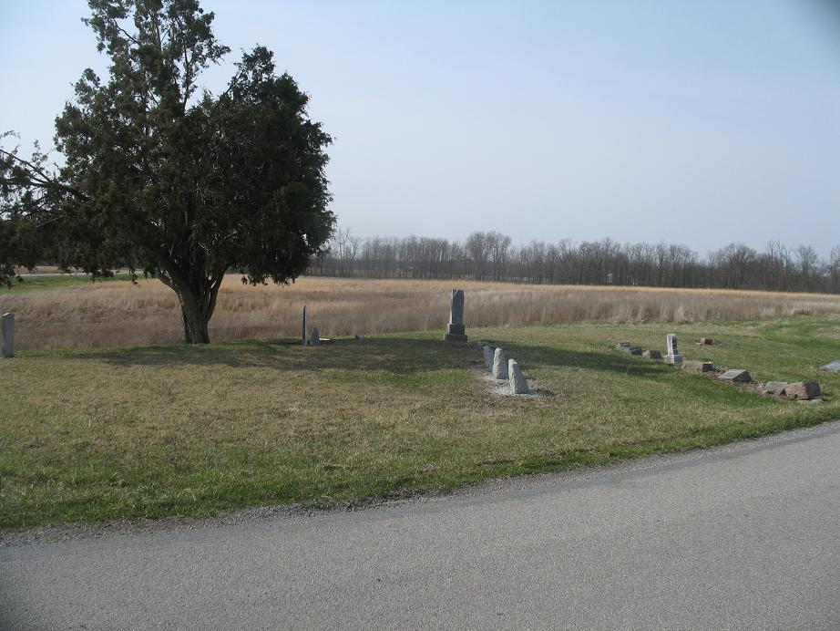
| Description | : | Located in Washington Township, it is on the west side of the Bend Road (TR 134), about 2 ¾ miles south of Ney at Bradshaw Road (TR 64). The cemetery is located in Washington Township, Defiance County, Ohio, and is # 2870 (Funk Cemetery / Mock Cemetery) in “Ohio Cemeteries 1803-2003”, compiled by the Ohio Genealogical Society. The U.S. Geological Survey (USGS) Geographic Names Information System (GNIS) feature ID for the cemetery is 1040730 (Funk Cemetery / Mock Cemetery). |
frequently asked questions (FAQ):
-
Where is Funk Cemetery?
Funk Cemetery is located at Bradshaw Road (Township Road 64) Washington Township, Defiance County ,Ohio , 43549USA.
-
Funk Cemetery cemetery's updated grave count on graveviews.com?
2 memorials
-
Where are the coordinates of the Funk Cemetery?
Latitude: 41.3396988
Longitude: -84.5164032


Nearby Cemetories:
1. Auglaize Village Cemetery
Defiance, Defiance County, USA
Coordinate: 41.3399760, -84.5165610
2. Moats Cemetery
Defiance County, USA
Coordinate: 41.3330420, -84.5194530
3. Lintz Cemetery
Ney, Defiance County, USA
Coordinate: 41.3760986, -84.5402985
4. Doud Cemetery
Ney, Defiance County, USA
Coordinate: 41.3811680, -84.5161110
5. Doll Cemetery
Ney, Defiance County, USA
Coordinate: 41.3809319, -84.4963684
6. Marysdale Immaculate Conception Catholic Cemetery
Ney, Defiance County, USA
Coordinate: 41.3499985, -84.4580994
7. Ney Cemetery
Ney, Defiance County, USA
Coordinate: 41.3856010, -84.5271988
8. Clinker Cemetery
Tiffin Township, Defiance County, USA
Coordinate: 41.3419991, -84.4473038
9. Blue Cemetery
The Bend, Defiance County, USA
Coordinate: 41.2871500, -84.5033200
10. Sherwood Cemetery
Sherwood, Defiance County, USA
Coordinate: 41.2900009, -84.5507965
11. Saint Stephens New Catholic Cemetery
The Bend, Defiance County, USA
Coordinate: 41.2820100, -84.5150800
12. Shirley Family Cemetery
The Bend, Defiance County, USA
Coordinate: 41.2821360, -84.5071690
13. Kibble Cemetery
Defiance County, USA
Coordinate: 41.3586769, -84.4374390
14. Liggett Scouts Burial Ground
The Bend, Defiance County, USA
Coordinate: 41.2761100, -84.5154500
15. Trinity Lutheran Cemetery
Ney, Defiance County, USA
Coordinate: 41.4016991, -84.5353012
16. Saint Johns Lutheran Cemetery
Sherwood, Defiance County, USA
Coordinate: 41.3092003, -84.5931015
17. Saint Stephens Old Cemetery
Defiance County, USA
Coordinate: 41.2747002, -84.4955978
18. Hill Cemetery
Sherwood, Defiance County, USA
Coordinate: 41.2824550, -84.4687870
19. Defiance County Home Cemetery
Evansport, Defiance County, USA
Coordinate: 41.3403810, -84.4216870
20. Defiance County Childrens Home Cemetery
Brunersburg, Defiance County, USA
Coordinate: 41.3461480, -84.4210910
21. Blair Cemetery
Sherwood, Defiance County, USA
Coordinate: 41.2677994, -84.5436020
22. Glore Cemetery
Sherwood, Defiance County, USA
Coordinate: 41.2639008, -84.5342026
23. McCauley Cemetery
Defiance County, USA
Coordinate: 41.3697014, -84.4203033
24. Tuttle Cemetery
Defiance, Defiance County, USA
Coordinate: 41.2756004, -84.4475021