
| Memorials | : | 7 |
| Location | : | The Bend, Defiance County, USA |
| Coordinate | : | 41.2820100, -84.5150800 |
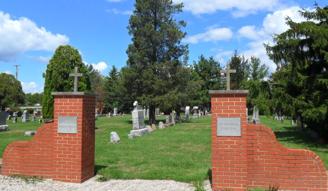
| Description | : | The New Saint Stephens Cemetery is located near the intersection of Speaker road and The Bend road in Delaware township. The church, located across the street from the cemetery, is now called Saint Isidore Parish Delaware Bend. Saint Stephens church started in 1855 as a log church near the old cemetery a few miles away. In 1880 the church moved to its current location. In 2005 Saint Stephens church merged with Marysdale church to form Saint Isidore Catholic Parish. |
frequently asked questions (FAQ):
-
Where is Saint Stephens New Catholic Cemetery?
Saint Stephens New Catholic Cemetery is located at The Bend, Defiance County ,Ohio ,USA.
-
Saint Stephens New Catholic Cemetery cemetery's updated grave count on graveviews.com?
7 memorials
-
Where are the coordinates of the Saint Stephens New Catholic Cemetery?
Latitude: 41.2820100
Longitude: -84.5150800
Nearby Cemetories:
1. Liggett Scouts Burial Ground
The Bend, Defiance County, USA
Coordinate: 41.2761100, -84.5154500
2. Shirley Family Cemetery
The Bend, Defiance County, USA
Coordinate: 41.2821360, -84.5071690
3. Blue Cemetery
The Bend, Defiance County, USA
Coordinate: 41.2871500, -84.5033200
4. Saint Stephens Old Cemetery
Defiance County, USA
Coordinate: 41.2747002, -84.4955978
5. Glore Cemetery
Sherwood, Defiance County, USA
Coordinate: 41.2639008, -84.5342026
6. Blair Cemetery
Sherwood, Defiance County, USA
Coordinate: 41.2677994, -84.5436020
7. Sherwood Cemetery
Sherwood, Defiance County, USA
Coordinate: 41.2900009, -84.5507965
8. Hill Cemetery
Sherwood, Defiance County, USA
Coordinate: 41.2824550, -84.4687870
9. Moats Cemetery
Defiance County, USA
Coordinate: 41.3330420, -84.5194530
10. Tuttle Cemetery
Defiance, Defiance County, USA
Coordinate: 41.2756004, -84.4475021
11. Funk Cemetery
Defiance County, USA
Coordinate: 41.3396988, -84.5164032
12. Auglaize Village Cemetery
Defiance, Defiance County, USA
Coordinate: 41.3399760, -84.5165610
13. Pioneer Cemetery
Defiance County, USA
Coordinate: 41.2641200, -84.4404200
14. Eaton Cemetery
Paulding County, USA
Coordinate: 41.2402992, -84.5783005
15. Saint Johns Lutheran Cemetery
Sherwood, Defiance County, USA
Coordinate: 41.3092003, -84.5931015
16. Colby Cemetery
Defiance County, USA
Coordinate: 41.2532997, -84.5952988
17. Blair-Adams Sun Valley Cemetery
Cecil, Paulding County, USA
Coordinate: 41.2177180, -84.4772200
18. Renollet Cemetery
Paulding County, USA
Coordinate: 41.2122002, -84.5000000
19. Bakle Cemetery
Junction, Paulding County, USA
Coordinate: 41.2091510, -84.4922230
20. Immaculate Conception Cemetery
Crane Township, Paulding County, USA
Coordinate: 41.2325500, -84.5905100
21. Rochester Cemetery
Cecil, Paulding County, USA
Coordinate: 41.2313995, -84.5914001
22. Clinker Cemetery
Tiffin Township, Defiance County, USA
Coordinate: 41.3419991, -84.4473038
23. Marysdale Immaculate Conception Catholic Cemetery
Ney, Defiance County, USA
Coordinate: 41.3499985, -84.4580994
24. Kinzer Cemetery
Paulding County, USA
Coordinate: 41.2016983, -84.5049973