
| Memorials | : | 0 |
| Location | : | Barrow-In-Furness, Barrow-in-Furness Borough, England |
| Coordinate | : | 54.1352780, -3.1977780 |
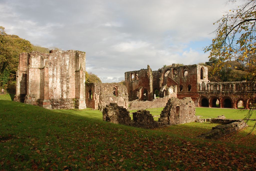
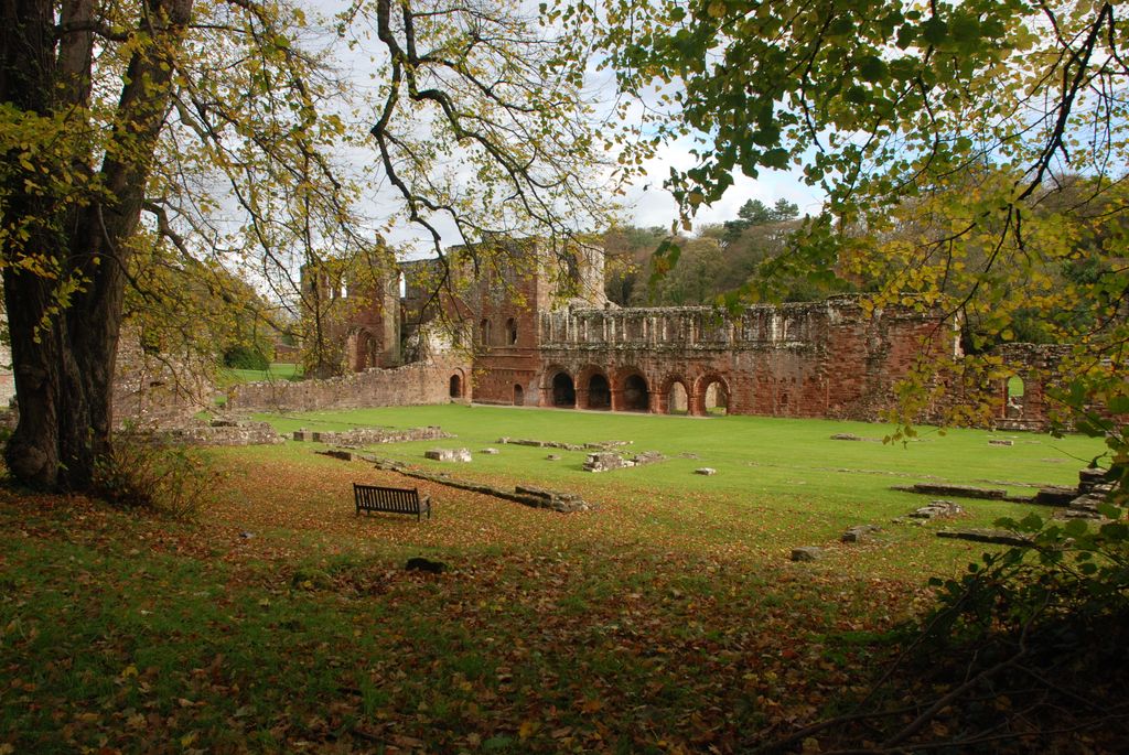
| Description | : | Furness Abbey, or St. Mary of Furness is a former monastery located in the northern outskirts of Barrow-in-Furness, Cumbria, England. The abbey dates back to 1123 and was once the second wealthiest and most powerful Cistercian monastery in the country, behind only Fountains Abbey in North Yorkshire. Founded in 1123 by Stephen, Count of Boulogne, it was built originally for the Order of Savigny. Located in the 'Vale of Nightshade', south of Dalton-in-Furness, the abbey is built entirely out of local sandstone. It passed in 1147 to the Cistercians, who gradually enlarged and rebuilt the original ornate church. The majority of... Read More |
frequently asked questions (FAQ):
-
Where is Furness Abbey?
Furness Abbey is located at Barrow-In-Furness, Barrow-in-Furness Borough ,Cumbria ,England.
-
Furness Abbey cemetery's updated grave count on graveviews.com?
0 memorials
-
Where are the coordinates of the Furness Abbey?
Latitude: 54.1352780
Longitude: -3.1977780
Nearby Cemetories:
1. Dalton-in-Furness Cemetery
Dalton-in-Furness, Barrow-in-Furness Borough, England
Coordinate: 54.1518460, -3.1851620
2. Barrow Cemetery and Crematorium
Barrow-In-Furness, Barrow-in-Furness Borough, England
Coordinate: 54.1261730, -3.2255870
3. St Mary Dalton In Furness Churchyard
Dalton-in-Furness, Barrow-in-Furness Borough, England
Coordinate: 54.1548790, -3.1870490
4. St Matthew's Churchyard
Dendron, South Lakeland District, England
Coordinate: 54.1263000, -3.1541700
5. St. Mary the Virgin Churchyard
Walney Island, Barrow-in-Furness Borough, England
Coordinate: 54.1064360, -3.2469950
6. St. Michael's Churchyard
Rampside, Barrow-in-Furness Borough, England
Coordinate: 54.0962700, -3.1644900
7. St Peter's Church
Lindal and Marton, Barrow-in-Furness Borough, England
Coordinate: 54.1728010, -3.1514610
8. St Mary's and St Michael's Churchyard
Great Urswick, South Lakeland District, England
Coordinate: 54.1582220, -3.1223190
9. St. Peter's Churchyard
Ireleth, Barrow-in-Furness Borough, England
Coordinate: 54.1871790, -3.1909530
10. Saint Cuthbert Churchyard
Aldingham, South Lakeland District, England
Coordinate: 54.1302260, -3.0983760
11. Society of Friends Sunbrick Burial Ground
Bardsea, South Lakeland District, England
Coordinate: 54.1559770, -3.0945220
12. Saint Michael and The Holy Angels Churchyard
Pennington, South Lakeland District, England
Coordinate: 54.1873000, -3.1315900
13. Holy Trinity Churchyard
Bardsea, South Lakeland District, England
Coordinate: 54.1620160, -3.0722870
14. Ulverston Cemetery
Ulverston, South Lakeland District, England
Coordinate: 54.1832760, -3.0880270
15. Holy Trinity Churchyard (Defunct)
Ulverston, South Lakeland District, England
Coordinate: 54.1937610, -3.0977900
16. St Lukes Churchyard
Haverigg, Copeland Borough, England
Coordinate: 54.1968680, -3.2925720
17. Conishead Priory
Ulverston, South Lakeland District, England
Coordinate: 54.1736640, -3.0690050
18. St George Churchyard
Millom, Copeland Borough, England
Coordinate: 54.2085440, -3.2718660
19. Millom Cemetery
Millom, Copeland Borough, England
Coordinate: 54.2088860, -3.2731320
20. St Mary with Holy Trinity Churchyard
Ulverston, South Lakeland District, England
Coordinate: 54.1987330, -3.0914520
21. St Cuthbert's Churchyard
Kirkby Ireleth, South Lakeland District, England
Coordinate: 54.2298000, -3.1770820
22. Holy Trinity Churchyard
Millom, Copeland Borough, England
Coordinate: 54.2206610, -3.2727780
23. Wall End Church of Christ Cemetery
Kirkby in Furness, South Lakeland District, England
Coordinate: 54.2389300, -3.1753120
24. St John the Evangelist's Church
Osmotherley, South Lakeland District, England
Coordinate: 54.2298882, -3.1077388