
| Memorials | : | 0 |
| Location | : | Ulverston, South Lakeland District, England |
| Coordinate | : | 54.1937610, -3.0977900 |
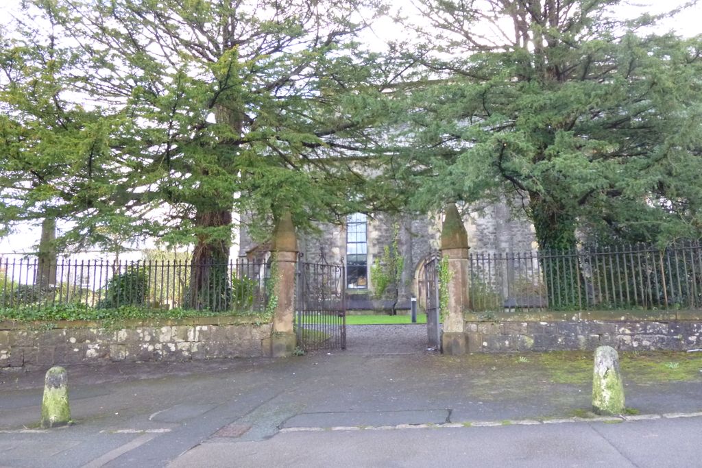
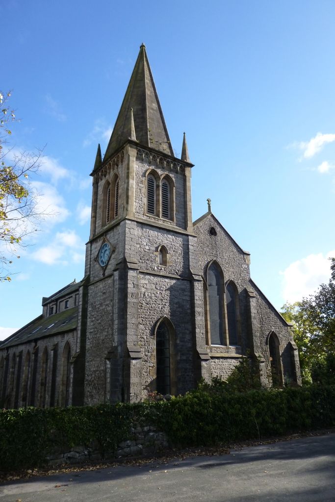
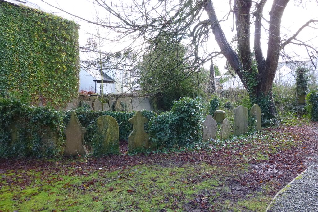
| Description | : | The Church was founded in 1832, closed in 1976, converted for use as a sports hall until 1996 when it was converted into residential apartments, and is currently (2017) known as ‘Trinity Court’, Most of the grave headstones in the churchyard have been removed from their original position and relocated to and around the east perimeter wall. A small group of gravestones to the left of the original churchyard entrance, now a pedestrian only entrance from the main A590 road, are in their original location. Many of these are heavily overgrown with ivy and their inscriptions are illegible. Holy Trinity, Ulverston,... Read More |
frequently asked questions (FAQ):
-
Where is Holy Trinity Churchyard (Defunct)?
Holy Trinity Churchyard (Defunct) is located at New Church Lane Ulverston, South Lakeland District ,Cumbria , LA12 7NHEngland.
-
Holy Trinity Churchyard (Defunct) cemetery's updated grave count on graveviews.com?
0 memorials
-
Where are the coordinates of the Holy Trinity Churchyard (Defunct)?
Latitude: 54.1937610
Longitude: -3.0977900
Nearby Cemetories:
1. St Mary with Holy Trinity Churchyard
Ulverston, South Lakeland District, England
Coordinate: 54.1987330, -3.0914520
2. Ulverston Cemetery
Ulverston, South Lakeland District, England
Coordinate: 54.1832760, -3.0880270
3. Saint Michael and The Holy Angels Churchyard
Pennington, South Lakeland District, England
Coordinate: 54.1873000, -3.1315900
4. Conishead Priory
Ulverston, South Lakeland District, England
Coordinate: 54.1736640, -3.0690050
5. Holy Trinity Churchyard
Bardsea, South Lakeland District, England
Coordinate: 54.1620160, -3.0722870
6. St John the Evangelist's Church
Osmotherley, South Lakeland District, England
Coordinate: 54.2298882, -3.1077388
7. St Peter's Church
Lindal and Marton, Barrow-in-Furness Borough, England
Coordinate: 54.1728010, -3.1514610
8. Society of Friends Sunbrick Burial Ground
Bardsea, South Lakeland District, England
Coordinate: 54.1559770, -3.0945220
9. St Mary's and St Michael's Churchyard
Great Urswick, South Lakeland District, England
Coordinate: 54.1582220, -3.1223190
10. St. Mary's Churchyard
Penny Bridge, South Lakeland District, England
Coordinate: 54.2346660, -3.0605070
11. St. Peter's Churchyard
Ireleth, Barrow-in-Furness Borough, England
Coordinate: 54.1871790, -3.1909530
12. St Cuthbert's Churchyard
Kirkby Ireleth, South Lakeland District, England
Coordinate: 54.2298000, -3.1770820
13. Saint Cuthbert Churchyard
Aldingham, South Lakeland District, England
Coordinate: 54.1302260, -3.0983760
14. Tottlebank Baptist Chapelyard
South Lakeland District, England
Coordinate: 54.2519210, -3.0534690
15. Wall End Church of Christ Cemetery
Kirkby in Furness, South Lakeland District, England
Coordinate: 54.2389300, -3.1753120
16. St Mary Dalton In Furness Churchyard
Dalton-in-Furness, Barrow-in-Furness Borough, England
Coordinate: 54.1548790, -3.1870490
17. Dalton-in-Furness Cemetery
Dalton-in-Furness, Barrow-in-Furness Borough, England
Coordinate: 54.1518460, -3.1851620
18. St Luke's Churchyard
Lowick, South Lakeland District, England
Coordinate: 54.2654390, -3.0916890
19. St. John the Baptist Church
Flookburgh, South Lakeland District, England
Coordinate: 54.1760608, -2.9736311
20. St Matthew's Churchyard
Dendron, South Lakeland District, England
Coordinate: 54.1263000, -3.1541700
21. Holy Trinity Churchyard
Colton, South Lakeland District, England
Coordinate: 54.2655370, -3.0480430
22. Saint Anne Churchyard
Haverthwaite, South Lakeland District, England
Coordinate: 54.2485890, -3.0037750
23. Haverthwaite Cemetery
Haverthwaite, South Lakeland District, England
Coordinate: 54.2479110, -3.0017410
24. Furness Abbey
Barrow-In-Furness, Barrow-in-Furness Borough, England
Coordinate: 54.1352780, -3.1977780