
| Memorials | : | 0 |
| Location | : | Millom, Copeland Borough, England |
| Coordinate | : | 54.2088860, -3.2731320 |
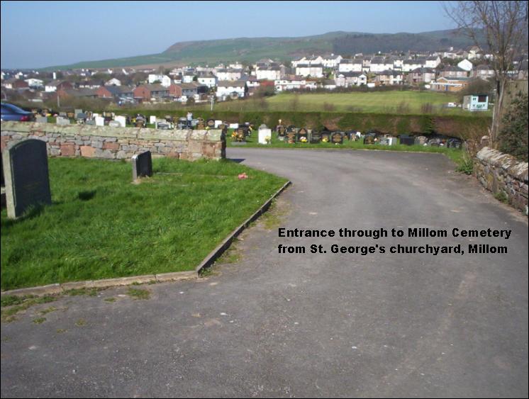
| Description | : | There are three 'cemeteries' in Millom, St. George's churchyard and Holy Trinity churchyard. Millom Cemetery, which opened in 1977, is located to the west of St. George's Church which sits prominently on a hill near the centre of the town. St. George's Church, churchyard and Millom Cemetery are accessed from St. George's Road between Market Square and the bridge over the railway. To get to Millom Cemetery from out of the town, by road, drive into the town to the mini roundabout by the petrol station and take the exit that leads over the railway bridge. Immediately over the bridge,... Read More |
frequently asked questions (FAQ):
-
Where is Millom Cemetery?
Millom Cemetery is located at Millom, Copeland Borough ,Cumbria ,England.
-
Millom Cemetery cemetery's updated grave count on graveviews.com?
0 memorials
-
Where are the coordinates of the Millom Cemetery?
Latitude: 54.2088860
Longitude: -3.2731320
Nearby Cemetories:
1. St George Churchyard
Millom, Copeland Borough, England
Coordinate: 54.2085440, -3.2718660
2. Holy Trinity Churchyard
Millom, Copeland Borough, England
Coordinate: 54.2206610, -3.2727780
3. St Lukes Churchyard
Haverigg, Copeland Borough, England
Coordinate: 54.1968680, -3.2925720
4. St Mary Churchyard
Whicham, Copeland Borough, England
Coordinate: 54.2326310, -3.3287160
5. St Anne Churchyard Thwaites
Millom Without, Copeland Borough, England
Coordinate: 54.2584700, -3.2632200
6. St. Peter's Churchyard
Ireleth, Barrow-in-Furness Borough, England
Coordinate: 54.1871790, -3.1909530
7. St Mary's Churchyard
Whitbeck, Copeland Borough, England
Coordinate: 54.2438000, -3.3533470
8. St Cuthbert's Churchyard
Kirkby Ireleth, South Lakeland District, England
Coordinate: 54.2298000, -3.1770820
9. Wall End Church of Christ Cemetery
Kirkby in Furness, South Lakeland District, England
Coordinate: 54.2389300, -3.1753120
10. St Mary Dalton In Furness Churchyard
Dalton-in-Furness, Barrow-in-Furness Borough, England
Coordinate: 54.1548790, -3.1870490
11. St. Mary Magdalene Parish Churchyard
Broughton-in-Furness, South Lakeland District, England
Coordinate: 54.2761400, -3.2152660
12. Dalton-in-Furness Cemetery
Dalton-in-Furness, Barrow-in-Furness Borough, England
Coordinate: 54.1518460, -3.1851620
13. St Peter's Church
Lindal and Marton, Barrow-in-Furness Borough, England
Coordinate: 54.1728010, -3.1514610
14. Saint Michael and The Holy Angels Churchyard
Pennington, South Lakeland District, England
Coordinate: 54.1873000, -3.1315900
15. Furness Abbey
Barrow-In-Furness, Barrow-in-Furness Borough, England
Coordinate: 54.1352780, -3.1977780
16. Barrow Cemetery and Crematorium
Barrow-In-Furness, Barrow-in-Furness Borough, England
Coordinate: 54.1261730, -3.2255870
17. St. Michael and All Angels Churchyard
Bootle, Copeland Borough, England
Coordinate: 54.2833510, -3.3732080
18. St John the Evangelist's Church
Osmotherley, South Lakeland District, England
Coordinate: 54.2298882, -3.1077388
19. St Mary's and St Michael's Churchyard
Great Urswick, South Lakeland District, England
Coordinate: 54.1582220, -3.1223190
20. St. Mary the Virgin Churchyard
Walney Island, Barrow-in-Furness Borough, England
Coordinate: 54.1064360, -3.2469950
21. Holy Trinity Churchyard (Defunct)
Ulverston, South Lakeland District, England
Coordinate: 54.1937610, -3.0977900
22. St Mary with Holy Trinity Churchyard
Ulverston, South Lakeland District, England
Coordinate: 54.1987330, -3.0914520
23. St John the Evangelist
Woodland, South Lakeland District, England
Coordinate: 54.2919829, -3.1579023
24. St Matthew's Churchyard
Dendron, South Lakeland District, England
Coordinate: 54.1263000, -3.1541700