
| Memorials | : | 0 |
| Location | : | Blount County, USA |
| Coordinate | : | 35.6232300, -84.1065100 |
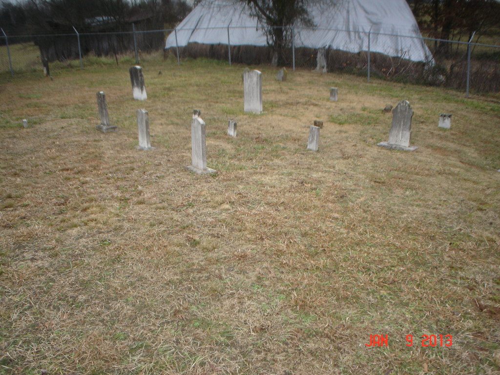
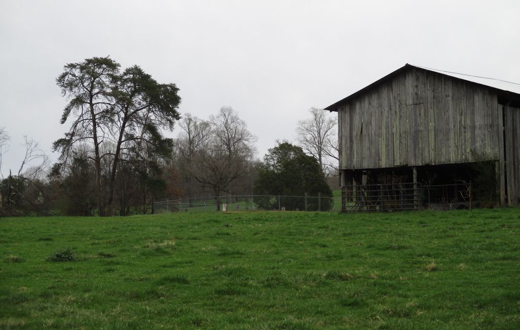
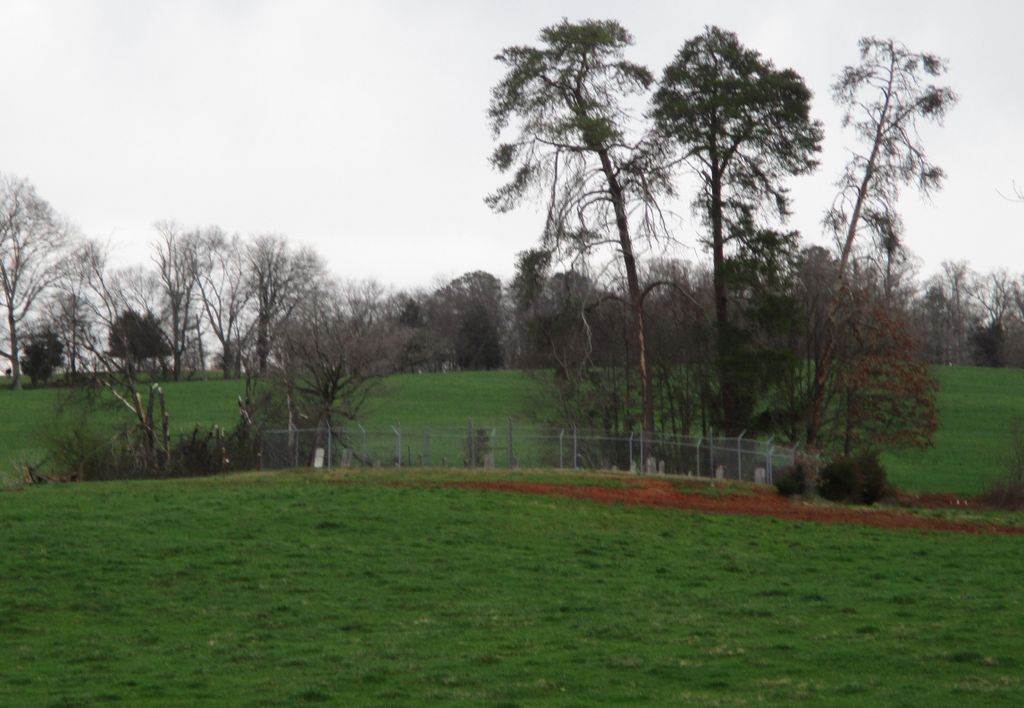
| Description | : | The Garner Family Cemetery is located behind the Williamson Chapel Church located at 1331 Williamson Chapel Road, Maryville, Tennessee. It is on private property surrounded by barbed wire fence. The cemetery can be seen from Williamson Chapel Road on a small rise behind the land owners barn. The cemetery itself appears to have a new chain linked fence around it. No direct access through gates to cemetery available. Cattle of unknown disposition are in pasture outside the chain link fence. |
frequently asked questions (FAQ):
-
Where is Garner Family Cemetery?
Garner Family Cemetery is located at 1311 Williamson Chapel Rd Blount County ,Tennessee ,USA.
-
Garner Family Cemetery cemetery's updated grave count on graveviews.com?
0 memorials
-
Where are the coordinates of the Garner Family Cemetery?
Latitude: 35.6232300
Longitude: -84.1065100
Nearby Cemetories:
1. Williamson Chapel Cemetery
Maryville, Blount County, USA
Coordinate: 35.6206017, -84.1074982
2. Faith Deliverance Church Cemetery
Blount County, USA
Coordinate: 35.6164200, -84.0946100
3. Liberty Baptist Church Cemetery
Maryville, Blount County, USA
Coordinate: 35.6260986, -84.1335983
4. Nelson Chapel Cemetery
Blount County, USA
Coordinate: 35.6068993, -84.0757980
5. Smyrna Baptist Church Cemetery
Blount County, USA
Coordinate: 35.6182750, -84.1444480
6. Lambert Cemetery
Blount County, USA
Coordinate: 35.6316986, -84.0674973
7. Bakers Creek Cemetery
Blount County, USA
Coordinate: 35.6563988, -84.1100006
8. Crossroads Tabernacle Cemetery
Blount County, USA
Coordinate: 35.6555000, -84.1173600
9. Four Mile Cemetery
Maryville, Blount County, USA
Coordinate: 35.5931015, -84.0832977
10. Union Grove Baptist Cemetery
Union Grove, Blount County, USA
Coordinate: 35.5883000, -84.1333000
11. Centenary Baptist Church Cemetery
Maryville, Blount County, USA
Coordinate: 35.6411018, -84.0582962
12. Bingham Cemetery
Loudon County, USA
Coordinate: 35.6555200, -84.1440500
13. Pine Grove Presbyterian Church Cemetery
Greenback, Loudon County, USA
Coordinate: 35.6527800, -84.1535600
14. Bogle Farm Cemetery
Blount County, USA
Coordinate: 35.6708565, -84.0913239
15. Kagleys Chapel Cemetery
Sixmile, Blount County, USA
Coordinate: 35.6183014, -84.0397034
16. Allegheny Baptist Church Cemetery
Maryville, Blount County, USA
Coordinate: 35.5923040, -84.0510180
17. Montgomery Cemetery
Blount County, USA
Coordinate: 35.6030998, -84.1735992
18. Bacon-Henley Cemetery
Monroe County, USA
Coordinate: 35.5691986, -84.1418991
19. Kelcie Young Farm Cemetery
Blount County, USA
Coordinate: 35.6376000, -84.0273000
20. McCollum Family Cemetery
Glendale, Loudon County, USA
Coordinate: 35.6425185, -84.1852114
21. Oakland United Methodist Church Cemetery
Monroe County, USA
Coordinate: 35.6143990, -84.1913986
22. Old Kagleys Cemetery
Maryville, Blount County, USA
Coordinate: 35.6294680, -84.0206430
23. Chota Memorial
Monroe County, USA
Coordinate: 35.5552670, -84.1315750
24. Salem Baptist Church Cemetery
Blount County, USA
Coordinate: 35.6982994, -84.1014023