| Memorials | : | 0 |
| Location | : | Mount Sterling, Gasconade County, USA |
| Coordinate | : | 38.4865050, -91.6355790 |
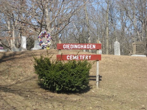
| Description | : | This cemetery was begun in 1855, shortly after the death of Elizabeth Wilhelmina Giedinghagen, the daughter of Frederick Wilhelm Giedinghagen, II and his wife Wilhelmina. Frederick earmarked an acre of his property as a cemetery for his relatives and neighbors to bury their dead. The cemetery was first called the Pin Oak Cemetery, and later the name was changed to the Giedinghagen Cemetery. Elizabeth Wilhelmina was the first person buried at this cemetery, and she has no headstone. Johanna Wilhelmina (Graeve) Giedinghagen was the second person buried there. |
frequently asked questions (FAQ):
-
Where is Giedinghagen Cemetery?
Giedinghagen Cemetery is located at 2593 River Rd Mount Sterling, Gasconade County ,Missouri , 65062USA.
-
Giedinghagen Cemetery cemetery's updated grave count on graveviews.com?
0 memorials
-
Where are the coordinates of the Giedinghagen Cemetery?
Latitude: 38.4865050
Longitude: -91.6355790
Nearby Cemetories:
1. Mount Sterling Cemetery
Gasconade County, USA
Coordinate: 38.4864006, -91.6343994
2. Butte Cemetery
Osage County, USA
Coordinate: 38.4789009, -91.6549988
3. Perkins Family Plot
Mount Sterling, Gasconade County, USA
Coordinate: 38.4690000, -91.6230000
4. Bumper Cemetery
Gasconade County, USA
Coordinate: 38.4516983, -91.6393967
5. Haynes Cemetery
Osage County, USA
Coordinate: 38.4575005, -91.6658020
6. Buschmann Cemetery
Gasconade County, USA
Coordinate: 38.4785040, -91.5857650
7. Karschnick Cemetery
Osage County, USA
Coordinate: 38.5208015, -91.6622009
8. Cox Cemetery
Osage County, USA
Coordinate: 38.4494019, -91.6697006
9. Hoffmann Cemetery
Bay, Gasconade County, USA
Coordinate: 38.4999850, -91.5779110
10. Useful Cemetery
Osage County, USA
Coordinate: 38.4513960, -91.6801960
11. Pilgrim Lutheran Church Cemetery
Freedom, Osage County, USA
Coordinate: 38.4636500, -91.6923200
12. Salem Reformed Cemetery
Hope, Osage County, USA
Coordinate: 38.5376930, -91.6511993
13. Leach Baker Cemetery
Osage County, USA
Coordinate: 38.4338989, -91.6568985
14. Schneider Cemetery
Gasconade County, USA
Coordinate: 38.4310989, -91.6436005
15. Salem Presbyterian Cemetery
Hope, Osage County, USA
Coordinate: 38.5407715, -91.6561356
16. Ryors Cemetery
Osage County, USA
Coordinate: 38.4997600, -91.7059100
17. Laubert Cemetery
Gasconade County, USA
Coordinate: 38.4338989, -91.5999985
18. Waters-Duncan Cemetery
Osage County, USA
Coordinate: 38.5331993, -91.6854095
19. Lambeth Cemetery
Freedom, Osage County, USA
Coordinate: 38.4789009, -91.7138977
20. Baecker Cemetery
Gasconade County, USA
Coordinate: 38.5503100, -91.6311300
21. Drusch Cemetery
Gasconade County, USA
Coordinate: 38.4254700, -91.5998900
22. Oklahoma Cemetery
Chamois, Osage County, USA
Coordinate: 38.5121050, -91.7185220
23. Atkins Cemetery
Bay, Gasconade County, USA
Coordinate: 38.4818993, -91.5453033
24. Cooper Family Cemetery
Cooper Hill, Osage County, USA
Coordinate: 38.4203940, -91.6698580

