
| Memorials | : | 0 |
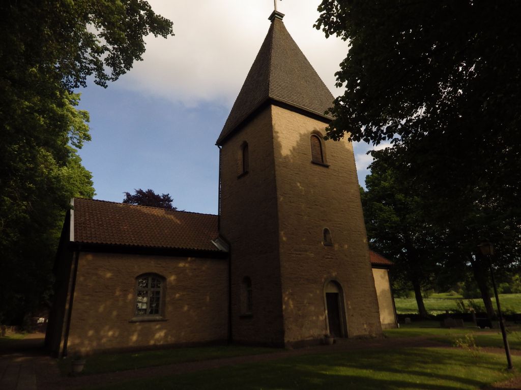
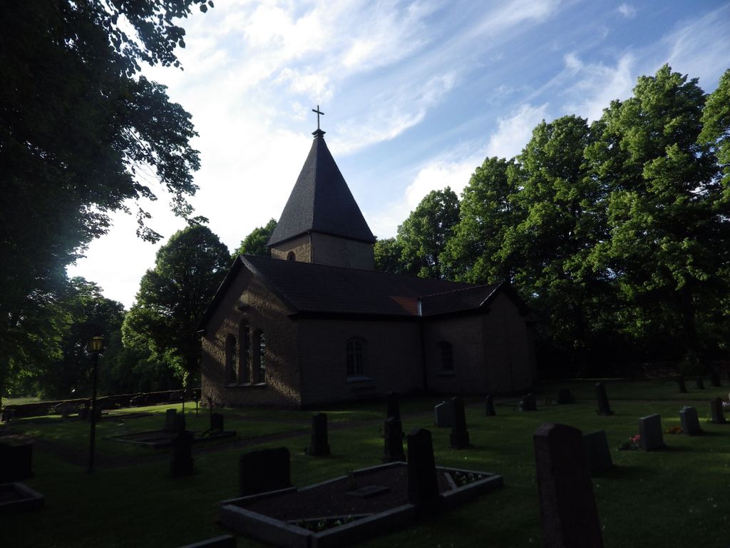
| Location | : | Oglunda, Skara kommun, Sweden |
| Phone | : | +46(511)26500 |
| Website | : | www.svenskakyrkan.se/skara/oglunda-kyrka |
| Coordinate | : | 58.4333860, 13.6907500 |
| Description | : | The original church in Öglunda was built in Romanesque style of limestone in the 12th century. In the 17th century the church was built. In 1883, a new longhouse was built across the old one. The church room was then oriented in the north-south. The sacristy was decorated in the former nave and the original choir is now a baptistery. Under the floor of the baptistery is a tomb, probably a priest's tomb from the 18th century. |
frequently asked questions (FAQ):
-
Where is Öglunda Kyrkogård?
Öglunda Kyrkogård is located at Öglunda kyrka Oglunda, Skara kommun ,Västra Götalands län , 532 92Sweden.
-
Öglunda Kyrkogård cemetery's updated grave count on graveviews.com?
0 memorials
-
Where are the coordinates of the Öglunda Kyrkogård?
Latitude: 58.4333860
Longitude: 13.6907500
Nearby Cemetories:
1. Varnhems kyrka & kyrkogård
Varnhem, Skara kommun, Sweden
Coordinate: 58.3848320, 13.6546520
2. Norra Lundby Cemetery
Norra Lundby, Skara kommun, Sweden
Coordinate: 58.3756059, 13.6203975
3. Norra Ving
Axvall, Skara kommun, Sweden
Coordinate: 58.3798321, 13.5758201
4. Våmbs kyrkogård
Vamb, Skövde kommun, Sweden
Coordinate: 58.3823220, 13.8141170
5. Säter Cemetery
Skövde kommun, Sweden
Coordinate: 58.4681421, 13.8385296
6. Saint Elins Kyrkogård
Skövde, Skövde kommun, Sweden
Coordinate: 58.3937400, 13.8436450
7. Sankta Helena kyrka
Skövde, Skövde kommun, Sweden
Coordinate: 58.3891070, 13.8471540
8. Häggums kyrkogård
Häggum, Skövde kommun, Sweden
Coordinate: 58.3212950, 13.7231800
9. Holmestad Cemetery
Holmestad, Götene kommun, Sweden
Coordinate: 58.5409768, 13.5704366
10. Marie kyrkogard
Skara kommun, Sweden
Coordinate: 58.3849100, 13.4690160
11. Binnebergs kyrkogård
Binneberg, Skövde kommun, Sweden
Coordinate: 58.5208473, 13.8652615
12. Sjogerstad kyrkogård
Sjogerstad, Skövde kommun, Sweden
Coordinate: 58.3191370, 13.8019180
13. Böja Kyrkogård
Boja, Skövde kommun, Sweden
Coordinate: 58.5542230, 13.7757480
14. Vättlösa kyrkogård
Götene kommun, Sweden
Coordinate: 58.5123370, 13.4918200
15. Old Cemetery
Skara, Skara kommun, Sweden
Coordinate: 58.3848740, 13.4457800
16. Horn Kyrkogärd
Skövde kommun, Sweden
Coordinate: 58.5210980, 13.8940840
17. Odensåkers kyrkogård
Odensaker, Mariestads kommun, Sweden
Coordinate: 58.5538500, 13.8838300
18. Brunnhems ödekyrkogård
Brunnhem, Falköpings kommun, Sweden
Coordinate: 58.2713770, 13.6962660
19. Händene kyrkogård
Skara kommun, Sweden
Coordinate: 58.3998830, 13.3779590
20. Tidavads kyrkogård
Tidavad, Mariestads kommun, Sweden
Coordinate: 58.5833190, 13.8534270
21. Segerstads kyrkogård
Falköpings kommun, Sweden
Coordinate: 58.2589130, 13.6673760
22. Kestads Kyrka
Kestad, Götene kommun, Sweden
Coordinate: 58.5653684, 13.4501088
23. Fullösa Kyrkogård
Fullosa, Götene kommun, Sweden
Coordinate: 58.5818900, 13.4789200
24. Marums kyrkogård
Skara kommun, Sweden
Coordinate: 58.3568350, 13.3682720