
| Memorials | : | 45 |
| Location | : | Omaha, Douglas County, USA |
| Coordinate | : | 41.3050003, -95.9744034 |
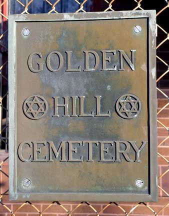
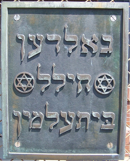
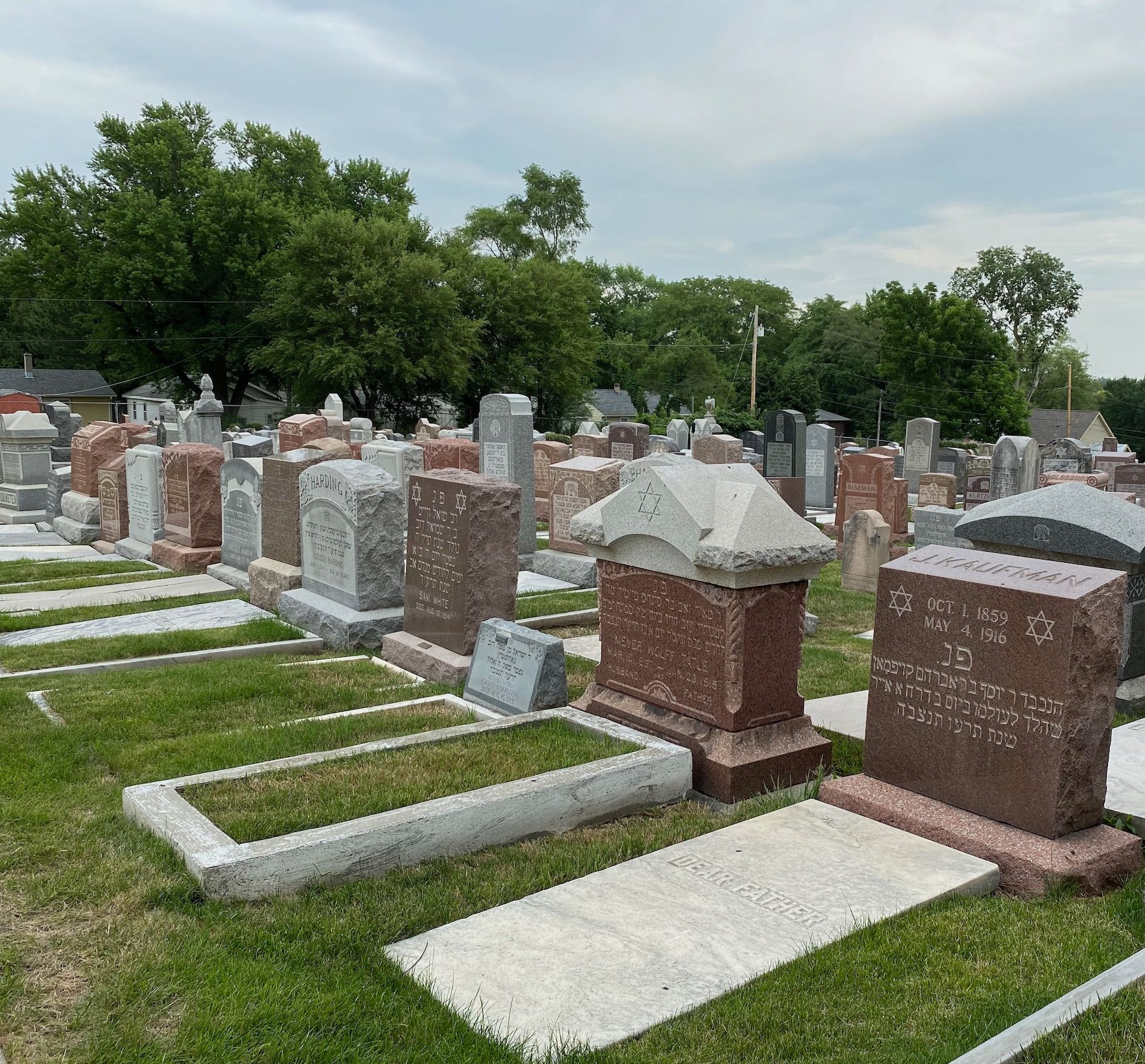
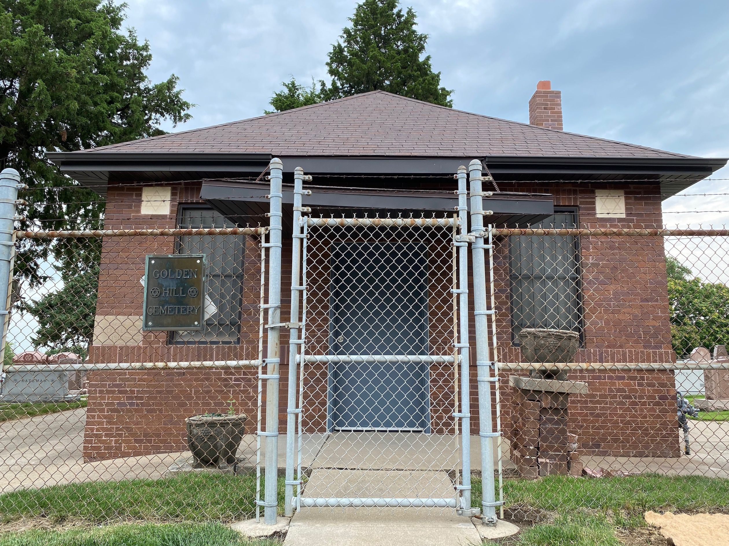
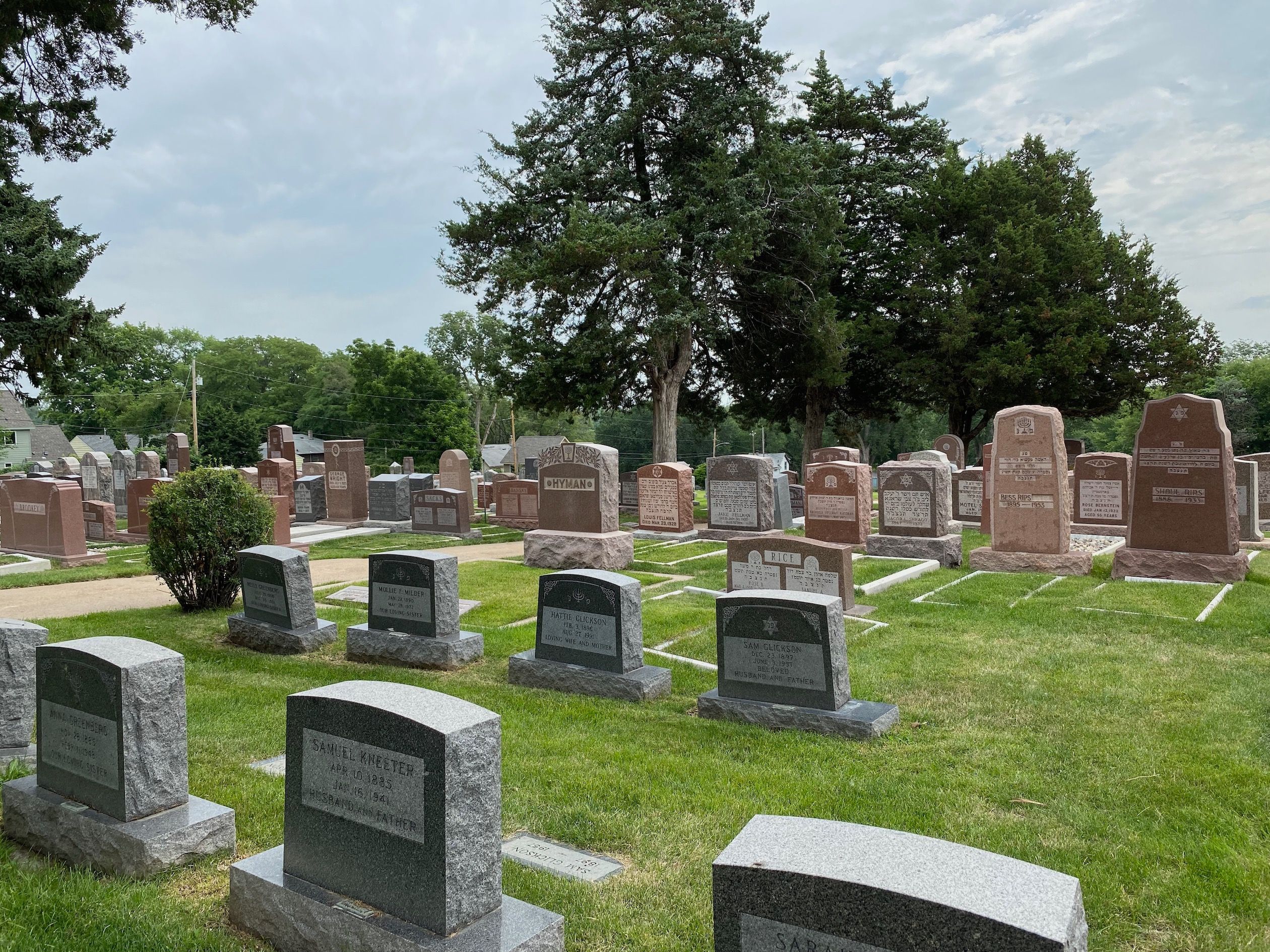
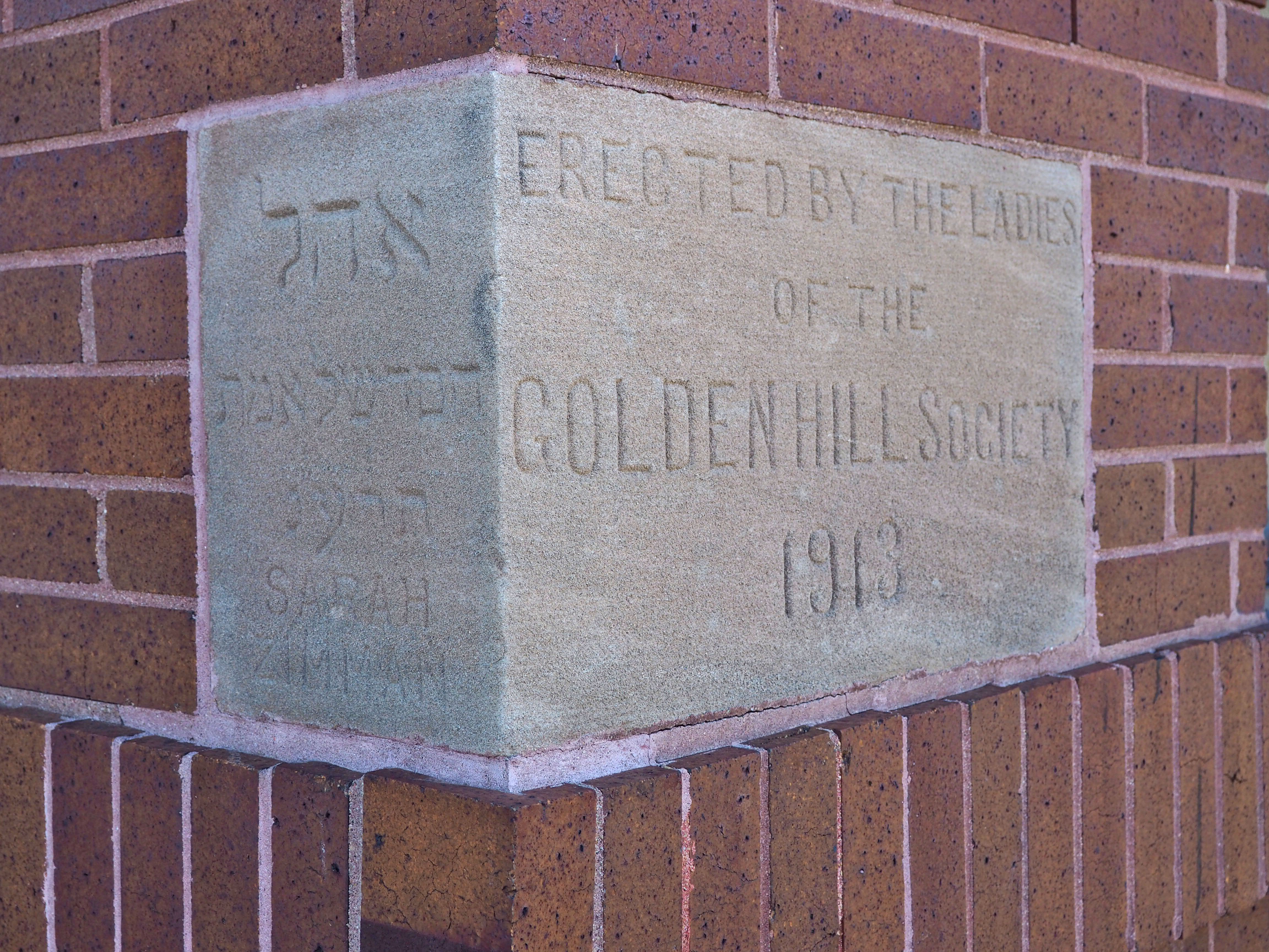
| Description | : | Golden Hill is a Jewish Cemetery located on North 42nd Street in Omaha Nebraska. The land was purchased by Chevra B'nai Israel Adas Russia in 1888 making it one of the oldest cemeteries in Omaha. At the time of purchase, the area was farm ground. The cemetery features a small Chapel on the west side and a circular drive through the center of the cemetery. The plots are all occupied or purchased. The entire property is fenced and the gates to the Driveway are kept locked, there is a walk-in gate that is open to visitors on the west side... Read More |
frequently asked questions (FAQ):
-
Where is Golden Hill Cemetery?
Golden Hill Cemetery is located at Omaha, Douglas County ,Nebraska ,USA.
-
Golden Hill Cemetery cemetery's updated grave count on graveviews.com?
45 memorials
-
Where are the coordinates of the Golden Hill Cemetery?
Latitude: 41.3050003
Longitude: -95.9744034
Nearby Cemetories:
1. Pleasant Hill Jewish Cemetery
Omaha, Douglas County, USA
Coordinate: 41.3185997, -95.9766998
2. Forest Lawn Memorial Park
Omaha, Douglas County, USA
Coordinate: 41.3272018, -95.9847031
3. Springwell Cemetery
Omaha, Douglas County, USA
Coordinate: 41.3114014, -96.0096970
4. Prospect Hill Cemetery
Omaha, Douglas County, USA
Coordinate: 41.2780991, -95.9593964
5. Potter Field
Omaha, Douglas County, USA
Coordinate: 41.3320274, -95.9902878
6. Mormon Pioneer Cemetery
Omaha, Douglas County, USA
Coordinate: 41.3348450, -95.9663720
7. Nash Chapel Crypt
Omaha, Douglas County, USA
Coordinate: 41.2665090, -95.9721790
8. Servants of Mary Cemetery
Omaha, Douglas County, USA
Coordinate: 41.3017170, -96.0258260
9. Mount Hope Cemetery
Omaha, Douglas County, USA
Coordinate: 41.3041992, -96.0310974
10. Mount Sinai Cemetery
Omaha, Douglas County, USA
Coordinate: 41.3116989, -96.0314026
11. First Central Congregational Columbarium
Omaha, Douglas County, USA
Coordinate: 41.2563456, -95.9658365
12. Holy Sepulchre Cemetery
Omaha, Douglas County, USA
Coordinate: 41.2543983, -95.9875031
13. Trinity Cathedral Columbarium
Omaha, Douglas County, USA
Coordinate: 41.2603900, -95.9393660
14. Douglas County Poor Farm Cemetery
Omaha, Douglas County, USA
Coordinate: 41.2437240, -95.9723480
15. Bohemian Cemetery
Omaha, Douglas County, USA
Coordinate: 41.2388992, -95.9955978
16. All Saints Episcopal Church Columbarium
Omaha, Douglas County, USA
Coordinate: 41.2785000, -96.0579000
17. Ak-Sar-Ben Racetrack Grounds
Omaha, Douglas County, USA
Coordinate: 41.2414703, -96.0159607
18. Westlawn-Hillcrest Memorial Park
Omaha, Douglas County, USA
Coordinate: 41.2346992, -95.9966965
19. Saint Andrews Episcopal Church Columbarium
Omaha, Douglas County, USA
Coordinate: 41.2492500, -96.0427500
20. Calvary Cemetery
Omaha, Douglas County, USA
Coordinate: 41.2364006, -96.0294037
21. Evergreen Memorial Park Cemetery
Omaha, Douglas County, USA
Coordinate: 41.2393990, -96.0355988
22. Countryside Community Church Columbarium
Omaha, Douglas County, USA
Coordinate: 41.2483660, -96.0500270
23. Union Memorial Cemetery
Omaha, Douglas County, USA
Coordinate: 41.3512611, -96.0620193
24. Resurrection Cemetery
Omaha, Douglas County, USA
Coordinate: 41.2344208, -96.0365448