
| Memorials | : | 0 |
| Location | : | Omaha, Douglas County, USA |
| Coordinate | : | 41.3348450, -95.9663720 |
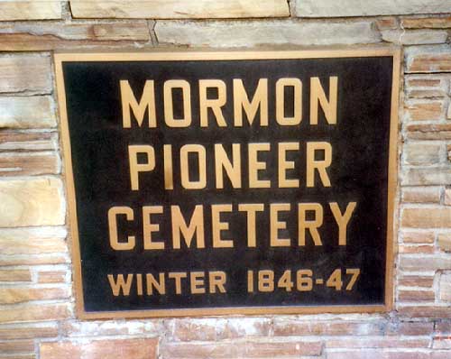
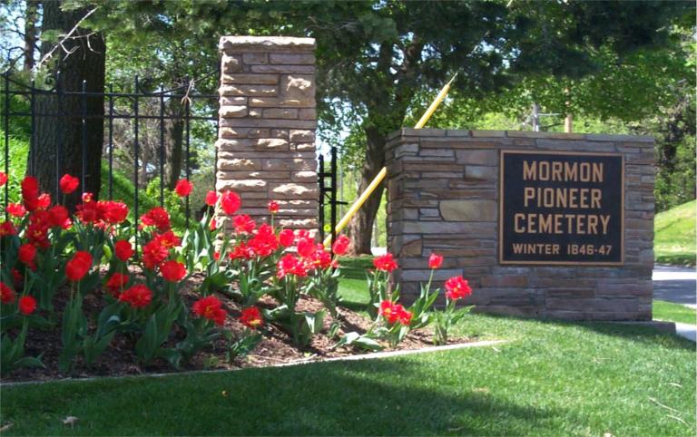
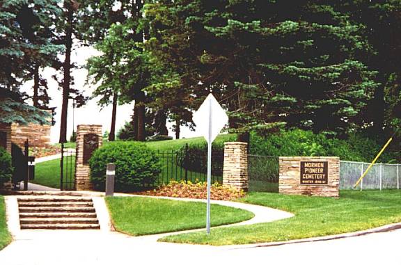
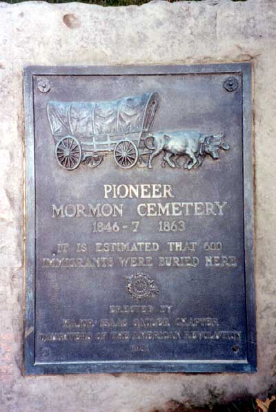
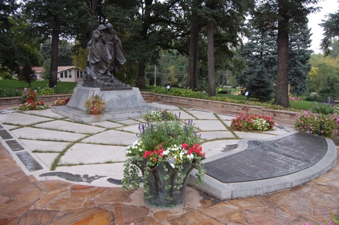
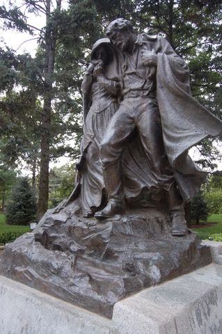
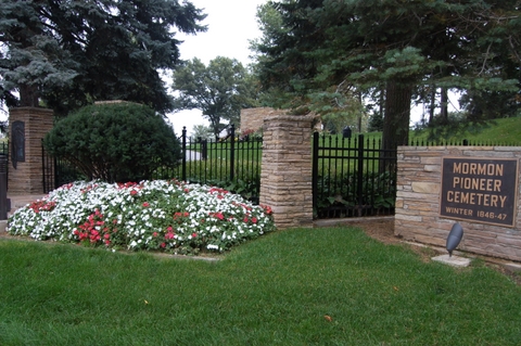
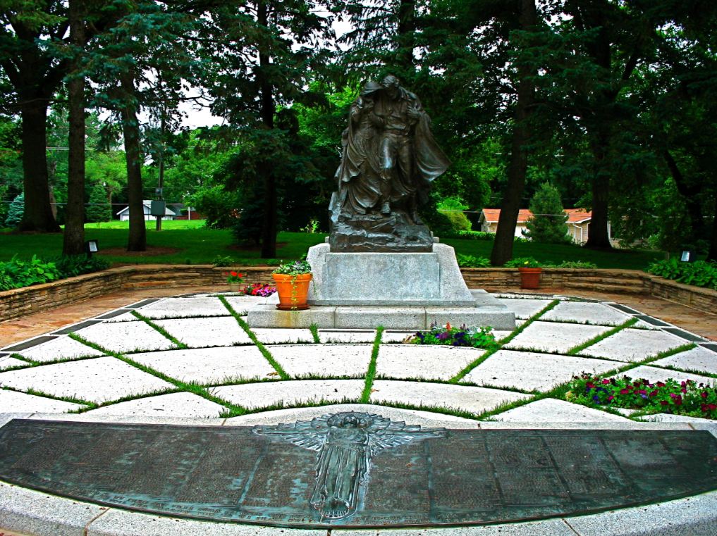
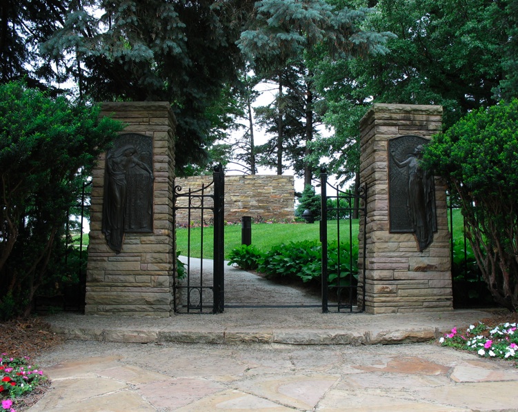
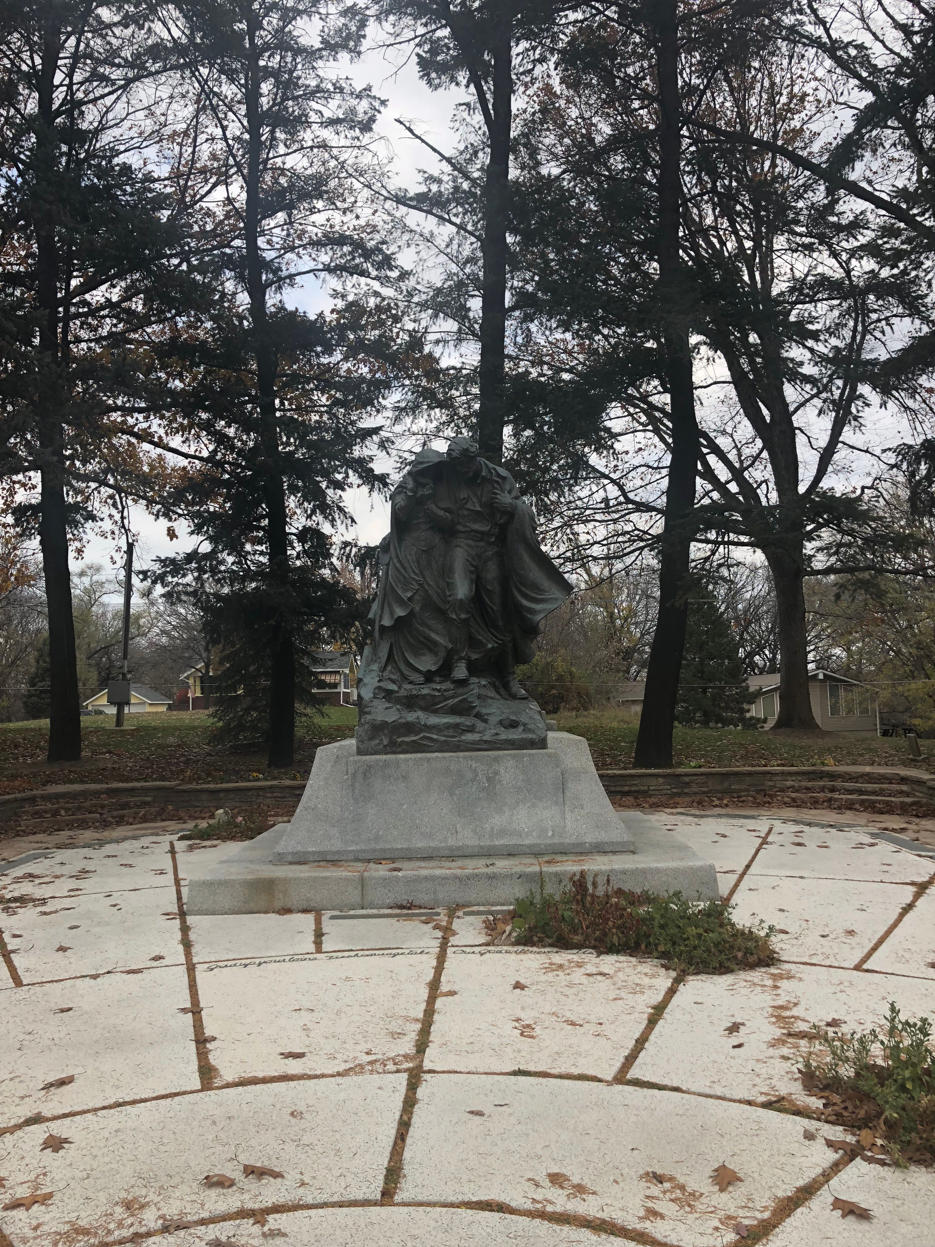
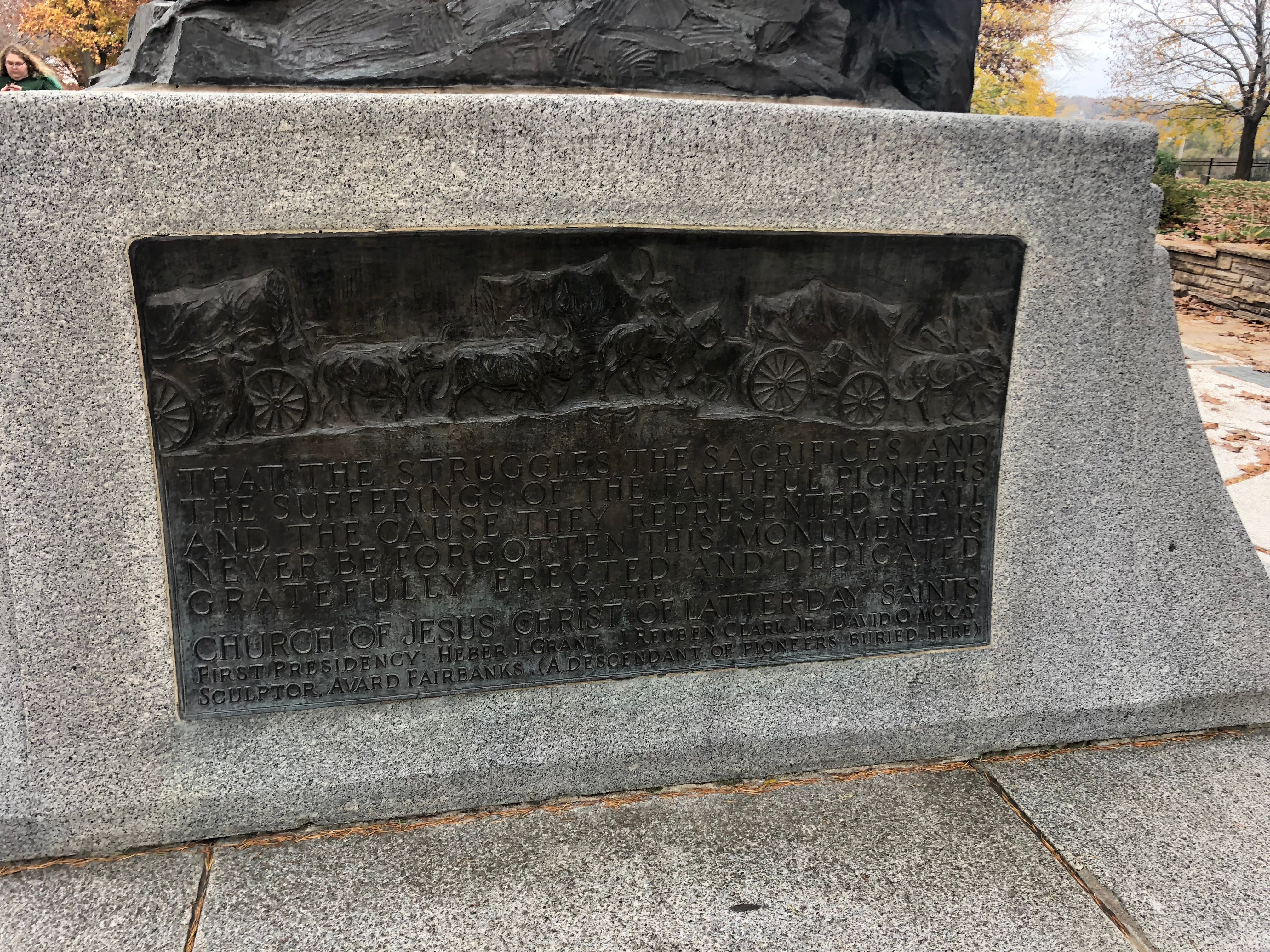
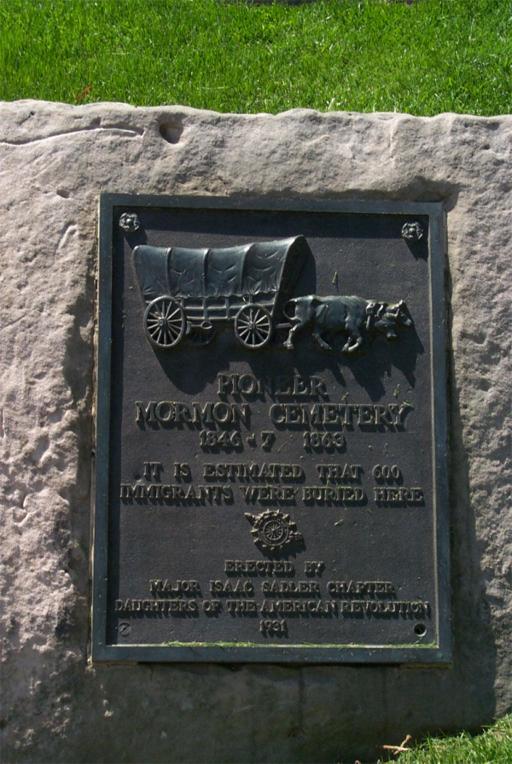
| Description | : | Located at 33rd & State Street in what is called "Historic Florence" Nebraska. In 1846, Winter Quarters Settlement was established by Brigham Young of the Church of Jesus Christ of Latter-day Saints. It became Florence in 1854 before it was annexed to Omaha. Approximately 4000 pioneers spent the winter there waiting to move west in the spring. About 600 of them died on the Nebraska bank of the Missouri River with countless others dying on the Iowa side and at outer settlements. The Winter Quarters Pioneer Cemetery is next to the Winter Quarters Temple of the LDS Church which is located at... Read More |
frequently asked questions (FAQ):
-
Where is Mormon Pioneer Cemetery?
Mormon Pioneer Cemetery is located at Omaha, Douglas County ,Nebraska ,USA.
-
Mormon Pioneer Cemetery cemetery's updated grave count on graveviews.com?
0 memorials
-
Where are the coordinates of the Mormon Pioneer Cemetery?
Latitude: 41.3348450
Longitude: -95.9663720
Nearby Cemetories:
1. Forest Lawn Memorial Park
Omaha, Douglas County, USA
Coordinate: 41.3272018, -95.9847031
2. Pleasant Hill Jewish Cemetery
Omaha, Douglas County, USA
Coordinate: 41.3185997, -95.9766998
3. Potter Field
Omaha, Douglas County, USA
Coordinate: 41.3320274, -95.9902878
4. Golden Hill Cemetery
Omaha, Douglas County, USA
Coordinate: 41.3050003, -95.9744034
5. Springwell Cemetery
Omaha, Douglas County, USA
Coordinate: 41.3114014, -96.0096970
6. Mount Sinai Cemetery
Omaha, Douglas County, USA
Coordinate: 41.3116989, -96.0314026
7. Servants of Mary Cemetery
Omaha, Douglas County, USA
Coordinate: 41.3017170, -96.0258260
8. Prospect Hill Cemetery
Omaha, Douglas County, USA
Coordinate: 41.2780991, -95.9593964
9. Mount Hope Cemetery
Omaha, Douglas County, USA
Coordinate: 41.3041992, -96.0310974
10. Shipley Cemetery
Washington County, USA
Coordinate: 41.3932991, -95.9828033
11. Nash Chapel Crypt
Omaha, Douglas County, USA
Coordinate: 41.2665090, -95.9721790
12. Union Memorial Cemetery
Omaha, Douglas County, USA
Coordinate: 41.3512611, -96.0620193
13. Trinity Cathedral Columbarium
Omaha, Douglas County, USA
Coordinate: 41.2603900, -95.9393660
14. First Central Congregational Columbarium
Omaha, Douglas County, USA
Coordinate: 41.2563456, -95.9658365
15. Holy Sepulchre Cemetery
Omaha, Douglas County, USA
Coordinate: 41.2543983, -95.9875031
16. Crescent Cemetery
Crescent, Pottawattamie County, USA
Coordinate: 41.3664894, -95.8566208
17. All Saints Episcopal Church Columbarium
Omaha, Douglas County, USA
Coordinate: 41.2785000, -96.0579000
18. Douglas County Poor Farm Cemetery
Omaha, Douglas County, USA
Coordinate: 41.2437240, -95.9723480
19. Evans Cemetery
Crescent, Pottawattamie County, USA
Coordinate: 41.3255997, -95.8368988
20. Bohemian Cemetery
Omaha, Douglas County, USA
Coordinate: 41.2388992, -95.9955978
21. Ak-Sar-Ben Racetrack Grounds
Omaha, Douglas County, USA
Coordinate: 41.2414703, -96.0159607
22. Westlawn-Hillcrest Memorial Park
Omaha, Douglas County, USA
Coordinate: 41.2346992, -95.9966965
23. Saint Andrews Episcopal Church Columbarium
Omaha, Douglas County, USA
Coordinate: 41.2492500, -96.0427500
24. Countryside Community Church Columbarium
Omaha, Douglas County, USA
Coordinate: 41.2483660, -96.0500270