
| Memorials | : | 8 |
| Location | : | Huntsville, Butler County, USA |
| Coordinate | : | 37.1475300, -86.8929900 |
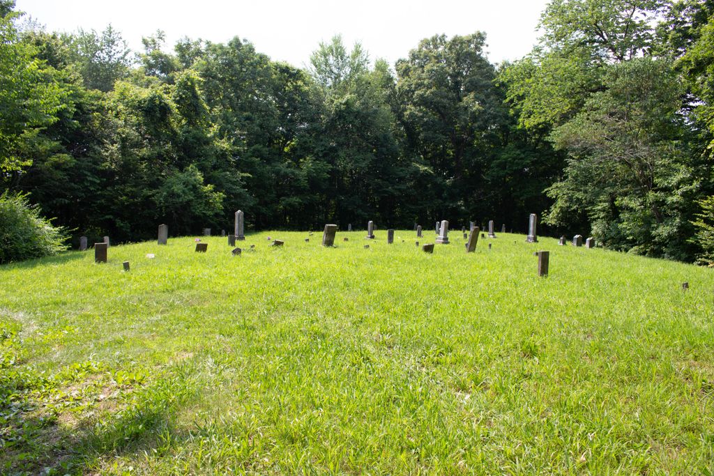
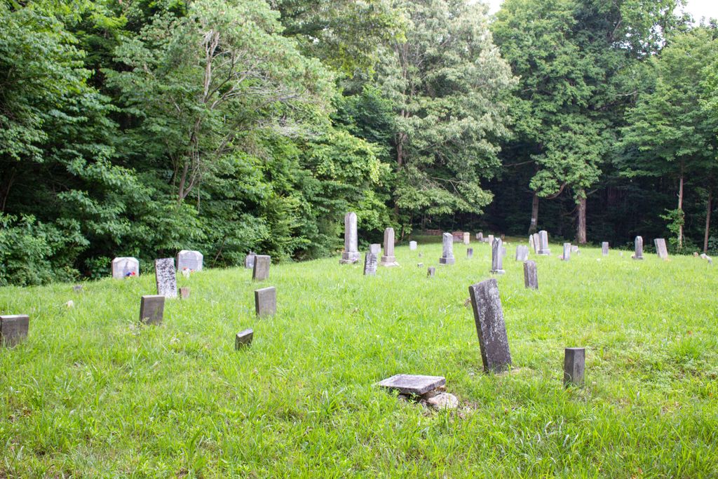
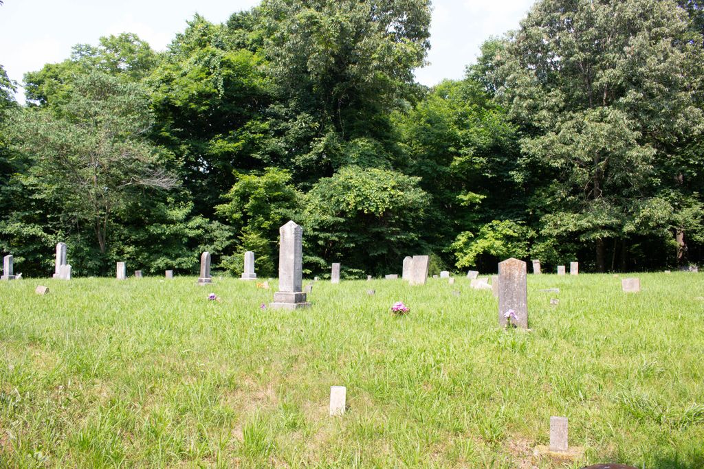
| Description | : | The cemetery is located on the south side of Penrod Road (Kentucky State Highway 949) about 0.9 miles west of its intersection with Huntsville-Quality Road (Kentucky State Highway 106). The cemetery is listed as the Greenhill – Tater Hill Cemetery on pages 168 – 170 of Cemeteries of Butler County, Kentucky, compiled by Anita Porter Dann, published by The Butler County Genealogical & Historical Society, Morgantown, Kentucky, © February 2002 |
frequently asked questions (FAQ):
-
Where is Greenhill-Tater Hill Cemetery?
Greenhill-Tater Hill Cemetery is located at Penrod Road (Kentucky State Highway 949) Huntsville, Butler County ,Kentucky , 42239USA.
-
Greenhill-Tater Hill Cemetery cemetery's updated grave count on graveviews.com?
8 memorials
-
Where are the coordinates of the Greenhill-Tater Hill Cemetery?
Latitude: 37.1475300
Longitude: -86.8929900
Nearby Cemetories:
1. Blaine Cemetery
Huntsville, Butler County, USA
Coordinate: 37.1569200, -86.8930200
2. Huntsville Methodist Church Cemetery
Huntsville, Butler County, USA
Coordinate: 37.1630516, -86.8846664
3. Huntsville Baptist Church Cemetery
Huntsville, Butler County, USA
Coordinate: 37.1632900, -86.8788600
4. Holland Cemetery
Butler County, USA
Coordinate: 37.1274500, -86.8700000
5. Corum Cemetery
Rochester, Butler County, USA
Coordinate: 37.1855320, -86.8844430
6. Oak Grove Cemetery
Morgantown, Butler County, USA
Coordinate: 37.1542015, -86.8450012
7. Old Hebron Cemetery
Muhlenberg County, USA
Coordinate: 37.1100800, -86.9107580
8. Mount Zion Cemetery
Butler County, USA
Coordinate: 37.1098240, -86.8683340
9. Mount Olivet Cemetery
Harper Crossroads, Butler County, USA
Coordinate: 37.1097100, -86.8683200
10. Pleasant Hill Cemetery
Pleasant Hill, Butler County, USA
Coordinate: 37.1808940, -86.8594010
11. Doc Gardner Cemetery
Pleasant Hill, Butler County, USA
Coordinate: 37.1785440, -86.8529110
12. New Midway Church Cemetery
Rochester, Butler County, USA
Coordinate: 37.1923650, -86.8827690
13. Midway Cemetery
Rochester, Butler County, USA
Coordinate: 37.1925011, -86.8824997
14. Mud River Mine Cemetery
Gus, Muhlenberg County, USA
Coordinate: 37.1375200, -86.9500030
15. Forest Oak Cemetery
Belton, Muhlenberg County, USA
Coordinate: 37.1753300, -86.9450250
16. New Hebron Hunt Cemetery
Muhlenberg County, USA
Coordinate: 37.1030760, -86.9230130
17. Mount Moriah Church Cemetery
Penrod, Muhlenberg County, USA
Coordinate: 37.1069090, -86.9410800
18. Rochester Cemetery
Rochester, Butler County, USA
Coordinate: 37.2052116, -86.8929291
19. Smith-Revlett Cemetery
Ennis, Muhlenberg County, USA
Coordinate: 37.1732972, -86.9601167
20. Webster Cemetery
Morgantown, Butler County, USA
Coordinate: 37.1739006, -86.8189011
21. Gardner Cemetery
Silver City, Butler County, USA
Coordinate: 37.1379710, -86.8110410
22. Clark Cemetery
Muhlenberg County, USA
Coordinate: 37.1317270, -86.9755410
23. Dick Green Cemetery
Rochester, Butler County, USA
Coordinate: 37.2000310, -86.8383090
24. Mud River Union Cemetery
Belton, Muhlenberg County, USA
Coordinate: 37.1617050, -86.9784720