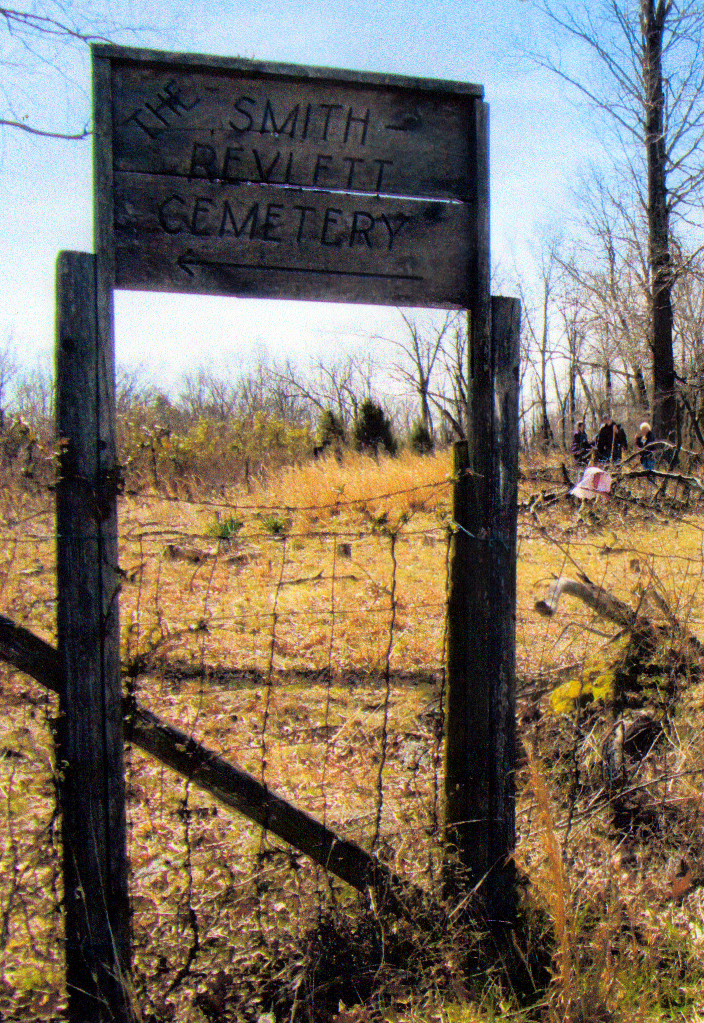
| Memorials | : | 0 |
| Location | : | Ennis, Muhlenberg County, USA |
| Coordinate | : | 37.1732972, -86.9601167 |
| Description | : | The Smith-Revlett Cemetery is located in rural Muhlenburg Co., KY about 8 miles south of Drakesboro. After traveling South on Highway 70, turn East at Browder and travel to Old Ennis on 2270. Turn right on Gordon Bradley Road, then turn onto Ailene Lane. Travel to the very end of Ailene Lane. In April 2013, this road ends at an abondoned house. The road beyond is a down a steep grade that has been completely washed out over the years. Stop at the top of the washed out road and look straight ahead (Southeast)across a wide valley,... Read More |
frequently asked questions (FAQ):
-
Where is Smith-Revlett Cemetery?
Smith-Revlett Cemetery is located at Ennis, Muhlenberg County ,Kentucky ,USA.
-
Smith-Revlett Cemetery cemetery's updated grave count on graveviews.com?
0 memorials
-
Where are the coordinates of the Smith-Revlett Cemetery?
Latitude: 37.1732972
Longitude: -86.9601167
Nearby Cemetories:
1. Forest Oak Cemetery
Belton, Muhlenberg County, USA
Coordinate: 37.1753300, -86.9450250
2. Mud River Union Cemetery
Belton, Muhlenberg County, USA
Coordinate: 37.1617050, -86.9784720
3. Allen's Chapel Cemetery
Ennis, Muhlenberg County, USA
Coordinate: 37.2000100, -86.9714400
4. Mud River Mine Cemetery
Gus, Muhlenberg County, USA
Coordinate: 37.1375200, -86.9500030
5. Union Chapel Cemetery
Ennis, Muhlenberg County, USA
Coordinate: 37.2089800, -86.9429900
6. Forest Grove Cemetery
Ennis, Muhlenberg County, USA
Coordinate: 37.1981770, -86.9965910
7. Clark Cemetery
Muhlenberg County, USA
Coordinate: 37.1317270, -86.9755410
8. Hortons Chapel Church of Christ Cemetery
Belton, Muhlenberg County, USA
Coordinate: 37.1379780, -87.0018570
9. Union Ridge Cemetery
Penrod, Muhlenberg County, USA
Coordinate: 37.1368860, -87.0027030
10. Blaine Cemetery
Huntsville, Butler County, USA
Coordinate: 37.1569200, -86.8930200
11. Peter Baker Family Cemetery
Penrod, Muhlenberg County, USA
Coordinate: 37.1215300, -86.9884700
12. Greenhill-Tater Hill Cemetery
Huntsville, Butler County, USA
Coordinate: 37.1475300, -86.8929900
13. Penrod Family Cemetery
Muhlenberg County, USA
Coordinate: 37.1155680, -86.9812490
14. Huntsville Methodist Church Cemetery
Huntsville, Butler County, USA
Coordinate: 37.1630516, -86.8846664
15. Corum Cemetery
Rochester, Butler County, USA
Coordinate: 37.1855320, -86.8844430
16. Rochester Cemetery
Rochester, Butler County, USA
Coordinate: 37.2052116, -86.8929291
17. Browder Cemetery
Muhlenberg County, USA
Coordinate: 37.2066994, -87.0291977
18. New Midway Church Cemetery
Rochester, Butler County, USA
Coordinate: 37.1923650, -86.8827690
19. Midway Cemetery
Rochester, Butler County, USA
Coordinate: 37.1925011, -86.8824997
20. Huntsville Baptist Church Cemetery
Huntsville, Butler County, USA
Coordinate: 37.1632900, -86.8788600
21. Bell Family Cemetery
Belton, Muhlenberg County, USA
Coordinate: 37.1504140, -87.0377300
22. Penrod Baptist Church Cemetery
Penrod, Muhlenberg County, USA
Coordinate: 37.1132202, -86.9982071
23. Mount Moriah Church Cemetery
Penrod, Muhlenberg County, USA
Coordinate: 37.1069090, -86.9410800
24. James Cemetery
Penrod, Muhlenberg County, USA
Coordinate: 37.1110850, -87.0049810

