| Memorials | : | 0 |
| Location | : | Pond Creek, Grant County, USA |
| Coordinate | : | 36.6366600, -97.7054000 |
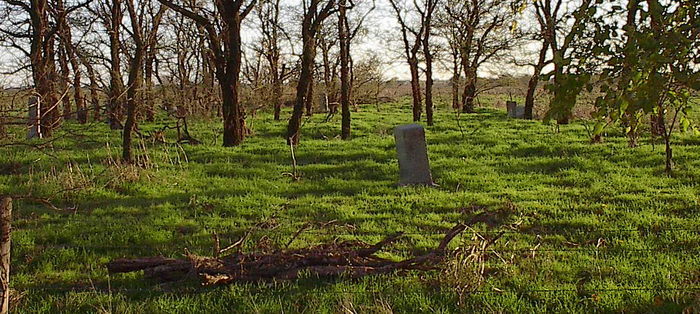
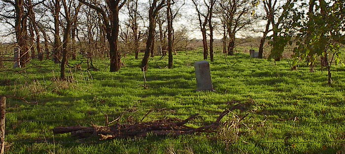
| Description | : | Greenwood Cemetery is located in Reno Township, in the Northwest Quarter of Section 23, Township 25 North, Range 5 West. To reach the cemetery from Pond Creek, go two miles south on U.S. Highway 81, then five miles east. It has been mistakenly called the Goldsmith Cemetery because several members of the Goldsmith family are buried there. Additional details of the cemetery, including all title conveyances with book and page numbers from the County Clerk's records in the Court House at Medford, are referenced on Page 15 of the book: THE SILENT CITIES OF GRANT COUNTY, OKLAHOMA, by Pearcy and Talkington,... Read More |
frequently asked questions (FAQ):
-
Where is Greenwood Cemetery?
Greenwood Cemetery is located at Pond Creek, Grant County ,Oklahoma ,USA.
-
Greenwood Cemetery cemetery's updated grave count on graveviews.com?
0 memorials
-
Where are the coordinates of the Greenwood Cemetery?
Latitude: 36.6366600
Longitude: -97.7054000
Nearby Cemetories:
1. Mount Pleasant Cemetery
Salt Fork, Grant County, USA
Coordinate: 36.6217003, -97.6333008
2. White Cemetery
Hunter, Garfield County, USA
Coordinate: 36.5788994, -97.6660995
3. Pond Creek Cemetery
Pond Creek, Grant County, USA
Coordinate: 36.6521988, -97.7936020
4. Smith Cemetery
Jefferson, Grant County, USA
Coordinate: 36.7088800, -97.7139000
5. Liberty Cemetery
Grant County, USA
Coordinate: 36.7235985, -97.7149963
6. Old Pond Creek Ranch Cowboy Burials
Pond Creek, Grant County, USA
Coordinate: 36.7086920, -97.7909950
7. Valley Center Cemetery
Pond Creek, Grant County, USA
Coordinate: 36.6081009, -97.8281021
8. Lamont Cemetery
Lamont, Grant County, USA
Coordinate: 36.6967010, -97.5792007
9. Kremlin Cemetery
Kremlin, Garfield County, USA
Coordinate: 36.5494003, -97.8131027
10. Mount Vernon Cemetery
Lamont, Grant County, USA
Coordinate: 36.6082993, -97.5167007
11. Rosemound Cemetery
Medford, Grant County, USA
Coordinate: 36.8044014, -97.7039032
12. Fairview Cemetery
Grant County, USA
Coordinate: 36.7813988, -97.8139038
13. Klondike Cemetery
Grant County, USA
Coordinate: 36.7592010, -97.8566971
14. Breckinridge Lutheran Cemetery
Breckinridge, Garfield County, USA
Coordinate: 36.4632988, -97.7474976
15. Mount Zion Cemetery
Nash, Grant County, USA
Coordinate: 36.6594009, -97.9285965
16. Heitholt Memorial Cemetery
Garfield County, USA
Coordinate: 36.5353012, -97.5156021
17. Chisholm Trail Burial Park
Enid, Garfield County, USA
Coordinate: 36.4632500, -97.7921900
18. Bayard Cemetery
Deer Creek, Grant County, USA
Coordinate: 36.7747002, -97.5344009
19. Paradise Cemetery
Breckinridge, Garfield County, USA
Coordinate: 36.4336014, -97.7018967
20. Medford Mennonite Cemetery
Medford, Grant County, USA
Coordinate: 36.8403000, -97.6968000
21. Eddy New Home Cemetery
Grant County, USA
Coordinate: 36.7311600, -97.4802800
22. Coldwater Cemetery
Grant County, USA
Coordinate: 36.6956900, -97.9571500
23. Saint Mary Calvary Cemetery
Medford, Grant County, USA
Coordinate: 36.8471985, -97.7061005
24. Mennonite Brethren Cemetery
Enid, Garfield County, USA
Coordinate: 36.4637900, -97.8605300


