
| Memorials | : | 11 |
| Location | : | Yale, Payne County, USA |
| Coordinate | : | 36.0443993, -96.6613998 |
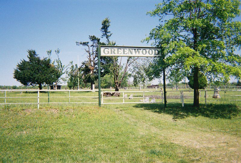
| Description | : | Located south of State Highway 51 between Yale and Schlegel, Oklahoma. Directions: Turn south off State Highway 51 onto Greenwood Road. The cemetery is located on the west side of Greenwood Road. |
frequently asked questions (FAQ):
-
Where is Greenwood Cemetery?
Greenwood Cemetery is located at Greenwood Road Yale, Payne County ,Oklahoma ,USA.
-
Greenwood Cemetery cemetery's updated grave count on graveviews.com?
10 memorials
-
Where are the coordinates of the Greenwood Cemetery?
Latitude: 36.0443993
Longitude: -96.6613998
Nearby Cemetories:
1. Drumright North Cemetery
Drumright, Creek County, USA
Coordinate: 36.0022011, -96.6093979
2. Underwood Cemetery
Yale, Payne County, USA
Coordinate: 36.1086006, -96.6778030
3. Euchee Valley Memorial Park
Indian Township, Payne County, USA
Coordinate: 35.9839020, -96.6961060
4. Highland Cemetery
Oilton, Creek County, USA
Coordinate: 36.0844002, -96.5952988
5. Lough Gravesite
Drumright, Creek County, USA
Coordinate: 35.9893100, -96.5980420
6. Henry Hunter Cemetery
Cushing, Payne County, USA
Coordinate: 35.9667015, -96.6864014
7. Silver Star Cemetery
Cushing, Payne County, USA
Coordinate: 35.9852982, -96.7305984
8. Harrell Cemetery
Cushing, Payne County, USA
Coordinate: 35.9706001, -96.7138977
9. New Zion Cemetery
Cushing, Payne County, USA
Coordinate: 36.0227290, -96.7680020
10. Fairlawn Cemetery
Cushing, Payne County, USA
Coordinate: 36.0197740, -96.7678360
11. South Side Cemetery
Drumright, Creek County, USA
Coordinate: 35.9482994, -96.6072006
12. Lawson Cemetery
Yale, Payne County, USA
Coordinate: 36.1525002, -96.6941986
13. Brooks Cemetery
Silver City, Creek County, USA
Coordinate: 36.0971985, -96.5299988
14. Union Cemetery
Cushing, Payne County, USA
Coordinate: 35.9998703, -96.8025360
15. Diamond G Cemetery
Jennings, Pawnee County, USA
Coordinate: 36.1752566, -96.6405065
16. Shamrock Cemetery
Shamrock, Creek County, USA
Coordinate: 35.9150009, -96.5905991
17. Bend Cemetery
Ripley, Payne County, USA
Coordinate: 36.0360985, -96.8371964
18. Dunkin Cemetery
Ripley, Payne County, USA
Coordinate: 36.0368996, -96.8375015
19. Lutheran Cemetery
Lincoln County, USA
Coordinate: 35.9343100, -96.7843700
20. Jennings Cemetery
Jennings, Pawnee County, USA
Coordinate: 36.1878014, -96.5905991
21. Church of the Brethren Cemetery
Cushing, Payne County, USA
Coordinate: 35.9819870, -96.8372955
22. New Friendship Cemetery
Silver City, Creek County, USA
Coordinate: 36.0905991, -96.4764023
23. Sunrise Cemetery
Pawnee County, USA
Coordinate: 36.2030000, -96.6336000
24. Allen Family Cemetery
Lincoln County, USA
Coordinate: 35.8841600, -96.6283300