
| Memorials | : | 0 |
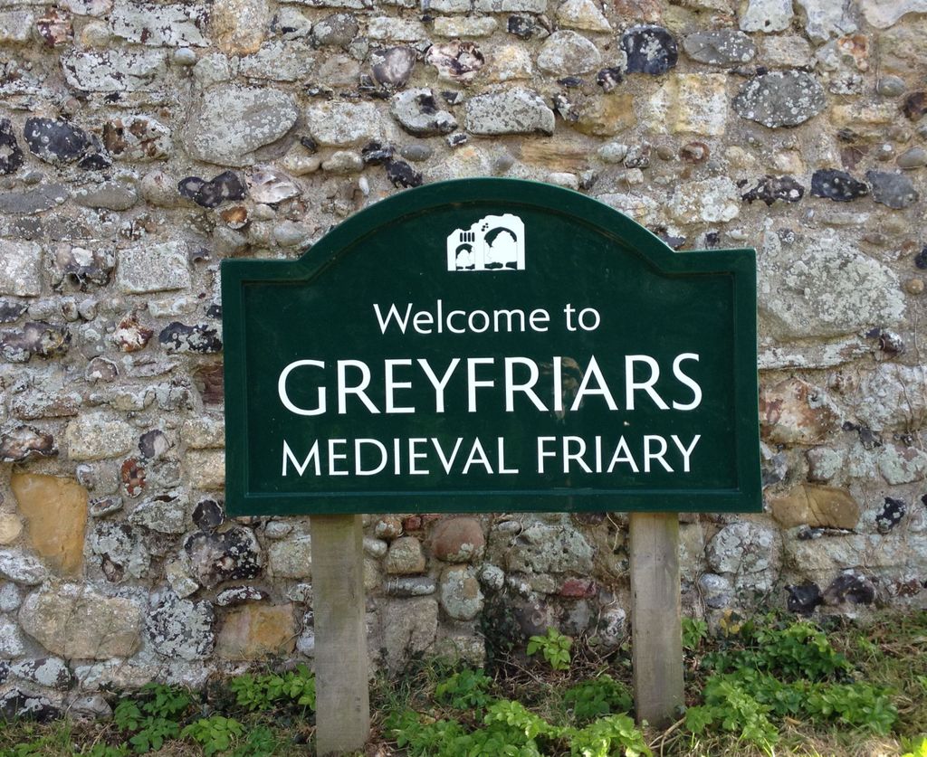
| Location | : | Dunwich, Suffolk Coastal District, England |
| Coordinate | : | 52.2755000, 1.6307000 |
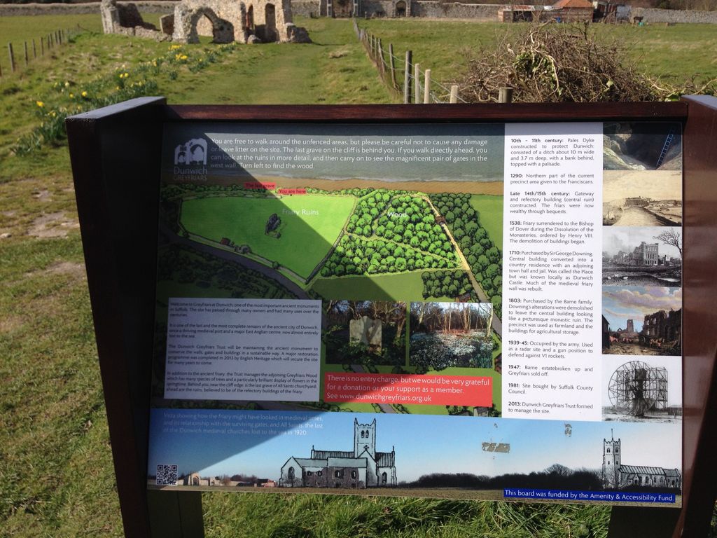
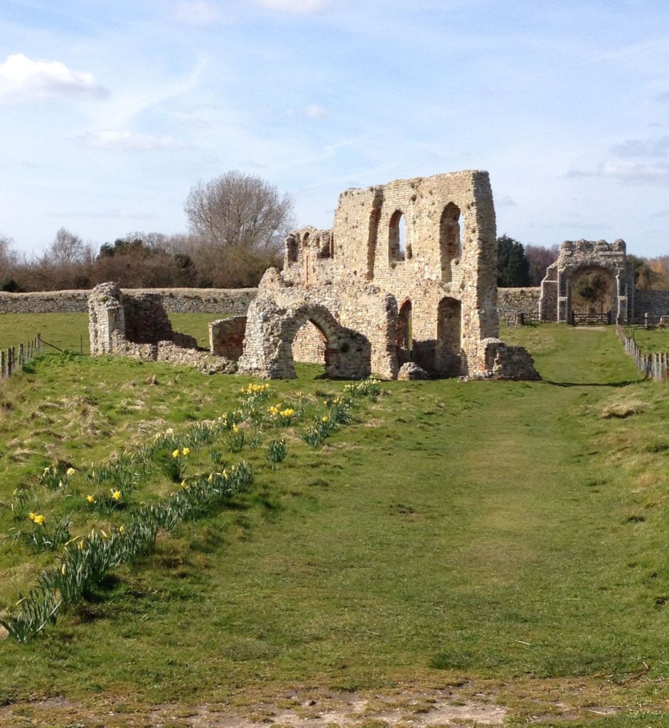
| Description | : | Greyfriars was a Franciscan friary in Dunwich, Suffolk. The friary was founded before 1277 by Richard FitzJohn and his wife Alice and dissolved in 1538 during the Dissolution of the Monasteries. The original site, which had 20 friars in 1277 when it first appears in records, was threatened by coastal erosion and the friary was moved to its present position in 1289. Many of the buildings are believed to have been destroyed on dissolution, with the remains used as a house, a town hall and a jail at various times. Modern remains consist of a precinct wall, two gatehouses... Read More |
frequently asked questions (FAQ):
-
Where is Greyfriars Medieval Friary?
Greyfriars Medieval Friary is located at Dunwich, Suffolk Coastal District ,Suffolk ,England.
-
Greyfriars Medieval Friary cemetery's updated grave count on graveviews.com?
0 memorials
-
Where are the coordinates of the Greyfriars Medieval Friary?
Latitude: 52.2755000
Longitude: 1.6307000
Nearby Cemetories:
1. All Saints Churchyard
Dunwich, Suffolk Coastal District, England
Coordinate: 52.2752300, 1.6321940
2. St. James's Churchyard
Dunwich, Suffolk Coastal District, England
Coordinate: 52.2779090, 1.6261340
3. Black Friars Priory
Dunwich, Suffolk Coastal District, England
Coordinate: 52.2719920, 1.6395154
4. Holy Trinity Churchyard
Middleton, Suffolk Coastal District, England
Coordinate: 52.2542140, 1.5589130
5. Holy Trinity Churchyard
Blythburgh, Suffolk Coastal District, England
Coordinate: 52.3211920, 1.5947390
6. All Saints Churchyard
Darsham, Suffolk Coastal District, England
Coordinate: 52.2741900, 1.5474200
7. St. Peter's Churchyard Extension
Theberton, Suffolk Coastal District, England
Coordinate: 52.2374910, 1.5693750
8. St. Peter's Churchyard
Theberton, Suffolk Coastal District, England
Coordinate: 52.2374790, 1.5682140
9. Saint Peter's Churchyard
Thorington, Suffolk Coastal District, England
Coordinate: 52.3118310, 1.5534681
10. St. Edmund's Churchyard
Southwold, Waveney District, England
Coordinate: 52.3282060, 1.6786390
11. St Margaret of Antioch Churchyard
Reydon, Waveney District, England
Coordinate: 52.3451350, 1.6556580
12. Southwold Cemetery
Southwold, Waveney District, England
Coordinate: 52.3457710, 1.6572730
13. All Saints Churchyard
Blyford, Waveney District, England
Coordinate: 52.3351840, 1.5574440
14. Quaker cemetery
Leiston, Suffolk Coastal District, England
Coordinate: 52.2073800, 1.5742950
15. Leiston Cemetery
Leiston, Suffolk Coastal District, England
Coordinate: 52.2105940, 1.5626350
16. St. Andrew's Churchyard
Bramfield, Suffolk Coastal District, England
Coordinate: 52.3102311, 1.5179990
17. United Reform Churchyard
Bramfield, Suffolk Coastal District, England
Coordinate: 52.3119170, 1.5183490
18. St. Margaret's Parish Churchyard
Leiston, Suffolk Coastal District, England
Coordinate: 52.2066800, 1.5679300
19. Ss Peter and Paul Churchyard
Wangford, Waveney District, England
Coordinate: 52.3546610, 1.6197460
20. St George's Churchyard
Dittisham, South Hams District, England
Coordinate: 52.1993239, 1.5785005
21. St Andrew's Churchyard
Sotherton, Waveney District, England
Coordinate: 52.3591930, 1.5837900
22. St. Lawrence Churchyard
Knodishall, Suffolk Coastal District, England
Coordinate: 52.2024000, 1.5488000
23. St Andrews Churchyard
Aldringham, Suffolk Coastal District, England
Coordinate: 52.1888450, 1.5877820
24. St Mary Churchyard
Uggeshall, Waveney District, England
Coordinate: 52.3665630, 1.6054470