
| Memorials | : | 16 |
| Location | : | Gibson County, USA |
| Coordinate | : | 36.0317001, -88.9617004 |
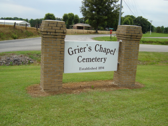
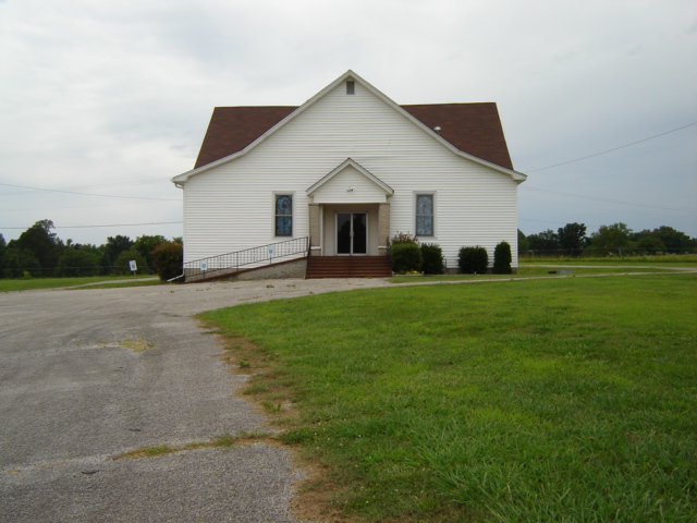
| Description | : | On 3-Aug-1894, F. Markham & his wife, Susan, and S.S. Grier and his wife, Harriet, deeded an acre of land to the trustees of the Methodist Episcopal Church. Only a few years later, Harriet was the first person to be buried in the cemetery. |
frequently asked questions (FAQ):
-
Where is Griers Chapel Cemetery?
Griers Chapel Cemetery is located at Gibson County ,Tennessee ,USA.
-
Griers Chapel Cemetery cemetery's updated grave count on graveviews.com?
16 memorials
-
Where are the coordinates of the Griers Chapel Cemetery?
Latitude: 36.0317001
Longitude: -88.9617004
Nearby Cemetories:
1. Mount Sinai Cemetery
Gibson County, USA
Coordinate: 36.0238991, -88.9535980
2. Bucksnort Cemetery
Gibson County, USA
Coordinate: 36.0318985, -88.9888992
3. Beech Grove Baptist Church Cemetery
Dyer, Gibson County, USA
Coordinate: 36.0281710, -88.9886220
4. Cooper Family Cemetery
Trenton, Gibson County, USA
Coordinate: 36.0418840, -88.9371910
5. Biggs Family Cemetery
Grizzard, Gibson County, USA
Coordinate: 36.0184200, -88.9935500
6. Poplar Grove Cemetery
Dyer, Gibson County, USA
Coordinate: 36.0574989, -88.9389038
7. Harrison Cemetery
Gibson County, USA
Coordinate: 36.0321300, -88.9191800
8. Oakwood Cemetery
Dyer, Gibson County, USA
Coordinate: 36.0619011, -88.9875031
9. Raines Cemetery
Trenton, Gibson County, USA
Coordinate: 35.9970680, -88.9811270
10. New Bethlehem Memorial Cemetery
Dyer, Gibson County, USA
Coordinate: 36.0689090, -88.9452540
11. Keeley Cemetery
Gibson County, USA
Coordinate: 36.0511017, -88.9175034
12. Union United Methodist Cemetery
Gibson County, USA
Coordinate: 36.0203018, -88.9122009
13. Apostolic Faith Tabernacle Cemetery
Dyer, Gibson County, USA
Coordinate: 36.0732460, -88.9674180
14. New Bethlehem Baptist Church Cemetery
Dyer, Gibson County, USA
Coordinate: 36.0715180, -88.9448400
15. Salem Baptist Church Cemetery
Trenton, Gibson County, USA
Coordinate: 36.0266991, -88.9075012
16. Keas Cemetery
Dyer, Gibson County, USA
Coordinate: 36.0769005, -88.9757996
17. Bobbitt Cemetery
Dyer, Gibson County, USA
Coordinate: 36.0774994, -88.9850006
18. William P. Seat Gravesite
Trenton, Gibson County, USA
Coordinate: 35.9814589, -88.9419286
19. Burrow-Webb Burial Grounds
Trenton, Gibson County, USA
Coordinate: 35.9847970, -88.9302150
20. Cartwright Family
Dyer, Gibson County, USA
Coordinate: 36.0523510, -88.9001610
21. Clear Creek Cemetery
Currie, Gibson County, USA
Coordinate: 36.0400009, -89.0299988
22. Oakland Cemetery
Trenton, Gibson County, USA
Coordinate: 35.9708080, -88.9462580
23. Hall Family Cemetery
Dyer, Gibson County, USA
Coordinate: 36.0302900, -89.0393600
24. Ward Cemetery
Trenton, Gibson County, USA
Coordinate: 35.9696440, -88.9484860