
| Memorials | : | 9 |
| Location | : | Dyer, Gibson County, USA |
| Coordinate | : | 36.0715180, -88.9448400 |
| Description | : | From Front St. in Dyer, travel east on College St. for 1.4 mi., continuing on New Bethlehem Rd. for 1.4 mi to the church & cemetery to the north (left) behind the church. |
frequently asked questions (FAQ):
-
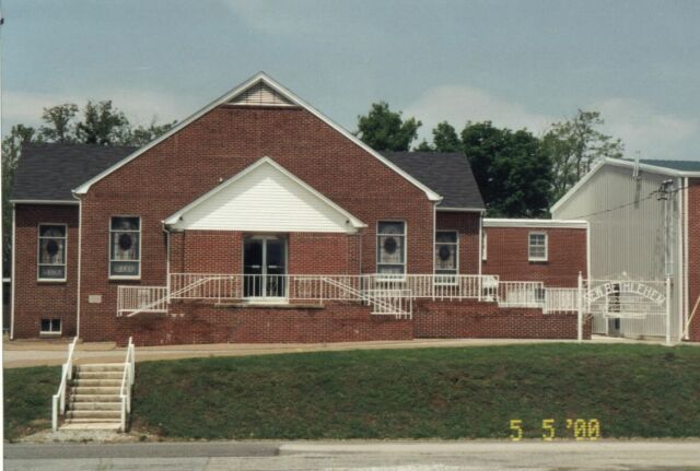
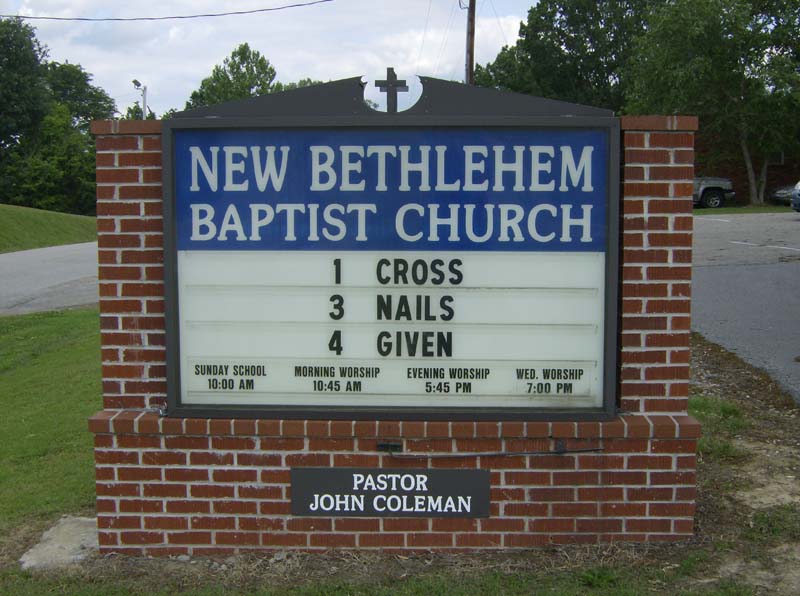
Where is New Bethlehem Baptist Church Cemetery?
New Bethlehem Baptist Church Cemetery is located at New Bethlehem Rd Dyer, Gibson County ,Tennessee ,USA.
-
New Bethlehem Baptist Church Cemetery cemetery's updated grave count on graveviews.com?
9 memorials
-
Where are the coordinates of the New Bethlehem Baptist Church Cemetery?
Latitude: 36.0715180
Longitude: -88.9448400
Nearby Cemetories:
1. New Bethlehem Memorial Cemetery
Dyer, Gibson County, USA
Coordinate: 36.0689090, -88.9452540
2. Poplar Grove Cemetery
Dyer, Gibson County, USA
Coordinate: 36.0574989, -88.9389038
3. Apostolic Faith Tabernacle Cemetery
Dyer, Gibson County, USA
Coordinate: 36.0732460, -88.9674180
4. Keas Cemetery
Dyer, Gibson County, USA
Coordinate: 36.0769005, -88.9757996
5. Keeley Cemetery
Gibson County, USA
Coordinate: 36.0511017, -88.9175034
6. Cooper Family Cemetery
Trenton, Gibson County, USA
Coordinate: 36.0418840, -88.9371910
7. Bobbitt Cemetery
Dyer, Gibson County, USA
Coordinate: 36.0774994, -88.9850006
8. Oakwood Cemetery
Dyer, Gibson County, USA
Coordinate: 36.0619011, -88.9875031
9. Cartwright Family
Dyer, Gibson County, USA
Coordinate: 36.0523510, -88.9001610
10. Hopper Cemetery
Dyer, Gibson County, USA
Coordinate: 36.0936200, -88.9878680
11. Griers Chapel Cemetery
Gibson County, USA
Coordinate: 36.0317001, -88.9617004
12. Harrison Cemetery
Gibson County, USA
Coordinate: 36.0321300, -88.9191800
13. Mount Sinai Cemetery
Gibson County, USA
Coordinate: 36.0238991, -88.9535980
14. Mount Zion Cemetery
Dyer, Gibson County, USA
Coordinate: 36.0936775, -88.8878403
15. Salem Cemetery
Rutherford, Gibson County, USA
Coordinate: 36.1217003, -88.9266968
16. Bucksnort Cemetery
Gibson County, USA
Coordinate: 36.0318985, -88.9888992
17. Salem Baptist Church Cemetery
Trenton, Gibson County, USA
Coordinate: 36.0266991, -88.9075012
18. Beech Grove Baptist Church Cemetery
Dyer, Gibson County, USA
Coordinate: 36.0281710, -88.9886220
19. Union United Methodist Cemetery
Gibson County, USA
Coordinate: 36.0203018, -88.9122009
20. Biggs Family Cemetery
Grizzard, Gibson County, USA
Coordinate: 36.0184200, -88.9935500
21. Antioch Cumberland Presbyterian Cemetery
Bradford, Gibson County, USA
Coordinate: 36.1050010, -88.8742630
22. Antioch Methodist Cemetery
Bradford, Gibson County, USA
Coordinate: 36.1061400, -88.8737340
23. Mount Olive Cemetery
Dyer, Gibson County, USA
Coordinate: 36.0807991, -89.0278015
24. Crockett Memorial Plot
Rutherford, Gibson County, USA
Coordinate: 36.1299620, -88.9871980