
| Memorials | : | 0 |
| Location | : | Carthage, Hamilton County, USA |
| Coordinate | : | 39.2047000, -84.4770730 |
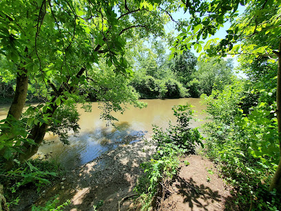
| Description | : | This cemetery is defunct. It was located where the Carthage and Springdale Turnpike (Vine Street) crosses the Mill Creek in Hartwell about one-half mile west of White's Station. Griffin's Station was a scattered settlement, the buildings being strung out from the bank of the Mill Creek, west of the present Carthage Fairgrounds, north to Caldwell Road. It was established by October 1793. The map location is approximate. The cemetery is located in Springfield Township, Hamilton County, Ohio, and is # 14549 (Caldwell Cemetery) in “Ohio Cemeteries 1803-2003”, compiled by the Ohio Genealogical Society. |
frequently asked questions (FAQ):
-
Where is Griffins Station Cemetery?
Griffins Station Cemetery is located at Vine Street (Ohio State Route 4) Carthage, Hamilton County ,Ohio , 45216USA.
-
Griffins Station Cemetery cemetery's updated grave count on graveviews.com?
0 memorials
-
Where are the coordinates of the Griffins Station Cemetery?
Latitude: 39.2047000
Longitude: -84.4770730
Nearby Cemetories:
1. City Infirmary Cemetery
Hartwell, Hamilton County, USA
Coordinate: 39.2123500, -84.4806700
2. Saint Clare Convent Cemetery
Mount Healthy, Hamilton County, USA
Coordinate: 39.2206750, -84.4782390
3. Longview Hospital Cemetery
Roselawn, Hamilton County, USA
Coordinate: 39.1887730, -84.4691660
4. Convent of the Good Shepherd Cemetery (Defunct)
Carthage, Hamilton County, USA
Coordinate: 39.2055250, -84.5042780
5. Voorhees Family Burying Ground
Lockland, Hamilton County, USA
Coordinate: 39.2296982, -84.4480972
6. Beech Grove Cemetery
Springfield Township, Hamilton County, USA
Coordinate: 39.2364006, -84.4916992
7. Old Finneytown Cemetery
Finneytown, Hamilton County, USA
Coordinate: 39.1962220, -84.5206120
8. Reading Cemetery
Reading, Hamilton County, USA
Coordinate: 39.2296982, -84.4419022
9. LaRue-Gardner Family Cemetery
Wyoming Meadows, Hamilton County, USA
Coordinate: 39.2347603, -84.5071411
10. Saint Mary Cemetery
Saint Bernard, Hamilton County, USA
Coordinate: 39.1664009, -84.4880981
11. Sisters of Notre Dame Cemetery
Reading, Hamilton County, USA
Coordinate: 39.2219009, -84.4297028
12. Saints Peter and Paul Old Cemetery
Reading, Hamilton County, USA
Coordinate: 39.2218000, -84.4291800
13. Pleasant Ridge Presbyterian Cemetery
Pleasant Ridge, Hamilton County, USA
Coordinate: 39.1794014, -84.4332962
14. Saints Peter And Paul Cemetery
Reading, Hamilton County, USA
Coordinate: 39.2308006, -84.4313965
15. All Saints Episcopal Church Memorial Garden
Pleasant Ridge, Hamilton County, USA
Coordinate: 39.1856910, -84.4241000
16. Saint John Cemetery
Saint Bernard, Hamilton County, USA
Coordinate: 39.1643982, -84.5053024
17. James Moore Family Cemetery
Wildbrook Acres, Hamilton County, USA
Coordinate: 39.2442741, -84.5157166
18. Spring Grove Cemetery
Cincinnati, Hamilton County, USA
Coordinate: 39.1647900, -84.5231500
19. First German Protestant Cemetery
Avondale, Hamilton County, USA
Coordinate: 39.1492004, -84.4863968
20. Skillman Family Cemetery
Woodlawn, Hamilton County, USA
Coordinate: 39.2588654, -84.4576950
21. Gilbert Family Cemetery
Sycamore, Hamilton County, USA
Coordinate: 39.2250500, -84.4085400
22. Bishop Cemetery (Defunct)
College Hill, Hamilton County, USA
Coordinate: 39.1910210, -84.5489570
23. Laboiteaux-Cary Cemetery
North College Hill, Hamilton County, USA
Coordinate: 39.2181015, -84.5500031
24. Saint Marys Cemetery
Mount Healthy, Hamilton County, USA
Coordinate: 39.2329900, -84.5427000