
| Memorials | : | 0 |
| Location | : | Teague, Freestone County, USA |
| Coordinate | : | 31.6278000, -96.3771973 |
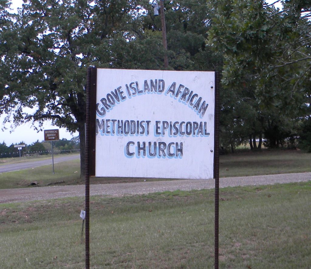
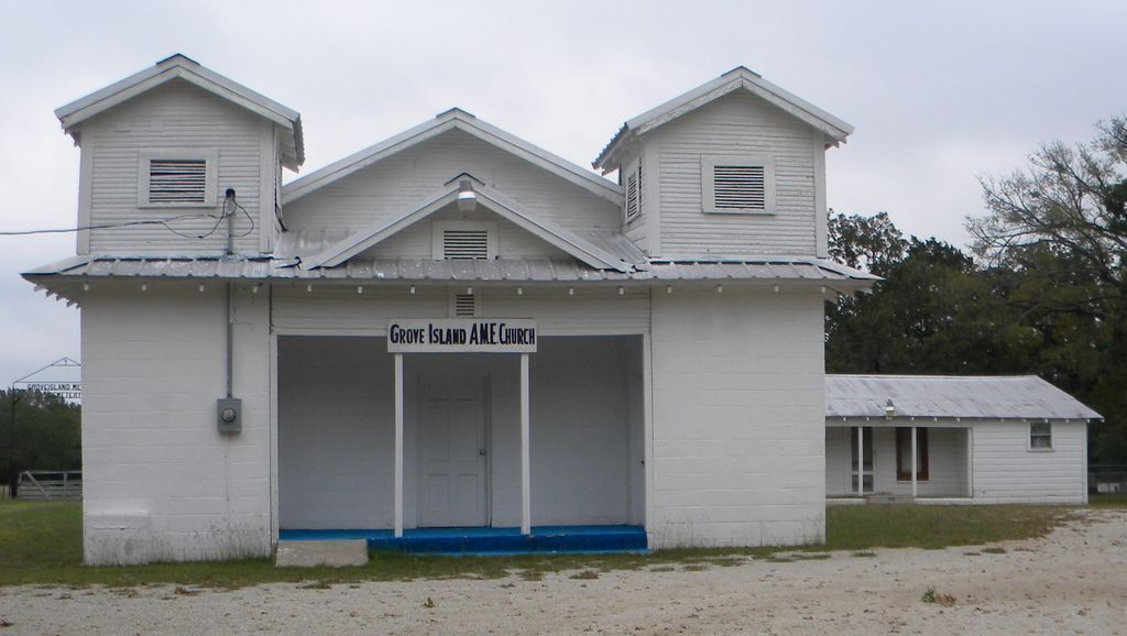
| Description | : | This cemetery was established for the parishioners of the Grove Island African Methodist Episcopal Church. From Teague, go west on Farm-to-Market road 1365. At the intersection where Prairie Grove Church Rd turns to the left, stop and look back to the right prior to the intersection and see the cemetery. The Grove Island AME church lists its address as County Road 901. |
frequently asked questions (FAQ):
-
Where is Grove Island African Methodist Episcopal Cemetery?
Grove Island African Methodist Episcopal Cemetery is located at Teague, Freestone County ,Texas ,USA.
-
Grove Island African Methodist Episcopal Cemetery cemetery's updated grave count on graveviews.com?
0 memorials
-
Where are the coordinates of the Grove Island African Methodist Episcopal Cemetery?
Latitude: 31.6278000
Longitude: -96.3771973
Nearby Cemetories:
1. Grayson Chapel Cemetery
Teague, Freestone County, USA
Coordinate: 31.6265620, -96.3254110
2. Oak Island Cemetery
Freestone County, USA
Coordinate: 31.6756001, -96.3764038
3. Mount Canaan Cemetery
Teague, Freestone County, USA
Coordinate: 31.5927780, -96.3379110
4. Cotton Gin Cemetery
Cotton Gin, Freestone County, USA
Coordinate: 31.6798401, -96.3520508
5. Greenwood Cemetery
Teague, Freestone County, USA
Coordinate: 31.6208000, -96.2966995
6. Hopewell Cemetery
Teague, Freestone County, USA
Coordinate: 31.6611004, -96.2947006
7. Antioch Cemetery
Teague, Freestone County, USA
Coordinate: 31.6399470, -96.2869110
8. Asia-Antioch Cemetery
Teague, Freestone County, USA
Coordinate: 31.6403008, -96.2857971
9. New Zion Baptist Church Cemetery
Freestone, Freestone County, USA
Coordinate: 31.7028500, -96.4130200
10. New Hope Cemetery
Cotton Gin, Freestone County, USA
Coordinate: 31.7031651, -96.4129333
11. Samford Family Cemetery
Teague, Freestone County, USA
Coordinate: 31.5475467, -96.3155775
12. J. I. Riddle Farm Cemetery
Freestone County, USA
Coordinate: 31.7255993, -96.3161011
13. Salem Cemetery
Freestone, Freestone County, USA
Coordinate: 31.5717660, -96.2648280
14. Shanks Cemetery
Kirvin, Freestone County, USA
Coordinate: 31.7322006, -96.3308029
15. Rocky Branch Cemetery
Kirvin, Freestone County, USA
Coordinate: 31.7404820, -96.3943890
16. McDonald Family Cemetery
Cotton Gin, Freestone County, USA
Coordinate: 31.7415260, -96.3935280
17. Kendrick Cemetery
Freestone County, USA
Coordinate: 31.5960999, -96.2307968
18. Horn
Wortham, Freestone County, USA
Coordinate: 31.7563782, -96.3374786
19. Driver Cemetery
Teague, Freestone County, USA
Coordinate: 31.6664009, -96.2230988
20. Union Cemetery
Freestone County, USA
Coordinate: 31.5259300, -96.2676870
21. Carter Family Cemetery
Fairfield, Freestone County, USA
Coordinate: 31.7487290, -96.2834230
22. George Cemetery
Freestone County, USA
Coordinate: 31.7005997, -96.2275009
23. Sessions Cemetery
Kirvin, Freestone County, USA
Coordinate: 31.7705994, -96.3217010
24. Woodland Cemetery
Kirvin, Freestone County, USA
Coordinate: 31.7838993, -96.3416977