| Memorials | : | 20 |
| Location | : | Strafford, Strafford County, USA |
| Coordinate | : | 43.3272220, -71.1238890 |
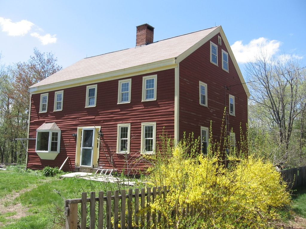
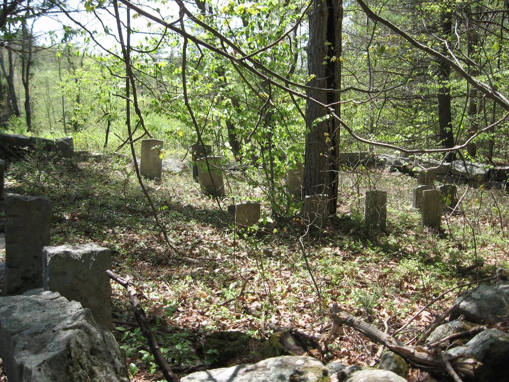
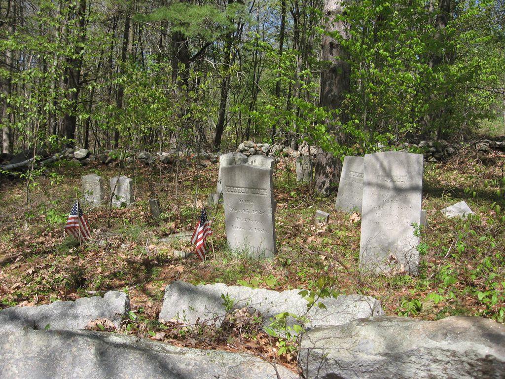
| Description | : | The Ham Homestead Burial Ground is located behind what was the Ham Tavern located at 691 First Crown Point Road, Strafford, NH. It is "at the foot of" "at the top of" or "on" Blue Job Mountain, depending on what you are reading or who you are talking to. The primary burials are that of the Ham family. George Ham was a soldier in the Revolutionary War and his son George, the War of 1812. Mark Ham was in the Civil War. There are also burials of Babb and Giles family members New Hampshire Old Graveyard Association database cemetery... Read More |
frequently asked questions (FAQ):
-
Where is Ham Homestead Burial Ground?
Ham Homestead Burial Ground is located at 1st Crown Point Road Strafford, Strafford County ,New Hampshire , 03884USA.
-
Ham Homestead Burial Ground cemetery's updated grave count on graveviews.com?
20 memorials
-
Where are the coordinates of the Ham Homestead Burial Ground?
Latitude: 43.3272220
Longitude: -71.1238890
Nearby Cemetories:
1. Scruton Cemetery
Strafford, Strafford County, USA
Coordinate: 43.3214700, -71.1139400
2. Scruton Cemetery
Strafford, Strafford County, USA
Coordinate: 43.3273500, -71.1103500
3. Mills Cemetery
Strafford, Strafford County, USA
Coordinate: 43.3355560, -71.1336110
4. Berry Cemetery
Strafford, Strafford County, USA
Coordinate: 43.3341670, -71.1383330
5. Otis Cemetery
Farmington, Strafford County, USA
Coordinate: 43.3272220, -71.1063890
6. Hayes Cemetery
Farmington, Strafford County, USA
Coordinate: 43.3403290, -71.1217700
7. Brock Cemetery
Strafford, Strafford County, USA
Coordinate: 43.3152780, -71.1083330
8. Brock Cemetery
Strafford, Strafford County, USA
Coordinate: 43.3129440, -71.1076110
9. Hall-Sanders Cemetery
Strafford, Strafford County, USA
Coordinate: 43.3134920, -71.1412000
10. Hayes Cemetery
Strafford, Strafford County, USA
Coordinate: 43.3167250, -71.1456770
11. Foss Cemetery
Strafford, Strafford County, USA
Coordinate: 43.3063650, -71.1262710
12. Foss Cemetery
Strafford, Strafford County, USA
Coordinate: 43.3293770, -71.1537690
13. Otis-Drew Cemetery
Strafford, Strafford County, USA
Coordinate: 43.3183330, -71.1527780
14. Brewster Cemetery
Strafford, Strafford County, USA
Coordinate: 43.3040700, -71.1339430
15. Drew Cemetery
Strafford, Strafford County, USA
Coordinate: 43.3214620, -71.1575460
16. Otis Cemetery
Farmington, Strafford County, USA
Coordinate: 43.3547220, -71.1261110
17. Berry-Foss Cemetery
Strafford Corner, Strafford County, USA
Coordinate: 43.3035540, -71.0928080
18. Stanton Family Cemetery
Strafford, Strafford County, USA
Coordinate: 43.3030200, -71.0927000
19. Lougee Cemetery
Strafford, Strafford County, USA
Coordinate: 43.3137810, -71.1678460
20. Bennett Cemetery
Farmington, Strafford County, USA
Coordinate: 43.3641670, -71.1177780
21. Blue Hills Cemetery
Strafford, Strafford County, USA
Coordinate: 43.3248620, -71.1756510
22. Hall - Gray Cemetery
Barnstead, Belknap County, USA
Coordinate: 43.3486110, -71.1666670
23. Bennett Cemetery
Farmington, Strafford County, USA
Coordinate: 43.3655560, -71.1166670
24. Berry Cemetery
Strafford, Strafford County, USA
Coordinate: 43.2986110, -71.0872220


