
| Memorials | : | 130 |
| Location | : | Harrisville, Dorchester County, USA |
| Coordinate | : | 38.4914100, -76.2169200 |
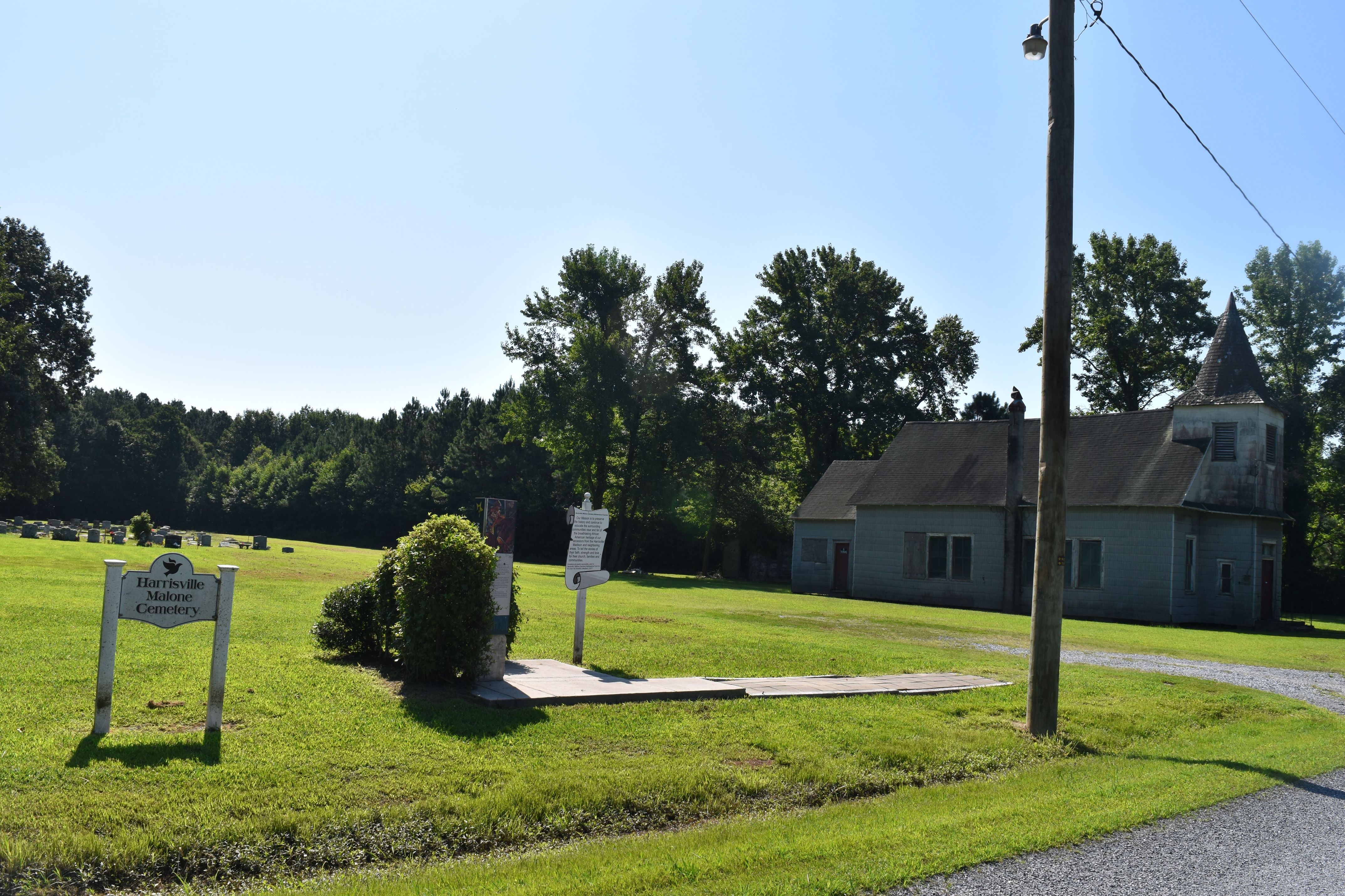
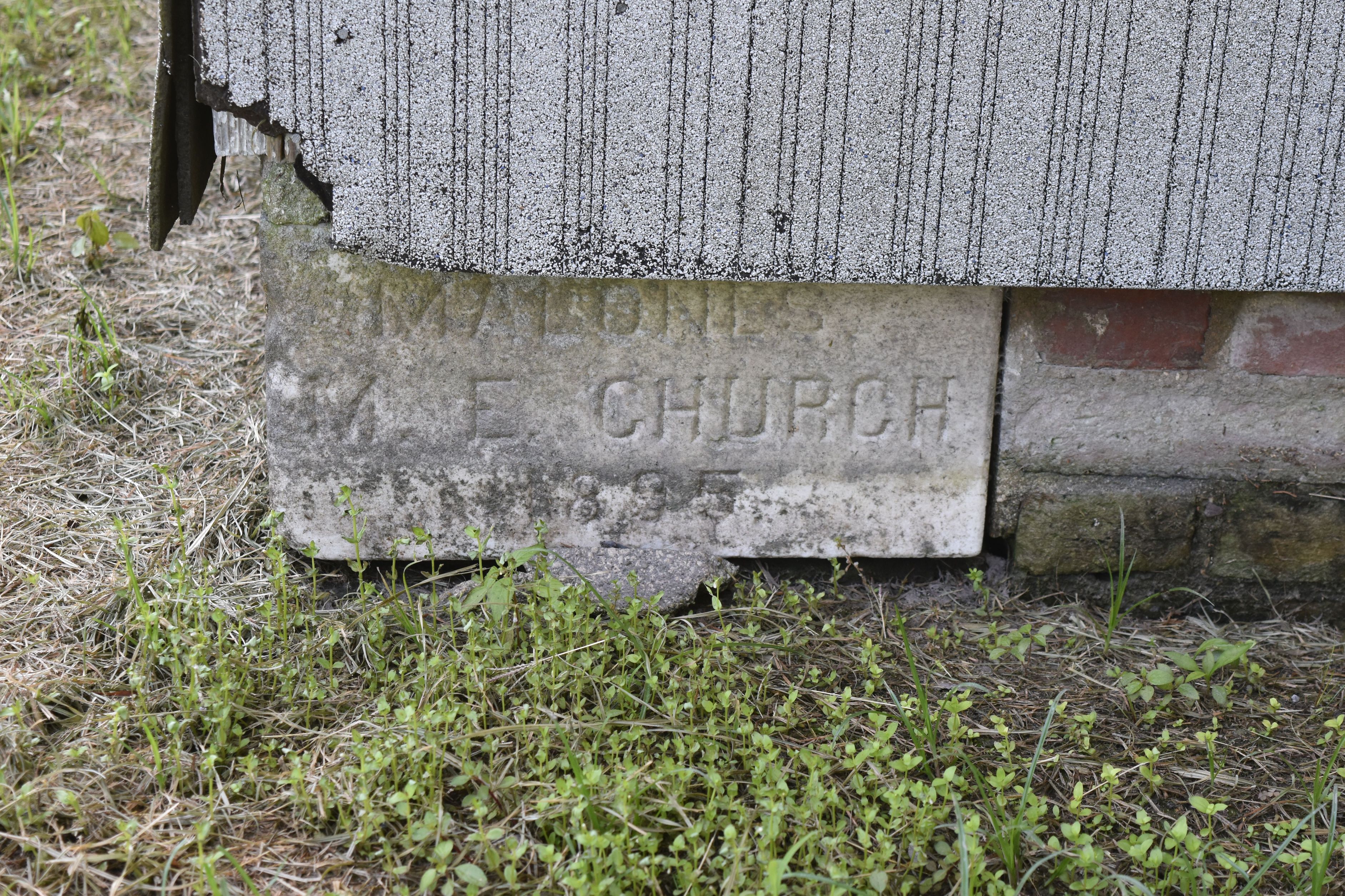
| Description | : | The Harrisville / Malone Cemetery's Maintenance Fund Inc. now manages the burials on the historic Malone M.E. Church grounds. The church was built in 1895. "The mission of the Fund is to preserve the history and continue to educate the surrounding communities near and far of the breathtaking African American heritage of our ancestors from the Harrisville / Madison and neighboring areas. To tell the stories of their faith, strength and love for their church, families and communities. |
frequently asked questions (FAQ):
-
Where is Harrisville Malone Cemetery?
Harrisville Malone Cemetery is located at 4676 White Marsh Road,Madison MD Harrisville, Dorchester County ,Maryland , 21648USA.
-
Harrisville Malone Cemetery cemetery's updated grave count on graveviews.com?
130 memorials
-
Where are the coordinates of the Harrisville Malone Cemetery?
Latitude: 38.4914100
Longitude: -76.2169200
Nearby Cemetories:
1. Gethsemane-Madison Cemetery
Madison, Dorchester County, USA
Coordinate: 38.5076000, -76.2210600
2. Joppa Cemetery
Madison, Dorchester County, USA
Coordinate: 38.5078011, -76.2200012
3. Old Trinity Episcopal Church Cemetery
Church Creek, Dorchester County, USA
Coordinate: 38.5040070, -76.1660580
4. Smithville Cemetery
Smithville, Dorchester County, USA
Coordinate: 38.4740000, -76.2753700
5. Old Field Cemetery
Cambridge, Dorchester County, USA
Coordinate: 38.4918870, -76.1324520
6. Antioch Cemetery
Dorchester County, USA
Coordinate: 38.5494003, -76.1568985
7. Blackwater National Wildlife Refuge Cemetery
Church Creek, Dorchester County, USA
Coordinate: 38.4239450, -76.1752370
8. George H. Applegarth Farm Cemetery
Cornersville, Dorchester County, USA
Coordinate: 38.5634000, -76.2442100
9. Grace Cemetery
Taylors Island, Dorchester County, USA
Coordinate: 38.4707985, -76.3091965
10. Brooks Creek Cemetery
Dorchester County, USA
Coordinate: 38.5549965, -76.2731628
11. Bethlehem Cemetery
Taylors Island, Dorchester County, USA
Coordinate: 38.4824982, -76.3167038
12. Oak Grove Methodist Episcopal Church Cemetery
Dorchester County, USA
Coordinate: 38.4134554, -76.2341108
13. Frank North Farm Cemetery
Cambridge, Dorchester County, USA
Coordinate: 38.5690983, -76.2387542
14. Dail Farm Cemetery
Cambridge, Dorchester County, USA
Coordinate: 38.5774855, -76.2502666
15. Dail Graveyard
Dorchester County, USA
Coordinate: 38.5487887, -76.1250697
16. Spedden-Seward Cemetery
Cambridge, Dorchester County, USA
Coordinate: 38.5786277, -76.2680635
17. Windemere Cemetery
Cambridge, Dorchester County, USA
Coordinate: 38.5811500, -76.1713400
18. Beckwith Cemetery
Hudson, Dorchester County, USA
Coordinate: 38.5937470, -76.2018590
19. Christ Rock United Methodist Church Cemetery
Cambridge, Dorchester County, USA
Coordinate: 38.5443878, -76.1030884
20. Saint Mary Star of the Sea Cemetery
Hooper Islands, Dorchester County, USA
Coordinate: 38.3856010, -76.2491989
21. Saint Johns United Methodist Church Cemetery
Church Creek, Dorchester County, USA
Coordinate: 38.3821983, -76.1936035
22. Saint John's Chapel Cemetery
Hudson, Dorchester County, USA
Coordinate: 38.6027985, -76.2213974
23. Moore / Marshall Cemetery
Cornersville, Dorchester County, USA
Coordinate: 38.6041496, -76.2211951
24. Stoney Point Graveyard - Neck District
Lloyds, Dorchester County, USA
Coordinate: 38.5998000, -76.1761500