
| Memorials | : | 19 |
| Location | : | Parsons, Decatur County, USA |
| Coordinate | : | 35.7190470, -88.1657000 |
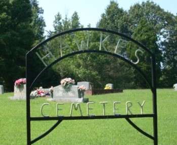
| Description | : | Hawkes Cemetery is located on the south side of Evanstown Road northwest of the Bible Hill community. It is indicated northwest of Bible Hill on the U.S.G.S. Parsons quadrangle (1986). The cemetery is well maintained. However, its age is difficult to determine. The oldest remaining markers are arrayed around a large open area in the center. Were there fieldstones here at one time? |
frequently asked questions (FAQ):
-
Where is Hawkes Cemetery?
Hawkes Cemetery is located at Evanstown Road Parsons, Decatur County ,Tennessee ,USA.
-
Hawkes Cemetery cemetery's updated grave count on graveviews.com?
19 memorials
-
Where are the coordinates of the Hawkes Cemetery?
Latitude: 35.7190470
Longitude: -88.1657000
Nearby Cemetories:
1. Box Cemetery
Decatur County, USA
Coordinate: 35.7069016, -88.1733017
2. Hendrix Cemetery
Bible Hill, Decatur County, USA
Coordinate: 35.7293220, -88.1518250
3. Arnold Cemetery
Decatur County, USA
Coordinate: 35.7210999, -88.1417007
4. Gulledge Cemetery
Decatur County, USA
Coordinate: 35.7392006, -88.1643982
5. Stephen Roberson Gravesite
Darden, Henderson County, USA
Coordinate: 35.7097750, -88.1919380
6. Bible Hill Church Cemetery
Parsons, Decatur County, USA
Coordinate: 35.7025880, -88.1425340
7. Hendrix Cemetery
Henderson County, USA
Coordinate: 35.7261009, -88.1996994
8. Long Cemetery
Decatur County, USA
Coordinate: 35.7032430, -88.1356640
9. Hill Cemetery
Parsons, Decatur County, USA
Coordinate: 35.6914190, -88.1505980
10. Hays Cemetery
Bible Hill, Decatur County, USA
Coordinate: 35.6914070, -88.1505910
11. Cheney Cemetery
Parsons, Decatur County, USA
Coordinate: 35.7219840, -88.1262170
12. Cedar Hill Cemetery
Henderson County, USA
Coordinate: 35.7484350, -88.1840030
13. Gabbard Cemetery
Parsons, Decatur County, USA
Coordinate: 35.6875340, -88.1507260
14. Montgomery Cemetery
Thurman, Decatur County, USA
Coordinate: 35.7464170, -88.1938370
15. Cub Creek Hall Cemetery
Parsons, Decatur County, USA
Coordinate: 35.7529410, -88.1492770
16. Gulledge Cemetery
Henderson County, USA
Coordinate: 35.7515450, -88.1926980
17. Park Cemetery
Henderson County, USA
Coordinate: 35.7517620, -88.1951990
18. Morris Cemetery
Wildersville, Henderson County, USA
Coordinate: 35.7416420, -88.2085370
19. Mount Ararat Cemetery
Darden, Henderson County, USA
Coordinate: 35.6907997, -88.2031021
20. Bowman Cemetery
Jeannette, Decatur County, USA
Coordinate: 35.7317350, -88.1147700
21. McMurry Cemetery
Parsons, Decatur County, USA
Coordinate: 35.6864650, -88.1294860
22. Gibson Cemetery
Yellow Springs, Decatur County, USA
Coordinate: 35.7585700, -88.1412850
23. Stills Cemetery
Parsons, Decatur County, USA
Coordinate: 35.6848660, -88.1269820
24. Evans Cemetery
Henderson County, USA
Coordinate: 35.6977997, -88.2172012