
| Memorials | : | 0 |
| Location | : | Parsons, Decatur County, USA |
| Coordinate | : | 35.6875340, -88.1507260 |
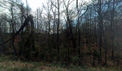
| Description | : | From the intersection of E Main & Tennessee Ave., in Parsons, travel west on W Main St. for 0.2 mi., turning north (right) onto Bible Hill Rd., going 3.2 mi., turning south at the intersection of Tip Hayes Rd. & 2 private drives. Travel due west on the private drive between the house & a barn for about 200 yards to the cemetery in the edge of the woods on the north (right) side. |
frequently asked questions (FAQ):
-
Where is Gabbard Cemetery?
Gabbard Cemetery is located at 3523 Bible Hill Rd Parsons, Decatur County ,Tennessee , 38363USA.
-
Gabbard Cemetery cemetery's updated grave count on graveviews.com?
0 memorials
-
Where are the coordinates of the Gabbard Cemetery?
Latitude: 35.6875340
Longitude: -88.1507260
Nearby Cemetories:
1. Hays Cemetery
Bible Hill, Decatur County, USA
Coordinate: 35.6914070, -88.1505910
2. Hill Cemetery
Parsons, Decatur County, USA
Coordinate: 35.6914190, -88.1505980
3. Bible Hill Church Cemetery
Parsons, Decatur County, USA
Coordinate: 35.7025880, -88.1425340
4. McMurry Cemetery
Parsons, Decatur County, USA
Coordinate: 35.6864650, -88.1294860
5. Stills Cemetery
Parsons, Decatur County, USA
Coordinate: 35.6848660, -88.1269820
6. Long Cemetery
Decatur County, USA
Coordinate: 35.7032430, -88.1356640
7. Box Cemetery
Decatur County, USA
Coordinate: 35.7069016, -88.1733017
8. Cross Roads Church Cemetery
Parsons, Decatur County, USA
Coordinate: 35.6814030, -88.1150360
9. Decatur County Memorial Gardens
Parsons, Decatur County, USA
Coordinate: 35.6838580, -88.1127480
10. Apostolic Church of Jesus Christ Cemetery
Parsons, Decatur County, USA
Coordinate: 35.6871480, -88.1106520
11. Hawkes Cemetery
Parsons, Decatur County, USA
Coordinate: 35.7190470, -88.1657000
12. Arnold Cemetery
Decatur County, USA
Coordinate: 35.7210999, -88.1417007
13. Bear Creek Church Cemetery
Parsons, Decatur County, USA
Coordinate: 35.6491130, -88.1481300
14. Cheney Cemetery
Parsons, Decatur County, USA
Coordinate: 35.7219840, -88.1262170
15. Stephen Roberson Gravesite
Darden, Henderson County, USA
Coordinate: 35.7097750, -88.1919380
16. Hendrix Cemetery
Bible Hill, Decatur County, USA
Coordinate: 35.7293220, -88.1518250
17. Mount Ararat Cemetery
Darden, Henderson County, USA
Coordinate: 35.6907997, -88.2031021
18. Walker Cemetery
Parsons, Decatur County, USA
Coordinate: 35.7120360, -88.1066540
19. Keen Cemetery
Parsons, Decatur County, USA
Coordinate: 35.6459090, -88.1715020
20. Parsons Cemetery
Parsons, Decatur County, USA
Coordinate: 35.6472200, -88.1205000
21. Jennings Cemetery
Parsons, Decatur County, USA
Coordinate: 35.7191020, -88.1053980
22. Barnett Cemetery
Parsons, Decatur County, USA
Coordinate: 35.6377790, -88.1581500
23. Houston Cemetery
Parsons, Decatur County, USA
Coordinate: 35.7037230, -88.0904280
24. Iron Hill Church Cemetery
Parsons, Decatur County, USA
Coordinate: 35.6638920, -88.0932450