
| Memorials | : | 30 |
| Location | : | Hesper, Douglas County, USA |
| Coordinate | : | 38.8984413, -95.0635910 |
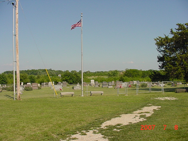
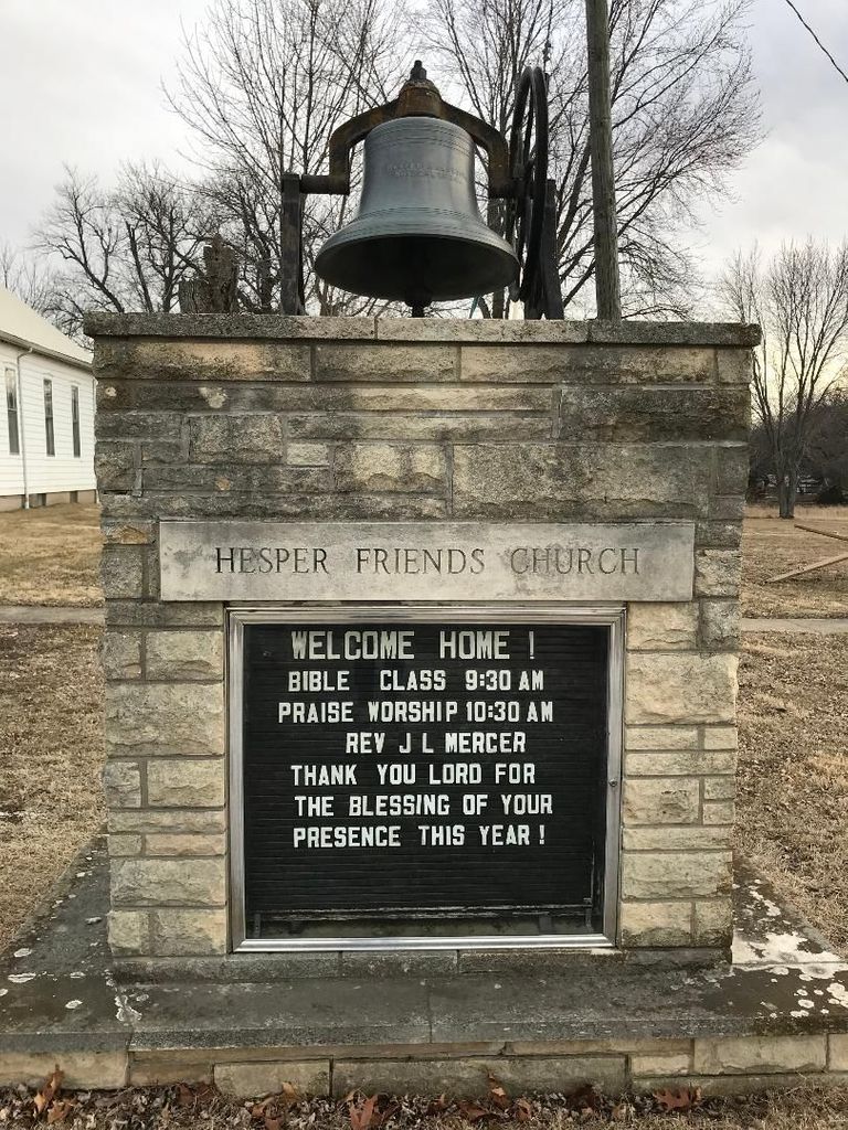
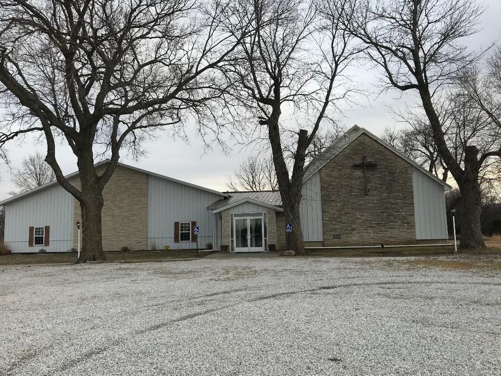
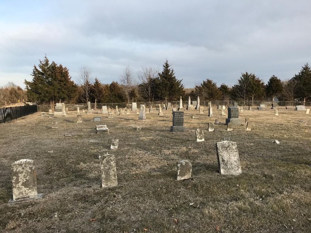
| Description | : | The land for this cemetery and the Hesper Friends Church was donated by Jonathan an Phebe Mendenhall in 1862. The church at that time was called Springfield Monthly Meeting. The cemetery is directly east of the church. The first grave is that of a fellow by the name of Elonzoamenzo Toothman in 1862 a native American. The name of Springfield Monthly Meeting was changed to Herper Monthly Meeting in 1883 Physical address: 2355 N 1100 Rd Eudora, KS 66025-9271 Mailing address: Hesper Monthly Meeting Of Friends 2355 N 1100 Rd Eudora, KS 66025-9271 |
frequently asked questions (FAQ):
-
Where is Hesper Friends Church Cemetery?
Hesper Friends Church Cemetery is located at Hesper, Douglas County ,Kansas ,USA.
-
Hesper Friends Church Cemetery cemetery's updated grave count on graveviews.com?
30 memorials
-
Where are the coordinates of the Hesper Friends Church Cemetery?
Latitude: 38.8984413
Longitude: -95.0635910
Nearby Cemetories:
1. Prairie Center Cemetery
De Soto, Johnson County, USA
Coordinate: 38.8925018, -95.0286026
2. Deay Cemetery
Eudora, Douglas County, USA
Coordinate: 38.8546486, -95.0749435
3. Adams Burial Ground
Gardner, Johnson County, USA
Coordinate: 38.8579483, -95.0384140
4. Cemetery Beni Israel
Eudora, Douglas County, USA
Coordinate: 38.9280128, -95.1122208
5. Southwest City Cemetery
Eudora, Douglas County, USA
Coordinate: 38.9334800, -95.1070300
6. Holy Family Cemetery
Eudora, Douglas County, USA
Coordinate: 38.9438050, -95.0933570
7. Eudora City Cemetery
Eudora, Douglas County, USA
Coordinate: 38.9455986, -95.0892029
8. Pleasant Valley Cemetery
Gardner, Johnson County, USA
Coordinate: 38.8480377, -95.0360489
9. Delaware Cemetery
Linwood, Leavenworth County, USA
Coordinate: 38.9642982, -95.0936356
10. Clearfield Cemetery
Clearfield, Douglas County, USA
Coordinate: 38.8260002, -95.0930023
11. Luckan Family Cemetery
Fall Leaf, Leavenworth County, USA
Coordinate: 38.9808500, -95.1128000
12. DeSoto Cemetery
De Soto, Johnson County, USA
Coordinate: 38.9710999, -94.9882965
13. Blue Mound Cemetery
Lawrence, Douglas County, USA
Coordinate: 38.9046600, -95.1865400
14. Four Corners Cemetery
Gardner, Johnson County, USA
Coordinate: 38.8314018, -94.9728012
15. Villa Eden Cemetery
Fall Leaf, Leavenworth County, USA
Coordinate: 38.9928500, -95.0985000
16. Vinland Cemetery
Vinland, Douglas County, USA
Coordinate: 38.8485985, -95.1763992
17. Union Congregational Cemetery
Linwood, Leavenworth County, USA
Coordinate: 39.0013351, -95.0370407
18. Franklin Cemetery
Douglas County, USA
Coordinate: 38.9437523, -95.1869431
19. Mount Sidney Cemetery
Linwood, Leavenworth County, USA
Coordinate: 39.0017014, -95.0243988
20. Saint Johns Catholic Cemetery
Douglas County, USA
Coordinate: 38.9437900, -95.1919600
21. Chance Cemetery
Linwood, Leavenworth County, USA
Coordinate: 39.0018997, -95.0156021
22. County Poor Farm Cemetery
Douglas County, USA
Coordinate: 38.9119400, -95.2214600
23. Kennedy Cemetery
Douglas County, USA
Coordinate: 38.9112900, -95.2269200
24. Cedar Junction Cemetery
Cedar, Johnson County, USA
Coordinate: 38.9776800, -94.9339500