
| Memorials | : | 0 |
| Location | : | Hever, Sevenoaks District, England |
| Coordinate | : | 51.1843770, 0.1111220 |
frequently asked questions (FAQ):
-
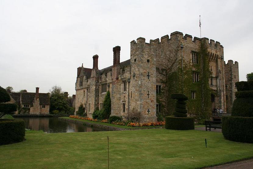
Where is Hever Castle Grounds?
Hever Castle Grounds is located at Hever, Sevenoaks District ,Kent ,England.
-
Hever Castle Grounds cemetery's updated grave count on graveviews.com?
0 memorials
-
Where are the coordinates of the Hever Castle Grounds?
Latitude: 51.1843770
Longitude: 0.1111220
Nearby Cemetories:
1. St Peter Churchyard
Hever, Sevenoaks District, England
Coordinate: 51.1838050, 0.1112430
2. Holy Trinity Churchyard
Markbeech, Sevenoaks District, England
Coordinate: 51.1651750, 0.1077720
3. St Mary Churchyard
Chiddingstone, Sevenoaks District, England
Coordinate: 51.1862770, 0.1461440
4. Chiddingstone Churchyard Extension
Chiddingstone, Sevenoaks District, England
Coordinate: 51.1861590, 0.1488930
5. Edenbridge Cemetery
Edenbridge, Sevenoaks District, England
Coordinate: 51.1962400, 0.0680000
6. Holy Trinity Churchyard
Crockham Hill, Sevenoaks District, England
Coordinate: 51.1982790, 0.1538090
7. St Peter and St Paul Churchyard
Edenbridge, Sevenoaks District, England
Coordinate: 51.1959000, 0.0661400
8. St. Lawrence's Catholic Churchyard
Edenbridge, Sevenoaks District, England
Coordinate: 51.1951354, 0.0654156
9. Cowden New Burial Ground
Cowden, Sevenoaks District, England
Coordinate: 51.1447210, 0.0958650
10. St Luke Churchyard
Chiddingstone Causeway, Sevenoaks District, England
Coordinate: 51.1974910, 0.1758540
11. St. John the Baptist Churchyard
Penshurst, Sevenoaks District, England
Coordinate: 51.1735240, 0.1834540
12. All Saints Churchyard
Blackham, Wealden District, England
Coordinate: 51.1411200, 0.1405600
13. St. Peter's Churchyard
Holtye, Wealden District, England
Coordinate: 51.1338783, 0.0821108
14. St. Peter's Churchyard
Fordcombe, Sevenoaks District, England
Coordinate: 51.1422043, 0.1792730
15. All Souls Churchyard
Poundsbridge, Sevenoaks District, England
Coordinate: 51.1540700, 0.1961470
16. St Martin of Tours Churchyard
Ashurst, Tunbridge Wells Borough, England
Coordinate: 51.1306560, 0.1590710
17. St. Mary's Churchyard
Ide Hill, Sevenoaks District, England
Coordinate: 51.2454500, 0.1277900
18. Chartwell
Edenbridge, Sevenoaks District, England
Coordinate: 51.2443430, 0.0833630
19. St. Mary's Churchyard
Leigh, Sevenoaks District, England
Coordinate: 51.1977660, 0.2151510
20. Dormansland Baptist Chapelyard
Dormansland, Tandridge District, England
Coordinate: 51.1634300, 0.0073300
21. St John the Evangelist Churchyard
Dormansland, Tandridge District, England
Coordinate: 51.1597320, 0.0054300
22. St. Mary the Virgin Churchyard
Speldhurst, Tunbridge Wells Borough, England
Coordinate: 51.1510790, 0.2198230
23. All Saints Churchyard
Langton Green, Tunbridge Wells Borough, England
Coordinate: 51.1309738, 0.2022060
24. St Peter and St Paul Churchyard
Lingfield, Tandridge District, England
Coordinate: 51.1763840, -0.0142480