
| Memorials | : | 0 |
| Location | : | Edenbridge, Sevenoaks District, England |
| Phone | : | +44 1732 862256 |
| Website | : | www.stlawrence.org.uk/ |
| Coordinate | : | 51.1951354, 0.0654156 |
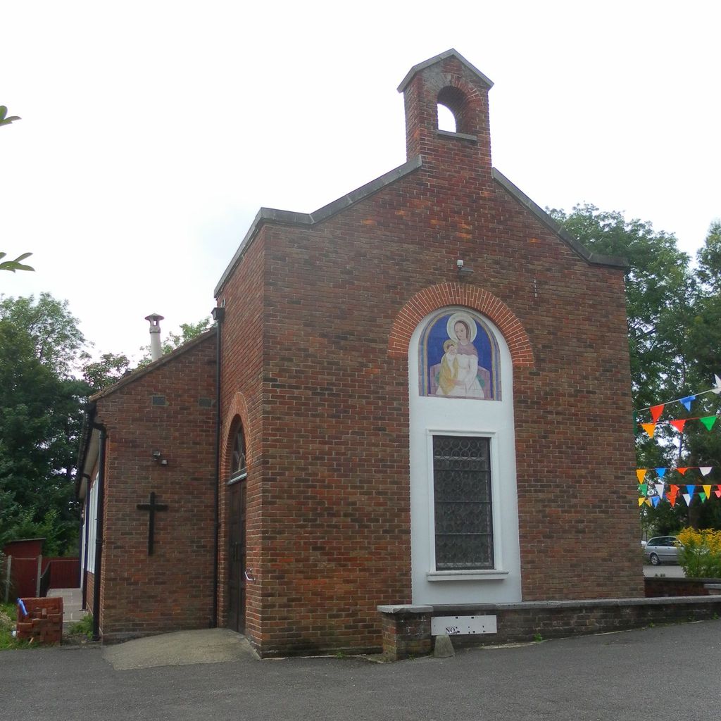
| Description | : | Churchyard of Roman Catholics St Lawrence's Church, registered in 1933. The church is set back from the High Street on the right hand side as you come from the north end of town, just before you reach the main postal sorting office. |
frequently asked questions (FAQ):
-
Where is St. Lawrence's Catholic Churchyard?
St. Lawrence's Catholic Churchyard is located at High Street Edenbridge, Sevenoaks District ,Kent , TN8 5AQEngland.
-
St. Lawrence's Catholic Churchyard cemetery's updated grave count on graveviews.com?
0 memorials
-
Where are the coordinates of the St. Lawrence's Catholic Churchyard?
Latitude: 51.1951354
Longitude: 0.0654156
Nearby Cemetories:
1. St Peter and St Paul Churchyard
Edenbridge, Sevenoaks District, England
Coordinate: 51.1959000, 0.0661400
2. Edenbridge Cemetery
Edenbridge, Sevenoaks District, England
Coordinate: 51.1962400, 0.0680000
3. Hever Castle Grounds
Hever, Sevenoaks District, England
Coordinate: 51.1843770, 0.1111220
4. St Peter Churchyard
Hever, Sevenoaks District, England
Coordinate: 51.1838050, 0.1112430
5. Holy Trinity Churchyard
Markbeech, Sevenoaks District, England
Coordinate: 51.1651750, 0.1077720
6. Dormansland Baptist Chapelyard
Dormansland, Tandridge District, England
Coordinate: 51.1634300, 0.0073300
7. Chartwell
Edenbridge, Sevenoaks District, England
Coordinate: 51.2443430, 0.0833630
8. St Mary Churchyard
Chiddingstone, Sevenoaks District, England
Coordinate: 51.1862770, 0.1461440
9. St John the Evangelist Churchyard
Dormansland, Tandridge District, England
Coordinate: 51.1597320, 0.0054300
10. Chiddingstone Churchyard Extension
Chiddingstone, Sevenoaks District, England
Coordinate: 51.1861590, 0.1488930
11. St Peter and St Paul Churchyard
Lingfield, Tandridge District, England
Coordinate: 51.1763840, -0.0142480
12. Cowden New Burial Ground
Cowden, Sevenoaks District, England
Coordinate: 51.1447210, 0.0958650
13. Holy Trinity Churchyard
Crockham Hill, Sevenoaks District, England
Coordinate: 51.1982790, 0.1538090
14. St. Peter's Churchyard
Holtye, Wealden District, England
Coordinate: 51.1338783, 0.0821108
15. St. Mary's Churchyard
Ide Hill, Sevenoaks District, England
Coordinate: 51.2454500, 0.1277900
16. St Luke Churchyard
Chiddingstone Causeway, Sevenoaks District, England
Coordinate: 51.1974910, 0.1758540
17. All Saints Churchyard
Blackham, Wealden District, England
Coordinate: 51.1411200, 0.1405600
18. St Mary the Virgin Churchyard
Westerham, Sevenoaks District, England
Coordinate: 51.2675000, 0.0734930
19. St Peter Churchyard
Limpsfield, Tandridge District, England
Coordinate: 51.2609596, 0.0123030
20. St. John the Evangelist Churchyard
Blindley Heath, Tandridge District, England
Coordinate: 51.1961510, -0.0536070
21. St. John the Baptist Churchyard
Penshurst, Sevenoaks District, England
Coordinate: 51.1735240, 0.1834540
22. St Peter Churchyard
Tandridge, Tandridge District, England
Coordinate: 51.2429480, -0.0320950
23. Mount Noddy Cemetery
East Grinstead, Mid Sussex District, England
Coordinate: 51.1316231, -0.0066281
24. St Mary the Virgin Churchyard
Oxted, Tandridge District, England
Coordinate: 51.2590680, -0.0086690