
| Memorials | : | 0 |
| Location | : | Ardmore, Carter County, USA |
| Coordinate | : | 34.1069810, -97.1722810 |
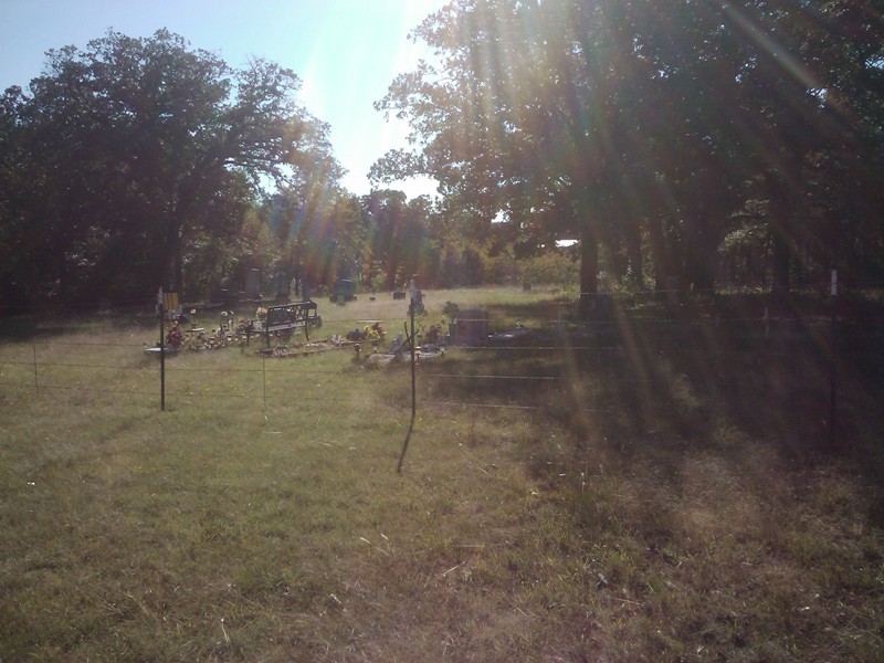
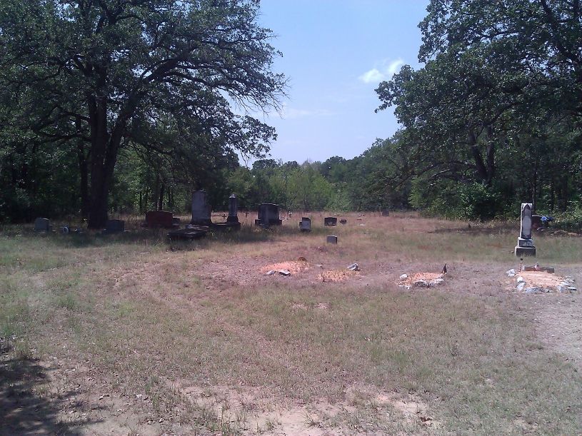
| Description | : | Hickory Indian Cemetery is located in Section 23, Township 5 South, Range 1 East in Carter County, Oklahoma. It is approximately five miles southwest of the city of Ardmore. Driving Directions: From Ardmore, take Commerce Street south to Highway 70. Turn right (west) onto Highway 70. The highway passes under Interstate 35. At the stop sign turn left (south) onto Hedges Road. Go 1 and 3/4 mile south. Turn right (west) onto Bussel Road. Go 1 mile. Turn left (south) onto Plainview Road. Go south 1/2 mile. Turn left (east) onto Lockwood Lane. Follow Lockwood Lane until it... Read More |
frequently asked questions (FAQ):
-
Where is Hickory Indian Cemetery?
Hickory Indian Cemetery is located at Ardmore, Carter County ,Oklahoma ,USA.
-
Hickory Indian Cemetery cemetery's updated grave count on graveviews.com?
0 memorials
-
Where are the coordinates of the Hickory Indian Cemetery?
Latitude: 34.1069810
Longitude: -97.1722810
Nearby Cemetories:
1. McAlister Cemetery
Carter County, USA
Coordinate: 34.0806007, -97.1560974
2. Crinerville Cemetery
Brock, Carter County, USA
Coordinate: 34.0900002, -97.2097015
3. Hillcrest Memorial Park
Ardmore, Carter County, USA
Coordinate: 34.1413994, -97.1316986
4. Rose Hill Cemetery
Ardmore, Carter County, USA
Coordinate: 34.1453018, -97.1355972
5. Saint Marys Cemetery
Ardmore, Carter County, USA
Coordinate: 34.1486015, -97.1355972
6. Mount Zion Cemetery
Ardmore, Carter County, USA
Coordinate: 34.1486015, -97.1343994
7. Porter Indian Cemetery
Carter County, USA
Coordinate: 34.0791512, -97.1177979
8. Saint Philip's Episcopal Church Columbarium
Ardmore, Carter County, USA
Coordinate: 34.1727540, -97.1351420
9. Gordon Cemetery
Marietta, Love County, USA
Coordinate: 34.0270300, -97.2235500
10. Clearview Cemetery
Ardmore, Carter County, USA
Coordinate: 34.1878260, -97.1075960
11. Greenville Cemetery
Greenville, Love County, USA
Coordinate: 34.0189018, -97.1222000
12. Cheek Cemetery
Lone Grove Township, Carter County, USA
Coordinate: 34.0828018, -97.2872009
13. Cheek Love Cemetery
Ardmore, Carter County, USA
Coordinate: 34.1058006, -97.2932968
14. Concord Cemetery
Carter County, USA
Coordinate: 34.1267300, -97.0520900
15. Lone Grove Cemetery
Lone Grove, Carter County, USA
Coordinate: 34.1893997, -97.2613983
16. West Memorial Cemetery
Lone Grove, Carter County, USA
Coordinate: 34.1885180, -97.2696880
17. Edwards Cemetery
Love County, USA
Coordinate: 34.0182991, -97.0802994
18. Maxwell-Woods Cemetery
Ardmore, Carter County, USA
Coordinate: 34.2219500, -97.1360900
19. Pruitt Cemetery
Ardmore, Carter County, USA
Coordinate: 34.1974983, -97.0736008
20. Provence Cemetery
Ardmore, Carter County, USA
Coordinate: 34.1549988, -97.0211029
21. Cole Cemetery
Ardmore, Carter County, USA
Coordinate: 34.2281560, -97.1025460
22. Legate Cemetery
Hoxbar, Love County, USA
Coordinate: 34.0583000, -97.0117035
23. Eastman Cemetery
Eastman, Love County, USA
Coordinate: 33.9881400, -97.2654500
24. Love Cemetery
Love County, USA
Coordinate: 33.9874992, -97.0661011