
| Memorials | : | 1 |
| Location | : | Ardmore, Carter County, USA |
| Coordinate | : | 34.2281560, -97.1025460 |
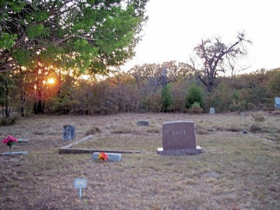
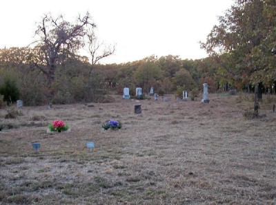
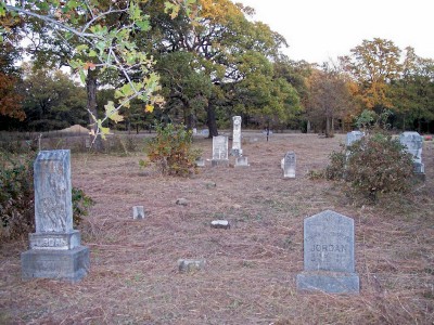
| Description | : | A road leads to this small cemetery, but the gate is normally locked. George Washington ("G.W.") Cole, one of the earliest of the non-Chickasaw families to settle in Ardmore, which was then within Indian Territory, purchased a plot of land which included a small cemetery known as Yates Cemetery. Later, G.W. donated 10 acres of land to the County Commission to preserve the cemetery. After G.W. died, the name was changed to Cole Cemetery, according to Images of America: Ardmore. |
frequently asked questions (FAQ):
-
Where is Cole Cemetery?
Cole Cemetery is located at Ardmore, Carter County ,Oklahoma ,USA.
-
Cole Cemetery cemetery's updated grave count on graveviews.com?
0 memorials
-
Where are the coordinates of the Cole Cemetery?
Latitude: 34.2281560
Longitude: -97.1025460
Nearby Cemetories:
1. Maxwell-Woods Cemetery
Ardmore, Carter County, USA
Coordinate: 34.2219500, -97.1360900
2. Pruitt Cemetery
Ardmore, Carter County, USA
Coordinate: 34.1974983, -97.0736008
3. Clearview Cemetery
Ardmore, Carter County, USA
Coordinate: 34.1878260, -97.1075960
4. Abramville Cemetery
Gene Autry, Carter County, USA
Coordinate: 34.2729000, -97.0752500
5. Saint Philip's Episcopal Church Columbarium
Ardmore, Carter County, USA
Coordinate: 34.1727540, -97.1351420
6. Mount Pleasant Cemetery
Gene Autry, Carter County, USA
Coordinate: 34.2517014, -97.0180969
7. Berwyn Cemetery
Gene Autry, Carter County, USA
Coordinate: 34.2848015, -97.0421982
8. Old Berwyn Cemetery
Gene Autry, Carter County, USA
Coordinate: 34.2909775, -97.0420685
9. Mount Zion Cemetery
Ardmore, Carter County, USA
Coordinate: 34.1486015, -97.1343994
10. Saint Marys Cemetery
Ardmore, Carter County, USA
Coordinate: 34.1486015, -97.1355972
11. Big Branch Cemetery
Carter County, USA
Coordinate: 34.2910995, -97.0307999
12. Rose Hill Cemetery
Ardmore, Carter County, USA
Coordinate: 34.1453018, -97.1355972
13. Springer Cemetery
Springer, Carter County, USA
Coordinate: 34.3129700, -97.1367000
14. Hillcrest Memorial Park
Ardmore, Carter County, USA
Coordinate: 34.1413994, -97.1316986
15. Provence Cemetery
Ardmore, Carter County, USA
Coordinate: 34.1549988, -97.0211029
16. Gaines Cemetery
Carter County, USA
Coordinate: 34.2788800, -97.2130500
17. Calvary Cemetery
Gene Autry, Carter County, USA
Coordinate: 34.3213150, -97.0451350
18. Concord Cemetery
Carter County, USA
Coordinate: 34.1267300, -97.0520900
19. Glenn Cemetery
Glenn, Carter County, USA
Coordinate: 34.3067500, -97.1961000
20. Rice Cemetery
Carter County, USA
Coordinate: 34.3067500, -97.1961600
21. Hutchins Cemetery
Baum, Carter County, USA
Coordinate: 34.2712631, -96.9771805
22. Thomas Cemetery
Baum, Carter County, USA
Coordinate: 34.2449989, -96.9672012
23. Henderson Cemetery
Gene Autry, Carter County, USA
Coordinate: 34.3168983, -97.0117035
24. Young Cemetery
Gene Autry, Carter County, USA
Coordinate: 34.2969017, -96.9760971