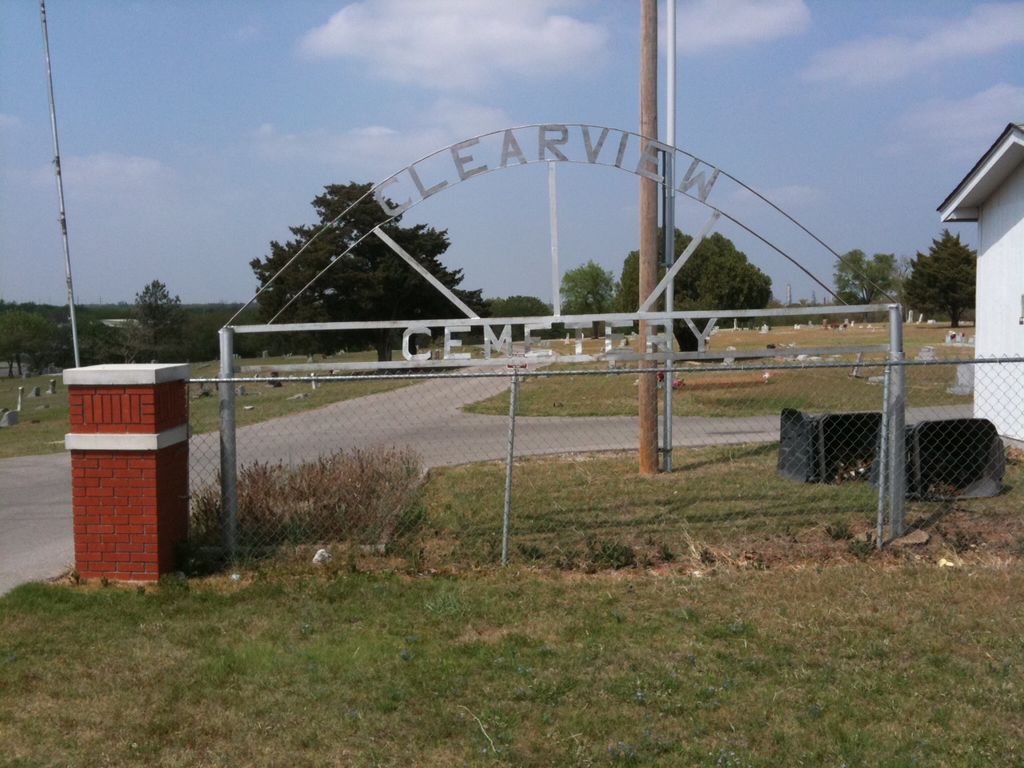
| Memorials | : | 0 |
| Location | : | Ardmore, Carter County, USA |
| Coordinate | : | 34.1878260, -97.1075960 |
| Description | : | The largest African American cemetery in Carter County. Located just northeast of the intersection of highways 142 & 199. |
frequently asked questions (FAQ):
-
Where is Clearview Cemetery?
Clearview Cemetery is located at Ardmore, Carter County ,Oklahoma ,USA.
-
Clearview Cemetery cemetery's updated grave count on graveviews.com?
0 memorials
-
Where are the coordinates of the Clearview Cemetery?
Latitude: 34.1878260
Longitude: -97.1075960
Nearby Cemetories:
1. Saint Philip's Episcopal Church Columbarium
Ardmore, Carter County, USA
Coordinate: 34.1727540, -97.1351420
2. Pruitt Cemetery
Ardmore, Carter County, USA
Coordinate: 34.1974983, -97.0736008
3. Cole Cemetery
Ardmore, Carter County, USA
Coordinate: 34.2281560, -97.1025460
4. Maxwell-Woods Cemetery
Ardmore, Carter County, USA
Coordinate: 34.2219500, -97.1360900
5. Mount Zion Cemetery
Ardmore, Carter County, USA
Coordinate: 34.1486015, -97.1343994
6. Saint Marys Cemetery
Ardmore, Carter County, USA
Coordinate: 34.1486015, -97.1355972
7. Rose Hill Cemetery
Ardmore, Carter County, USA
Coordinate: 34.1453018, -97.1355972
8. Hillcrest Memorial Park
Ardmore, Carter County, USA
Coordinate: 34.1413994, -97.1316986
9. Concord Cemetery
Carter County, USA
Coordinate: 34.1267300, -97.0520900
10. Provence Cemetery
Ardmore, Carter County, USA
Coordinate: 34.1549988, -97.0211029
11. Abramville Cemetery
Gene Autry, Carter County, USA
Coordinate: 34.2729000, -97.0752500
12. Hickory Indian Cemetery
Ardmore, Carter County, USA
Coordinate: 34.1069810, -97.1722810
13. Mount Pleasant Cemetery
Gene Autry, Carter County, USA
Coordinate: 34.2517014, -97.0180969
14. Porter Indian Cemetery
Carter County, USA
Coordinate: 34.0791512, -97.1177979
15. Berwyn Cemetery
Gene Autry, Carter County, USA
Coordinate: 34.2848015, -97.0421982
16. McAlister Cemetery
Carter County, USA
Coordinate: 34.0806007, -97.1560974
17. Old Berwyn Cemetery
Gene Autry, Carter County, USA
Coordinate: 34.2909775, -97.0420685
18. Big Branch Cemetery
Carter County, USA
Coordinate: 34.2910995, -97.0307999
19. Nelda Cemetery
Durwood, Carter County, USA
Coordinate: 34.1749992, -96.9578018
20. Gaines Cemetery
Carter County, USA
Coordinate: 34.2788800, -97.2130500
21. Lone Grove Cemetery
Lone Grove, Carter County, USA
Coordinate: 34.1893997, -97.2613983
22. Springer Cemetery
Springer, Carter County, USA
Coordinate: 34.3129700, -97.1367000
23. Crinerville Cemetery
Brock, Carter County, USA
Coordinate: 34.0900002, -97.2097015
24. Thomas Cemetery
Baum, Carter County, USA
Coordinate: 34.2449989, -96.9672012


