
| Memorials | : | 0 |
| Location | : | Hoed, Syddjurs Kommune, Denmark |
| Phone | : | +45 29 27 48 56 |
| Coordinate | : | 56.3141952, 10.8169251 |
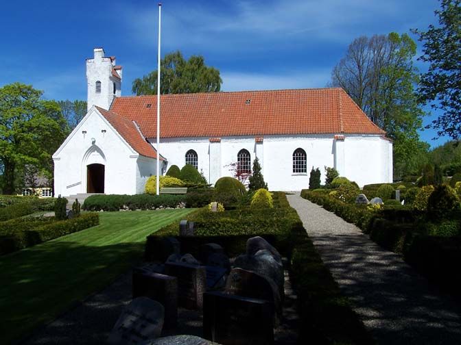
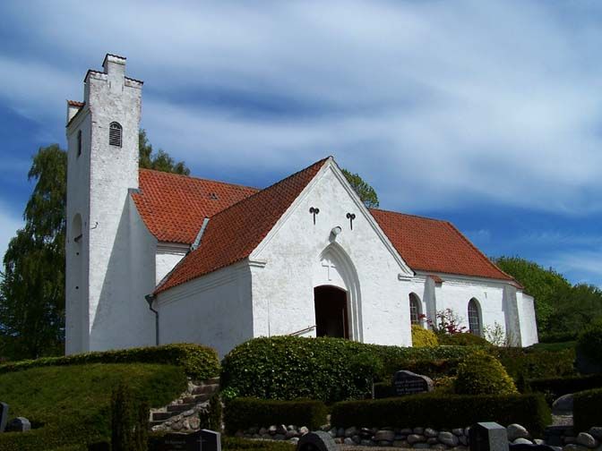
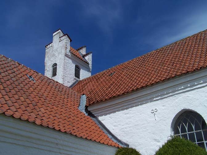
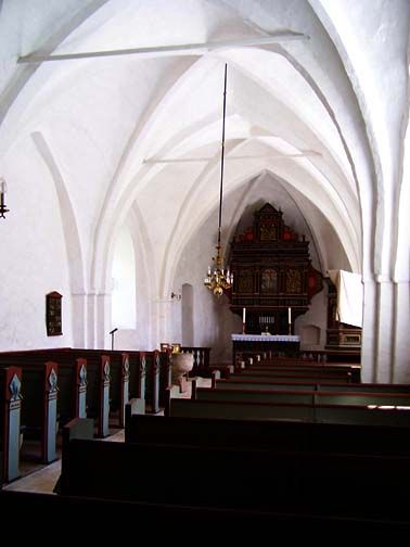
| Description | : | Hoed Kirke Glatvedvej 77 8444 Balle The church is situated just east of the little stream called Hoed å. The stream is the border between Norddjursk kommune and Syddjurs kommune, so the chuch is actually in Norddjurs kommune even though Hoed can only be listed as Syddjurs kommune on findagrave.com Hoed is in Norddjurs and Balle, the neighbouring village, is in Syddjurs. The church was build by the cisterian munks from the monastery at Øm near Ry, after they got land given to them by Bishop Svend of Århus in 1183. The church is build in roman style and has undergone several restorations and changes.... Read More |
frequently asked questions (FAQ):
-
Where is Hoed Church Cemetery?
Hoed Church Cemetery is located at Glatvedvej 77 Hoed, Syddjurs Kommune ,Midtjylland , 8444 BalleDenmark.
-
Hoed Church Cemetery cemetery's updated grave count on graveviews.com?
0 memorials
-
Where are the coordinates of the Hoed Church Cemetery?
Latitude: 56.3141952
Longitude: 10.8169251
Nearby Cemetories:
1. Rosmus Church Cemetery
Rosmus, Syddjurs Kommune, Denmark
Coordinate: 56.3034833, 10.7741167
2. Auning Kirke and Scheelske Tomb Chapel
Auning, Norddjurs Kommune, Denmark
Coordinate: 56.4349770, 10.3769300
3. Hjortshøj Kirke
Aarhus, Arhus Kommune, Denmark
Coordinate: 56.2526150, 10.2658140
4. Cemetery Vejby Risskov
Risskov, Arhus Kommune, Denmark
Coordinate: 56.1955060, 10.2119820
5. Nordre Kirkegård
Aarhus, Arhus Kommune, Denmark
Coordinate: 56.1675360, 10.2152930
6. Odder Family Cemetery
Juelsminde, Hedensted Kommune, Denmark
Coordinate: 56.1621860, 10.2059560
7. Sct. Pauls kirkegård
Hadsten, Favrskov Kommune, Denmark
Coordinate: 56.3292496, 10.0443639
8. Kristrup Cemetery
Randers, Randers Kommune, Denmark
Coordinate: 56.4427530, 10.0647430
9. Randers Eastern Cemetery
Randers, Randers Kommune, Denmark
Coordinate: 56.4741800, 10.0692300
10. Lyngby Kirke
Aarhus, Arhus Kommune, Denmark
Coordinate: 56.1711060, 10.0415580
11. Randers North Cemetery
Randers, Randers Kommune, Denmark
Coordinate: 56.4743500, 10.0395400
12. Besser Kirke
Aarhus, Arhus Kommune, Denmark
Coordinate: 55.8524220, 10.6295840
13. Odden Kirke
Overby, Odsherred Kommune, Denmark
Coordinate: 55.9572370, 11.4024570
14. Tranebjerg Churchyard
Tranebjerg, Samsø Kommune, Denmark
Coordinate: 55.8346500, 10.5866900
15. Granslev
Aarhus, Arhus Kommune, Denmark
Coordinate: 56.3333333, 9.9166667
16. Odder Sogns Churchyard
Odder, Odder Kommune, Denmark
Coordinate: 55.9783302, 10.1496408
17. Hvidsten Mindelund Kirkegård
Hvidsten, Randers Kommune, Denmark
Coordinate: 56.5530000, 10.0018000
18. Mariager Cemetery
Mariager, Mariagerfjord Kommune, Denmark
Coordinate: 56.6481661, 9.9796222
19. Hojby Church Cemetery
Hojby, Odsherred Kommune, Denmark
Coordinate: 55.9128130, 11.6003050
20. Fårevejle Church Cemetery
Farevejle, Odsherred Kommune, Denmark
Coordinate: 55.8025840, 11.4439750
21. Asnæs Church Cemetery
Holbaek, Holbæk Kommune, Denmark
Coordinate: 55.8097200, 11.4985480
22. Gulev Kirke
Bjerringbro, Viborg Kommune, Denmark
Coordinate: 56.3507800, 9.6787000
23. Ørum Kirke og Kirkegård
Ørum, Viborg Kommune, Denmark
Coordinate: 56.4826963, 9.6297221
24. Værslev Kirkegård
Vaerslev, Kalundborg Kommune, Denmark
Coordinate: 55.6552112, 11.2118242