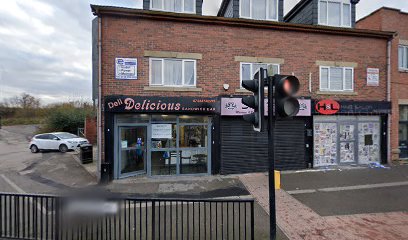
| Memorials | : | 0 |
| Location | : | Sheffield, Metropolitan Borough of Sheffield, England |
| Coordinate | : | 53.3857487, -1.4101372 |
| Description | : | Holy Trinity church, the first in Darnall, was built in 1840.. Holy Trinity, Darnall. The foundation stone for Holy Trinity Church, Darnall, was laid in April 1839 and the church was initially a chapel-of-ease to Christ Church, Attercliffe, until it became a separate parish in its own right in December 1844 (consecrated in October 1845). Holy Trinity Church was closed in 1975 and demolished. For some time, services were held in the adjoining school, until this was damaged by fire in September 1977. Thereafter, services were held in other churches in the parish until the new ecumenical Church of Christ in Darnall, (which was built on... Read More |
frequently asked questions (FAQ):
-
Where is Holy Trinity?
Holy Trinity is located at Station Road, Darnall Metropolitan Borough of Sheffield ,South Yorkshire , S9 4JUEngland.
-
Holy Trinity cemetery's updated grave count on graveviews.com?
0 memorials
-
Where are the coordinates of the Holy Trinity?
Latitude: 53.3857487
Longitude: -1.4101372
Nearby Cemetories:
1. Darnall Cemetery
Sheffield, Metropolitan Borough of Sheffield, England
Coordinate: 53.3892200, -1.4135700
2. Tinsley Park Cemetery
Sheffield, Metropolitan Borough of Sheffield, England
Coordinate: 53.3932810, -1.4077840
3. Christ Church Churchyard
Attercliffe, Metropolitan Borough of Sheffield, England
Coordinate: 53.3952000, -1.4307000
4. Christ Church Cemetery Attercliffe
Attercliffe, Metropolitan Borough of Sheffield, England
Coordinate: 53.3955262, -1.4309578
5. Zion Graveyard
Attercliffe, Metropolitan Borough of Sheffield, England
Coordinate: 53.3944160, -1.4326430
6. Attercliffe Municipal Cemetery
Attercliffe, Metropolitan Borough of Sheffield, England
Coordinate: 53.3957050, -1.4317500
7. Attercliffe Hilltop Cemetery
Attercliffe, Metropolitan Borough of Sheffield, England
Coordinate: 53.3992340, -1.4264000
8. St Joseph Roman Catholic Churchyard
Handsworth, Metropolitan Borough of Sheffield, England
Coordinate: 53.3722000, -1.3852900
9. Old Burial Ground
Handsworth, Metropolitan Borough of Sheffield, England
Coordinate: 53.3711700, -1.3847900
10. Saint Marys Old Burial Ground
Sheffield, Metropolitan Borough of Sheffield, England
Coordinate: 53.3712600, -1.3845600
11. Handsworth Old Cemetery
Sheffield, Metropolitan Borough of Sheffield, England
Coordinate: 53.3733495, -1.3776688
12. Handsworth New Cemetery
Sheffield, Metropolitan Borough of Sheffield, England
Coordinate: 53.3733800, -1.3776200
13. City Road Cemetery and Crematorium
Sheffield, Metropolitan Borough of Sheffield, England
Coordinate: 53.3694760, -1.4406940
14. St. Thomas' Churchyard
Brightside, Metropolitan Borough of Sheffield, England
Coordinate: 53.4068100, -1.4327000
15. Ballifield Hall Cemetery
Handsworth, Metropolitan Borough of Sheffield, England
Coordinate: 53.3708850, -1.3747270
16. Saint Johns Church Park Churchyard
Sheffield, Metropolitan Borough of Sheffield, England
Coordinate: 53.3839792, -1.4538831
17. Saint Lawrence Churchyard
Metropolitan Borough of Sheffield, England
Coordinate: 53.4110227, -1.3934800
18. St. Lawrence Churchyard
Rotherham, Metropolitan Borough of Rotherham, England
Coordinate: 53.4111526, -1.3928234
19. Cinder Hill Quaker Burial Ground
Sheffield, Metropolitan Borough of Sheffield, England
Coordinate: 53.3666700, -1.3744500
20. Intake Village Cemetery
Sheffield, Metropolitan Borough of Sheffield, England
Coordinate: 53.3569900, -1.4151300
21. St Mary Churchyard
Catcliffe, Metropolitan Borough of Rotherham, England
Coordinate: 53.3936830, -1.3621200
22. Cholera Monument
Sheffield, Metropolitan Borough of Sheffield, England
Coordinate: 53.3761350, -1.4580820
23. Burngreave Cemetery
Sheffield, Metropolitan Borough of Sheffield, England
Coordinate: 53.3969000, -1.4615000
24. Woodhouse Cemetery
Sheffield, Metropolitan Borough of Sheffield, England
Coordinate: 53.3591540, -1.3779410

