
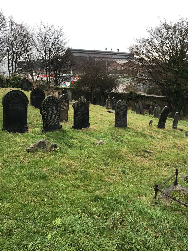
| Memorials | : | 17 |
| Location | : | Brightside, Metropolitan Borough of Sheffield, England |
| Coordinate | : | 53.4068100, -1.4327000 |
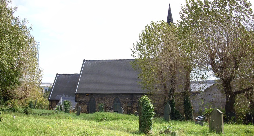
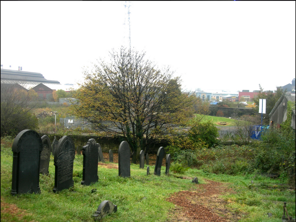
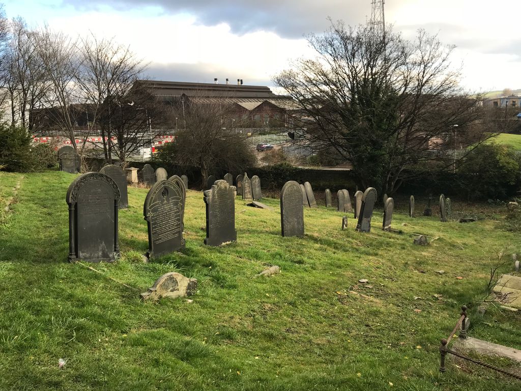
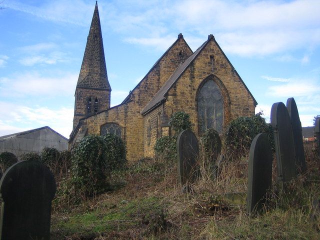
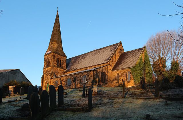
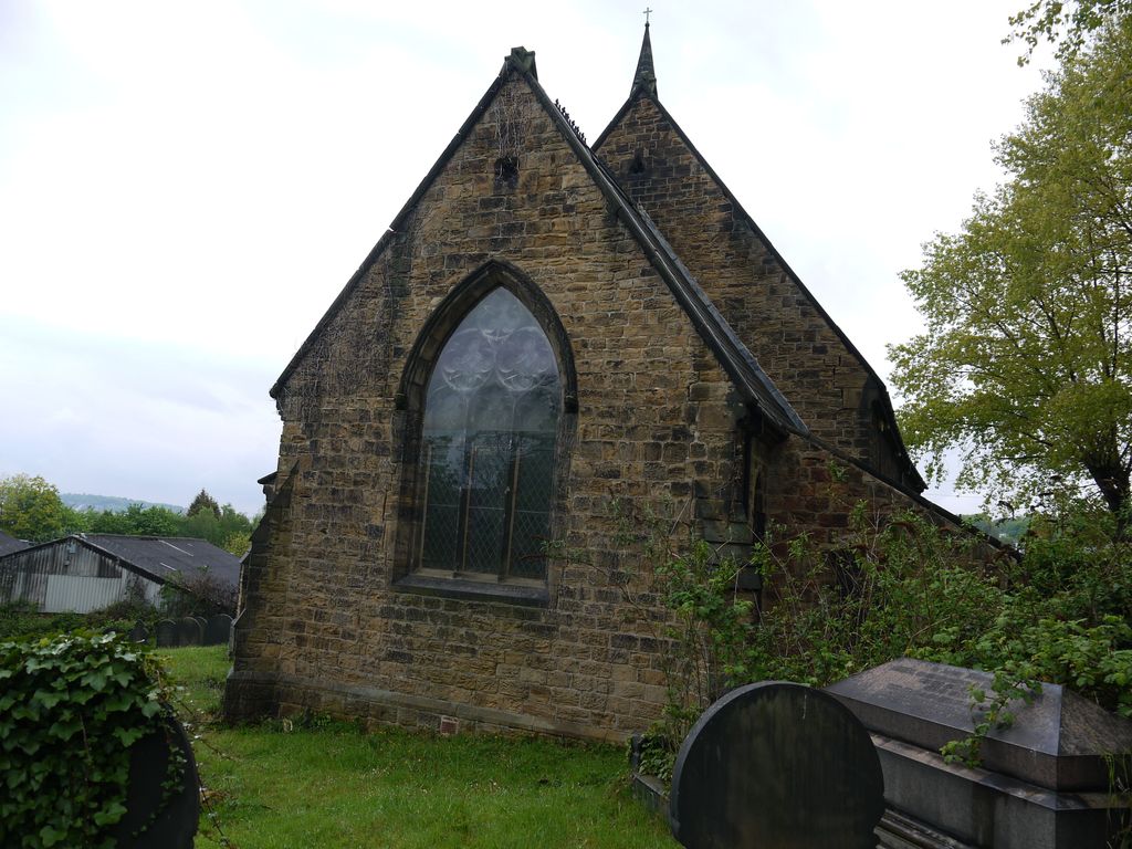
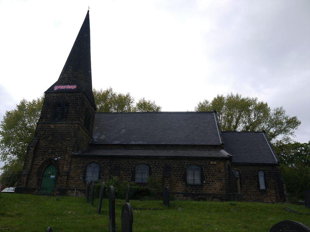
| Description | : | St Thomas was Grade II listed in 1973, but was closed and deconsecrated in 1979. During the 1980s, it was used as the Sheffield School of Gymnastics, then in 1995 it was restored as part of the TV series Challenge Anneka, to serve as a training centre for Greentop Circus. The Churchyard remains open to the public but sections of it are completely overgrown The vast majority of the headstones in place are in very good condition. |
frequently asked questions (FAQ):
-
Where is St. Thomas' Churchyard?
St. Thomas' Churchyard is located at Holywell Rd Brightside, Metropolitan Borough of Sheffield ,South Yorkshire , S9 1AWEngland.
-
St. Thomas' Churchyard cemetery's updated grave count on graveviews.com?
17 memorials
-
Where are the coordinates of the St. Thomas' Churchyard?
Latitude: 53.4068100
Longitude: -1.4327000

Nearby Cemetories:
1. Attercliffe Hilltop Cemetery
Attercliffe, Metropolitan Borough of Sheffield, England
Coordinate: 53.3992340, -1.4264000
2. Attercliffe Municipal Cemetery
Attercliffe, Metropolitan Borough of Sheffield, England
Coordinate: 53.3957050, -1.4317500
3. Christ Church Cemetery Attercliffe
Attercliffe, Metropolitan Borough of Sheffield, England
Coordinate: 53.3955262, -1.4309578
4. Christ Church Churchyard
Attercliffe, Metropolitan Borough of Sheffield, England
Coordinate: 53.3952000, -1.4307000
5. Zion Graveyard
Attercliffe, Metropolitan Borough of Sheffield, England
Coordinate: 53.3944160, -1.4326430
6. Shiregreen Cemetery
Sheffield, Metropolitan Borough of Sheffield, England
Coordinate: 53.4212050, -1.4360650
7. Burngreave Cemetery
Sheffield, Metropolitan Borough of Sheffield, England
Coordinate: 53.3969000, -1.4615000
8. Tinsley Park Cemetery
Sheffield, Metropolitan Borough of Sheffield, England
Coordinate: 53.3932810, -1.4077840
9. Darnall Cemetery
Sheffield, Metropolitan Borough of Sheffield, England
Coordinate: 53.3892200, -1.4135700
10. Christ Church Pitsmoor
Sheffield, Metropolitan Borough of Sheffield, England
Coordinate: 53.3969748, -1.4673422
11. Saint Lawrence Churchyard
Metropolitan Borough of Sheffield, England
Coordinate: 53.4110227, -1.3934800
12. St. Lawrence Churchyard
Rotherham, Metropolitan Borough of Rotherham, England
Coordinate: 53.4111526, -1.3928234
13. Holy Trinity
Sheffield, Metropolitan Borough of Sheffield, England
Coordinate: 53.3857487, -1.4101372
14. Saint Johns Church Park Churchyard
Sheffield, Metropolitan Borough of Sheffield, England
Coordinate: 53.3839792, -1.4538831
15. Ecclesfield Jewish Cemetery
Ecclesfield, Metropolitan Borough of Sheffield, England
Coordinate: 53.4299600, -1.4637700
16. Sheffield Cathedral
Sheffield, Metropolitan Borough of Sheffield, England
Coordinate: 53.3831040, -1.4692000
17. St. Philip's Churchyard
Sheffield, Metropolitan Borough of Sheffield, England
Coordinate: 53.3898180, -1.4789820
18. Cathedral Church of Saint Marie
Sheffield, Metropolitan Borough of Sheffield, England
Coordinate: 53.3811700, -1.4679400
19. Upper Chapel Courtyard
Sheffield, Metropolitan Borough of Sheffield, England
Coordinate: 53.3809000, -1.4682480
20. Wardsend Cemetery
Sheffield, Metropolitan Borough of Sheffield, England
Coordinate: 53.4086120, -1.4895330
21. Cholera Monument
Sheffield, Metropolitan Borough of Sheffield, England
Coordinate: 53.3761350, -1.4580820
22. St. Paul's Churchyard
Sheffield, Metropolitan Borough of Sheffield, England
Coordinate: 53.4333670, -1.4692500
23. St. Paul's Churchyard
Sheffield, Metropolitan Borough of Sheffield, England
Coordinate: 53.3798100, -1.4697300
24. St. Thomas the Apostle Churchyard
Kimberworth, Metropolitan Borough of Rotherham, England
Coordinate: 53.4337400, -1.3936000