
| Memorials | : | 0 |
| Location | : | Flookburgh, South Lakeland District, England |
| Coordinate | : | 54.1760608, -2.9736311 |
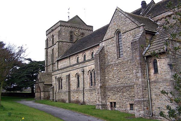
| Description | : | St John the Baptist's Church is in Station Road in the village of Flookburgh, on the Cartmel Peninsula in Cumbria, England Opened in 1900 |
frequently asked questions (FAQ):
-
Where is St. John the Baptist Church?
St. John the Baptist Church is located at Station Road Flookburgh, South Lakeland District ,Cumbria , LA11 7JYEngland.
-
St. John the Baptist Church cemetery's updated grave count on graveviews.com?
0 memorials
-
Where are the coordinates of the St. John the Baptist Church?
Latitude: 54.1760608
Longitude: -2.9736311
Nearby Cemetories:
1. St Mary's Churchyard
Allithwaite, South Lakeland District, England
Coordinate: 54.1835640, -2.9427590
2. Priory Church of St Mary & St Michael
Cartmel, South Lakeland District, England
Coordinate: 54.2011110, -2.9522220
3. Grange Fell Cemetery
Grange-over-Sands, South Lakeland District, England
Coordinate: 54.1923000, -2.9313800
4. Cartmel Cemetery
Cartmel, South Lakeland District, England
Coordinate: 54.2035730, -2.9546320
5. Field Broughton St Peter Churchyard
Grange-over-Sands, South Lakeland District, England
Coordinate: 54.2278420, -2.9421240
6. Conishead Priory
Ulverston, South Lakeland District, England
Coordinate: 54.1736640, -3.0690050
7. St Paul's Churchyard
Lindale, South Lakeland District, England
Coordinate: 54.2159090, -2.8999800
8. Holy Trinity Churchyard
Bardsea, South Lakeland District, England
Coordinate: 54.1620160, -3.0722870
9. John Wilkinson Memorial
Lindale, South Lakeland District, England
Coordinate: 54.2153750, -2.8933350
10. Ulverston Cemetery
Ulverston, South Lakeland District, England
Coordinate: 54.1832760, -3.0880270
11. St Mary with Holy Trinity Churchyard
Ulverston, South Lakeland District, England
Coordinate: 54.1987330, -3.0914520
12. Society of Friends Sunbrick Burial Ground
Bardsea, South Lakeland District, England
Coordinate: 54.1559770, -3.0945220
13. Haverthwaite Cemetery
Haverthwaite, South Lakeland District, England
Coordinate: 54.2479110, -3.0017410
14. Saint Anne Churchyard
Haverthwaite, South Lakeland District, England
Coordinate: 54.2485890, -3.0037750
15. Holy Trinity Churchyard (Defunct)
Ulverston, South Lakeland District, England
Coordinate: 54.1937610, -3.0977900
16. St. Mary's Churchyard
Penny Bridge, South Lakeland District, England
Coordinate: 54.2346660, -3.0605070
17. Saint Cuthbert Churchyard
Aldingham, South Lakeland District, England
Coordinate: 54.1302260, -3.0983760
18. Height Quaker Burial Ground
Cartmel Fell, South Lakeland District, England
Coordinate: 54.2547900, -2.9123800
19. Arnside Cemetery
Arnside, South Lakeland District, England
Coordinate: 54.1922975, -2.8278230
20. Saint John Churchyard
Silverdale, City of Lancaster, England
Coordinate: 54.1716000, -2.8238000
21. St Mary's and St Michael's Churchyard
Great Urswick, South Lakeland District, England
Coordinate: 54.1582220, -3.1223190
22. Tottlebank Baptist Chapelyard
South Lakeland District, England
Coordinate: 54.2519210, -3.0534690
23. St. John Old Churchyard Extension
Silverdale, City of Lancaster, England
Coordinate: 54.1738400, -2.8213300
24. St. Mary’s Churchyard
Staveley-in-Cartmel, South Lakeland District, England
Coordinate: 54.2654520, -2.9543110