
| Memorials | : | 22 |
| Location | : | Nemaha Township, Nemaha County, USA |
| Coordinate | : | 40.4430199, -95.6980820 |
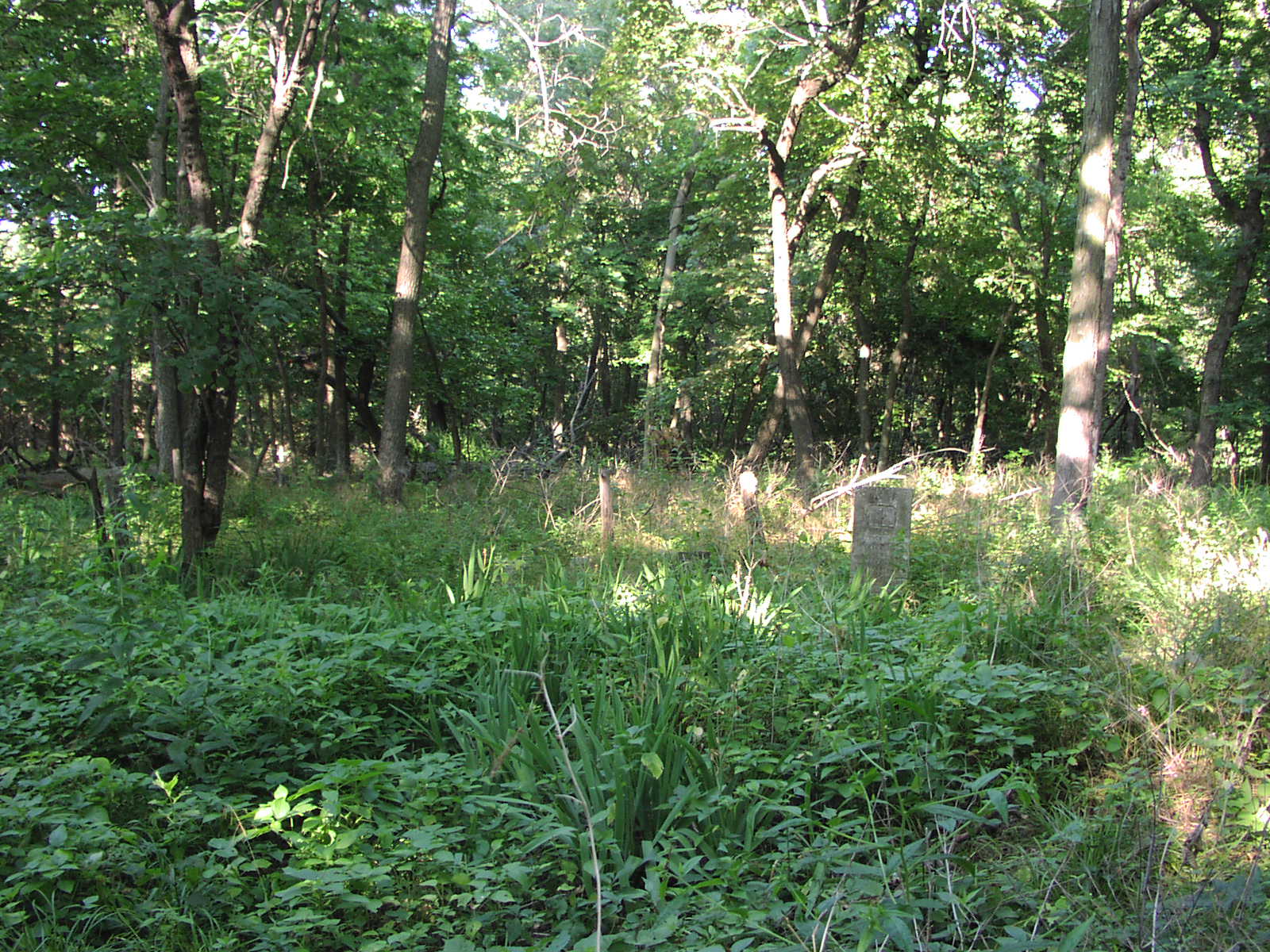
| Description | : | Honey Creek Cemetery was first used in the mid 1800s. The most recent burial was in 1934. The cemetery has been abandoned and is overgrown with timber. The headstones are in disrepair and there are believed to be some unmarked graves. Most of the stones are centrally located, but there are several more headstones in the northwest corner of the cemetery. In this location are about 3 hand-carved stones. There are also 3 nameless stones about 45 steps southeast of the centrally-located graves. More information can be found here: http://www.rootsweb.ancestry.com/~nenemaha/honeycreek/index.htm |
frequently asked questions (FAQ):
-
Where is Honey Creek Cemetery?
Honey Creek Cemetery is located at Nemaha Township, Nemaha County ,Nebraska ,USA.
-
Honey Creek Cemetery cemetery's updated grave count on graveviews.com?
22 memorials
-
Where are the coordinates of the Honey Creek Cemetery?
Latitude: 40.4430199
Longitude: -95.6980820
Nearby Cemetories:
1. Mount Vernon Cemetery
Peru, Nemaha County, USA
Coordinate: 40.4768982, -95.7208023
2. Sonora Cemetery
Watson, Atchison County, USA
Coordinate: 40.4730988, -95.6521988
3. Walnut Grove Cemetery
Brownville, Nemaha County, USA
Coordinate: 40.4023056, -95.6642990
4. London Cemetery
Peru, Nemaha County, USA
Coordinate: 40.4225006, -95.7621994
5. Karn Cemetery
Glenrock, Nemaha County, USA
Coordinate: 40.4789000, -95.7917000
6. Highland Methodist Cemetery
Nemaha County, USA
Coordinate: 40.4581850, -95.8097140
7. Addington Cemetery
Watson, Atchison County, USA
Coordinate: 40.4721985, -95.5828018
8. Highland Baptist Cemetery
Auburn, Nemaha County, USA
Coordinate: 40.4578018, -95.8191986
9. Kinser Burial Site
Watson, Atchison County, USA
Coordinate: 40.4974350, -95.5908610
10. Nemaha Cemetery
Nemaha, Nemaha County, USA
Coordinate: 40.3469009, -95.6596985
11. Millsap Cemetery
Rock Port, Atchison County, USA
Coordinate: 40.4150009, -95.5532990
12. Lansdown family burial site
Rock Port, Atchison County, USA
Coordinate: 40.4154319, -95.5522575
13. High Creek Cemetery
Rock Port, Atchison County, USA
Coordinate: 40.5086780, -95.5690380
14. Kite Cemetery
Nemaha County, USA
Coordinate: 40.3414001, -95.7842026
15. Clayton-Lewis Cemetery
Rock Port, Atchison County, USA
Coordinate: 40.5439730, -95.6102280
16. Stoner Cemetery
Atchison County, USA
Coordinate: 40.5127983, -95.5618973
17. Klaus Burial Site
Watson, Atchison County, USA
Coordinate: 40.4917400, -95.5440620
18. Linden Cemetery
Watson, Atchison County, USA
Coordinate: 40.4856130, -95.5383220
19. Sheridan Cemetery
Auburn, Nemaha County, USA
Coordinate: 40.3936005, -95.8591995
20. Clipfield Family Cemetery
Linden, Atchison County, USA
Coordinate: 40.4925560, -95.5313590
21. Glenrock Cemetery
Glenrock, Nemaha County, USA
Coordinate: 40.4644012, -95.8764038
22. Saint Bernards Church Cemetery
Julian, Nemaha County, USA
Coordinate: 40.5078000, -95.8592000
23. Saint Paul Lutheran Cemetery
Auburn, Nemaha County, USA
Coordinate: 40.3752000, -95.8573000
24. Elmwood Cemetery
Rock Port, Atchison County, USA
Coordinate: 40.4062740, -95.5206080