
| Memorials | : | 0 |
| Location | : | Franklin Township, Floyd County, USA |
| Coordinate | : | 38.2066994, -85.9503021 |
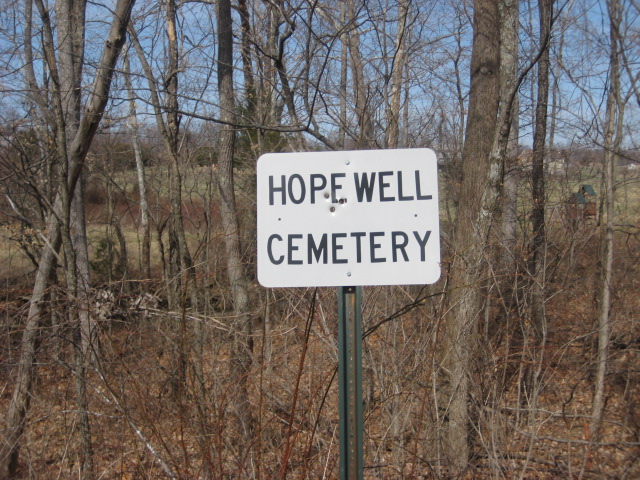
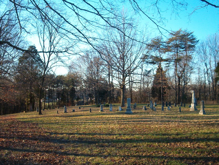
| Description | : | The cemetery is located in Franklin Township east of Hopewell Road. Indiana Cemetery Locations, Volume 4, published by the Indiana Genealogical Society (April 2009), gives the primary cemetery name as Hopewell Cemetery. The cemetery is listed in the Cemetery and Burial Grounds Registry of the Indiana Department of Natural Resources (DNR) and in the State Historical Architectural and Archaeological Research Database (SHAARD) with Cemetery Record Number CR-22-14 (Hopewell). The U.S. Geological Survey (USGS) Geographic Names Information System (GNIS) feature ID for the cemetery is 436446 (Hopewell Cemetery). |
frequently asked questions (FAQ):
-
Where is Hopewell Cemetery?
Hopewell Cemetery is located at Hopewell Road Franklin Township, Floyd County ,Indiana , 47136USA.
-
Hopewell Cemetery cemetery's updated grave count on graveviews.com?
0 memorials
-
Where are the coordinates of the Hopewell Cemetery?
Latitude: 38.2066994
Longitude: -85.9503021
Nearby Cemetories:
1. Finley Cemetery
Buchanan, Floyd County, USA
Coordinate: 38.2017000, -85.9469000
2. Antioch Cemetery
Franklin Township, Floyd County, USA
Coordinate: 38.2061005, -85.9289017
3. Zollman Family Cemetery
Lanesville, Harrison County, USA
Coordinate: 38.1933150, -85.9700020
4. Saint Johns Lutheran Church Cemetery
Lanesville, Harrison County, USA
Coordinate: 38.2205887, -85.9698715
5. Williams Cemetery
Franklin Township, Floyd County, USA
Coordinate: 38.2115000, -85.9239000
6. Reinhardt Cemetery
Lanesville, Harrison County, USA
Coordinate: 38.2155658, -85.9809906
7. Williams Cemetery
Lanesville, Harrison County, USA
Coordinate: 38.1877000, -85.9731000
8. Lieber Cemetery
Lanesville, Harrison County, USA
Coordinate: 38.1962010, -85.9808440
9. Heistand Cemetery
Harrison County, USA
Coordinate: 38.1796989, -85.9452972
10. Blunk Knobs Cemetery
Edwardsville, Floyd County, USA
Coordinate: 38.2078000, -85.9156000
11. Tabler Cemetery
Harrison County, USA
Coordinate: 38.1788600, -85.9499900
12. Old Saint John's Lutheran Church Cemetery
Franklin Township, Harrison County, USA
Coordinate: 38.2053160, -85.9861170
13. Roudenbush Cemetery
Lanesville, Harrison County, USA
Coordinate: 38.2145070, -85.9866500
14. Mount Zion United Methodist Church Cemetery
Edwardsville, Floyd County, USA
Coordinate: 38.2363014, -85.9326019
15. Gunn Cemetery
New Albany, Floyd County, USA
Coordinate: 38.2389000, -85.9337000
16. Woertz Cemetery
Lanesville, Harrison County, USA
Coordinate: 38.2125674, -85.9944614
17. Shoemaker-Tuell Cemetery
Elizabeth, Harrison County, USA
Coordinate: 38.1772003, -85.9800034
18. Brian Cemetery
Franklin Township, Floyd County, USA
Coordinate: 38.1868964, -85.9093043
19. Saint Marys Catholic Cemetery
Lanesville, Harrison County, USA
Coordinate: 38.2365837, -85.9805069
20. Captain McHarry Tomb
Franklin Township, Floyd County, USA
Coordinate: 38.1938000, -85.9044000
21. Old Union Cemetery
Lanesville, Harrison County, USA
Coordinate: 38.1686860, -85.9600810
22. Union Church Cemetery
Harrison County, USA
Coordinate: 38.1683006, -85.9599991
23. Silas Daily Cemetery
New Albany, Floyd County, USA
Coordinate: 38.2228000, -85.9030000
24. Lanesville Protestant Cemetery
Lanesville, Harrison County, USA
Coordinate: 38.2433014, -85.9738998