
| Memorials | : | 2 |
| Location | : | Edwardsville, Floyd County, USA |
| Coordinate | : | 38.2363014, -85.9326019 |
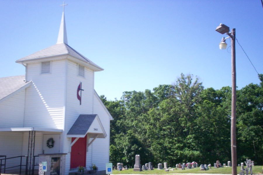
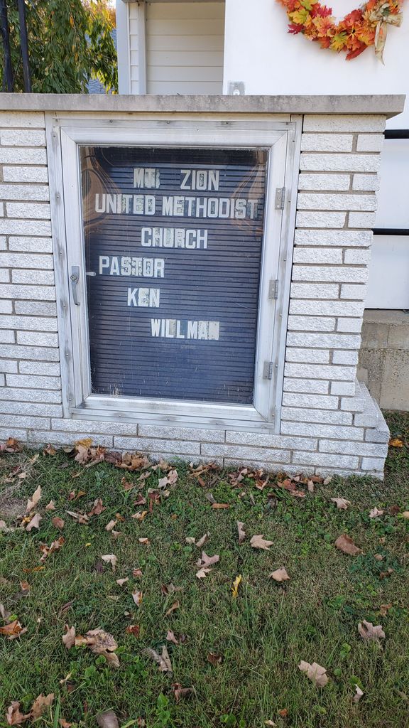
| Description | : | The cemetery is located in Franklin Township on the west side of Indiana State Highway 11 about 0.2 miles south of its intersection with Riley Ridge Road. Indiana Cemetery Locations, Volume 4, published by the Indiana Genealogical Society (April 2009), gives the primary cemetery name as Mount Zion Cemetery. The cemetery is listed in the Cemetery and Burial Grounds Registry of the Indiana Department of Natural Resources (DNR) and in the State Historical Architectural and Archaeological Research Database (SHAARD) with Cemetery Record Number CR-22-15 (Mount Zion). |
frequently asked questions (FAQ):
-
Where is Mount Zion United Methodist Church Cemetery?
Mount Zion United Methodist Church Cemetery is located at 3465 Indiana State Highway 11 Edwardsville, Floyd County ,Indiana , 47136USA.
-
Mount Zion United Methodist Church Cemetery cemetery's updated grave count on graveviews.com?
2 memorials
-
Where are the coordinates of the Mount Zion United Methodist Church Cemetery?
Latitude: 38.2363014
Longitude: -85.9326019
Nearby Cemetories:
1. Gunn Cemetery
New Albany, Floyd County, USA
Coordinate: 38.2389000, -85.9337000
2. Williams Cemetery
Franklin Township, Floyd County, USA
Coordinate: 38.2115000, -85.9239000
3. Silas Daily Cemetery
New Albany, Floyd County, USA
Coordinate: 38.2228000, -85.9030000
4. Hancock Cemetery
Franklin Township, Floyd County, USA
Coordinate: 38.2506000, -85.9006000
5. Wheeler Ridge Cemetery
Floyds Knobs, Floyd County, USA
Coordinate: 38.2505000, -85.9004000
6. Antioch Cemetery
Franklin Township, Floyd County, USA
Coordinate: 38.2061005, -85.9289017
7. Budd Cemetery
New Albany, Floyd County, USA
Coordinate: 38.2524000, -85.8987000
8. Blunk Knobs Cemetery
Edwardsville, Floyd County, USA
Coordinate: 38.2078000, -85.9156000
9. Davis Family Cemetery
Floyd County, USA
Coordinate: 38.2261000, -85.8942000
10. Hopewell Cemetery
Franklin Township, Floyd County, USA
Coordinate: 38.2066994, -85.9503021
11. Nance Farm Cemetery
Floyd County, USA
Coordinate: 38.2691160, -85.9281060
12. Lanesville Protestant Cemetery
Lanesville, Harrison County, USA
Coordinate: 38.2433014, -85.9738998
13. Saint Johns Lutheran Church Cemetery
Lanesville, Harrison County, USA
Coordinate: 38.2205887, -85.9698715
14. Daily Cemetery
New Albany, Floyd County, USA
Coordinate: 38.2196000, -85.8916000
15. Finley Cemetery
Buchanan, Floyd County, USA
Coordinate: 38.2017000, -85.9469000
16. Crone Cemetery
Floyd County, USA
Coordinate: 38.2668000, -85.9595000
17. Saint Marys Catholic Cemetery
Lanesville, Harrison County, USA
Coordinate: 38.2365837, -85.9805069
18. Old Salem Church Cemetery
Georgetown, Floyd County, USA
Coordinate: 38.2706000, -85.9558000
19. Newman Cemetery
Franklin Township, Floyd County, USA
Coordinate: 38.2322000, -85.8779000
20. Hammer Cemetery
Georgetown Township, Floyd County, USA
Coordinate: 38.2772000, -85.9506000
21. Reinhardt Cemetery
Lanesville, Harrison County, USA
Coordinate: 38.2155658, -85.9809906
22. Judd Cemetery
New Albany, Floyd County, USA
Coordinate: 38.2815000, -85.9318000
23. Davis Family Cemetery
Lanesville, Harrison County, USA
Coordinate: 38.2381058, -85.9902725
24. Bailey Cemetery
Franklin Township, Floyd County, USA
Coordinate: 38.2153015, -85.8814011