
| Memorials | : | 0 |
| Location | : | Carthage, Moore County, USA |
| Coordinate | : | 35.4819050, -79.3680030 |
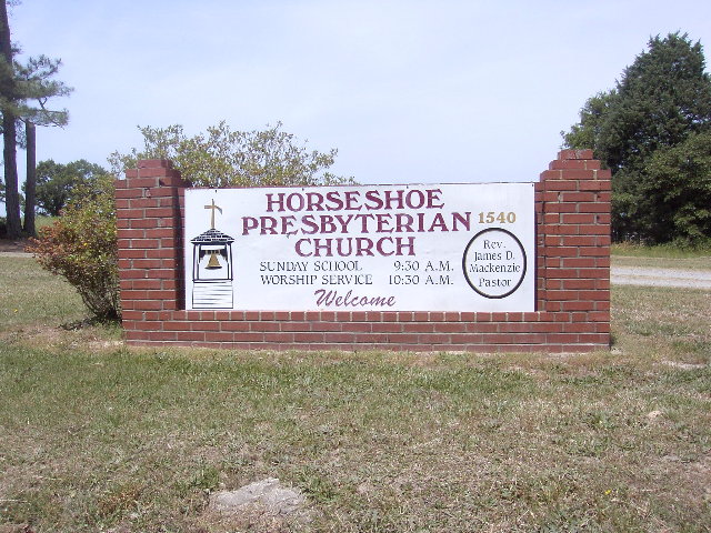
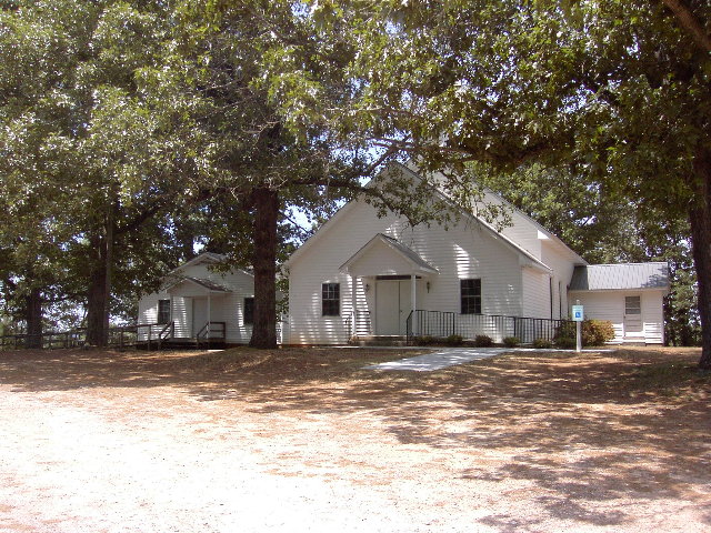
| Description | : | Church is located 1 mile NE (toward Carbonton) after passing entrance to “The House in the Horseshoe”. Church name display is located close to the highway and is very visible. The “House in the Horseshoe” is a locally well known NC Historical site where a skirmish was fought between local Whig Militiamen and Tories on July 29, 1781. A reenactment of this battle is held annually and the House is open year round for visitation. The “Horseshoe” name for the Church and the House is because they are located in the bend of Deep River that... Read More |
frequently asked questions (FAQ):
-
Where is Horseshoe Presbyterian Church Cemetery?
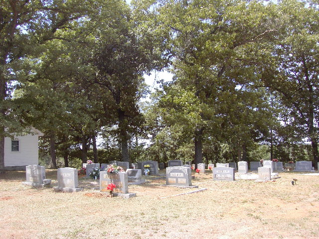
Horseshoe Presbyterian Church Cemetery is located at 1540 South Carbonton Road Carthage, Moore County ,North Carolina ,USA.
-
Horseshoe Presbyterian Church Cemetery cemetery's updated grave count on graveviews.com?
0 memorials
-
Where are the coordinates of the Horseshoe Presbyterian Church Cemetery?
Latitude: 35.4819050
Longitude: -79.3680030
Nearby Cemetories:
1. Euphronia Presbyterian Church Cemetery
Sanford, Lee County, USA
Coordinate: 35.4716560, -79.3468910
2. Williams Family Estate
Glendon, Moore County, USA
Coordinate: 35.4665330, -79.3837630
3. Alston Chapel United Church Of Christ Cemetery
Vass, Moore County, USA
Coordinate: 35.5025090, -79.3754640
4. Street Family Burying Ground-Street Plantation
Glendon, Moore County, USA
Coordinate: 35.4644900, -79.3948500
5. Reaves Chapel A.M.E. Zion Cemetery
Glendon, Moore County, USA
Coordinate: 35.4783820, -79.4038260
6. Farrar Cemetery
Lee County, USA
Coordinate: 35.5164986, -79.3347168
7. Becky Murchison Cemetery
Lee County, USA
Coordinate: 35.4794579, -79.3139531
8. Cornerstone Baptist Church Cemetery
Goldston, Chatham County, USA
Coordinate: 35.5248000, -79.3525260
9. Carbonton Quaker Church Cemetery
Carbonton, Chatham County, USA
Coordinate: 35.5238560, -79.3489800
10. Glendon Independent Christian Church Cemetery
Glendon, Moore County, USA
Coordinate: 35.4795950, -79.4232370
11. Carbonton United Methodist Church Cemetery
Carbonton, Chatham County, USA
Coordinate: 35.5242271, -79.3481140
12. Red Hill Missionary Baptist Church Cemetery
Goldston, Chatham County, USA
Coordinate: 35.5254090, -79.3926980
13. Dowd Family Cemetery
Carbonton, Chatham County, USA
Coordinate: 35.5288250, -79.3857350
14. James N. Oldham Family Cemetery
Carbonton, Chatham County, USA
Coordinate: 35.5327800, -79.3788900
15. New Hope AME Zion Church Cemetery
Sanford, Lee County, USA
Coordinate: 35.4948080, -79.3064570
16. Mashburn Family Cemetery
Chatham County, USA
Coordinate: 35.5316667, -79.3483333
17. Fair Promise United Methodist Church Cemetery
Glendon, Moore County, USA
Coordinate: 35.5001900, -79.4299400
18. Reaves Chapel A.M.E. Zion Church Cemetery
Goldston, Chatham County, USA
Coordinate: 35.5210820, -79.4183640
19. Carroll Family Cemetery
Goldston, Chatham County, USA
Coordinate: 35.5421150, -79.3596510
20. Hilliard Family Cemetery
Goldston, Chatham County, USA
Coordinate: 35.5374710, -79.4036410
21. Old Cool Springs Methodist Church Cemetery
Glendon, Moore County, USA
Coordinate: 35.4682070, -79.4438800
22. Cool Springs Methodist Church Cemetery
Carthage, Moore County, USA
Coordinate: 35.4679260, -79.4444680
23. Gaines Grove Baptist Church Cemetery
Chatham County, USA
Coordinate: 35.5487870, -79.3932020
24. Antioch Baptist Church Cemetery
Goldston, Chatham County, USA
Coordinate: 35.5523415, -79.3934479