
| Memorials | : | 0 |
| Location | : | Glendon, Moore County, USA |
| Coordinate | : | 35.4665330, -79.3837630 |
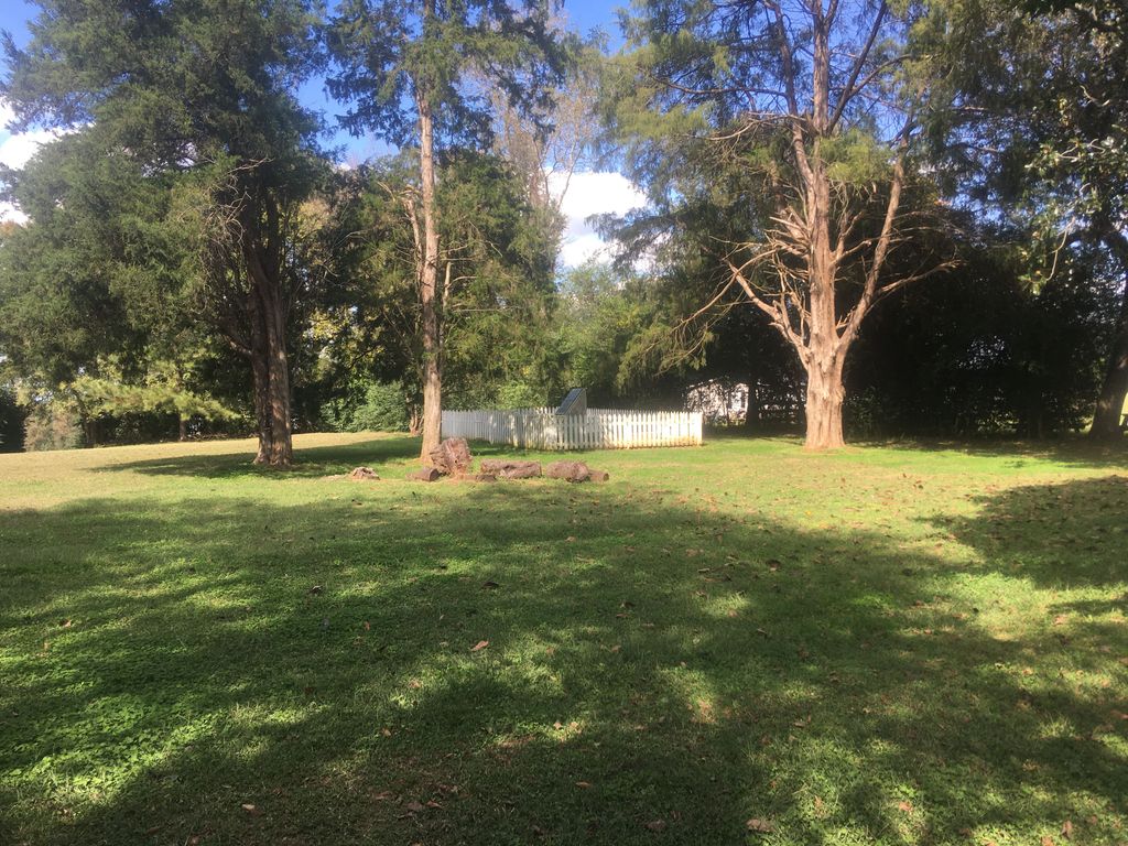
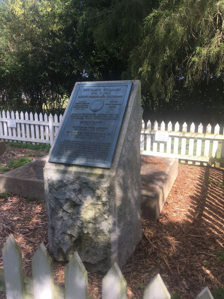
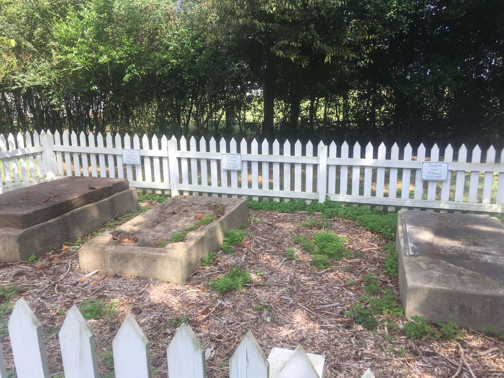
| Description | : | The house (ca. 1770) was first owned by Philip Alston, whose band of Whigs was attacked in 1781 by Tories led by David Fanning. Later, four-term North Carolina governor Benjamin Williams lived in the house and is interred there. |
frequently asked questions (FAQ):
-
Where is Williams Family Estate?
Williams Family Estate is located at 288 Alston House Rd Glendon, Moore County ,North Carolina , 27330USA.
-
Williams Family Estate cemetery's updated grave count on graveviews.com?
0 memorials
-
Where are the coordinates of the Williams Family Estate?
Latitude: 35.4665330
Longitude: -79.3837630
Nearby Cemetories:
1. Street Family Burying Ground-Street Plantation
Glendon, Moore County, USA
Coordinate: 35.4644900, -79.3948500
2. Horseshoe Presbyterian Church Cemetery
Carthage, Moore County, USA
Coordinate: 35.4819050, -79.3680030
3. Reaves Chapel A.M.E. Zion Cemetery
Glendon, Moore County, USA
Coordinate: 35.4783820, -79.4038260
4. Euphronia Presbyterian Church Cemetery
Sanford, Lee County, USA
Coordinate: 35.4716560, -79.3468910
5. Glendon Independent Christian Church Cemetery
Glendon, Moore County, USA
Coordinate: 35.4795950, -79.4232370
6. Alston Chapel United Church Of Christ Cemetery
Vass, Moore County, USA
Coordinate: 35.5025090, -79.3754640
7. Old Cool Springs Methodist Church Cemetery
Glendon, Moore County, USA
Coordinate: 35.4682070, -79.4438800
8. Cool Springs Methodist Church Cemetery
Carthage, Moore County, USA
Coordinate: 35.4679260, -79.4444680
9. Fair Promise United Methodist Church Cemetery
Glendon, Moore County, USA
Coordinate: 35.5001900, -79.4299400
10. Becky Murchison Cemetery
Lee County, USA
Coordinate: 35.4794579, -79.3139531
11. Red Hill Missionary Baptist Church Cemetery
Goldston, Chatham County, USA
Coordinate: 35.5254090, -79.3926980
12. Reaves Chapel A.M.E. Zion Church Cemetery
Goldston, Chatham County, USA
Coordinate: 35.5210820, -79.4183640
13. Dowd Family Cemetery
Carbonton, Chatham County, USA
Coordinate: 35.5288250, -79.3857350
14. Cornerstone Baptist Church Cemetery
Goldston, Chatham County, USA
Coordinate: 35.5248000, -79.3525260
15. Carbonton Quaker Church Cemetery
Carbonton, Chatham County, USA
Coordinate: 35.5238560, -79.3489800
16. Farrar Cemetery
Lee County, USA
Coordinate: 35.5164986, -79.3347168
17. Carbonton United Methodist Church Cemetery
Carbonton, Chatham County, USA
Coordinate: 35.5242271, -79.3481140
18. James N. Oldham Family Cemetery
Carbonton, Chatham County, USA
Coordinate: 35.5327800, -79.3788900
19. New Hope AME Zion Church Cemetery
Sanford, Lee County, USA
Coordinate: 35.4948080, -79.3064570
20. Mashburn Family Cemetery
Chatham County, USA
Coordinate: 35.5316667, -79.3483333
21. Hilliard Family Cemetery
Goldston, Chatham County, USA
Coordinate: 35.5374710, -79.4036410
22. Putnam Friends Church Cemetery
Carthage, Moore County, USA
Coordinate: 35.4430860, -79.4723730
23. Pleasant Hill Freewill Baptist Church Cemetery
Carthage, Moore County, USA
Coordinate: 35.4067770, -79.4425240
24. Carroll Family Cemetery
Goldston, Chatham County, USA
Coordinate: 35.5421150, -79.3596510