
| Memorials | : | 0 |
| Location | : | Glendon, Moore County, USA |
| Coordinate | : | 35.4682070, -79.4438800 |
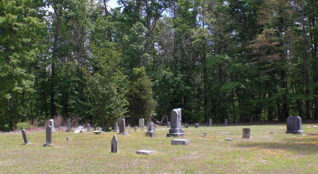
| Description | : | This cemetery is located directly across the street from Cool Springs United Methodist Church. |
frequently asked questions (FAQ):
-
Where is Old Cool Springs Methodist Church Cemetery?
Old Cool Springs Methodist Church Cemetery is located at Glendon, Moore County ,North Carolina ,USA.
-
Old Cool Springs Methodist Church Cemetery cemetery's updated grave count on graveviews.com?
0 memorials
-
Where are the coordinates of the Old Cool Springs Methodist Church Cemetery?
Latitude: 35.4682070
Longitude: -79.4438800
Nearby Cemetories:
1. Cool Springs Methodist Church Cemetery
Carthage, Moore County, USA
Coordinate: 35.4679260, -79.4444680
2. Glendon Independent Christian Church Cemetery
Glendon, Moore County, USA
Coordinate: 35.4795950, -79.4232370
3. Fair Promise United Methodist Church Cemetery
Glendon, Moore County, USA
Coordinate: 35.5001900, -79.4299400
4. Reaves Chapel A.M.E. Zion Cemetery
Glendon, Moore County, USA
Coordinate: 35.4783820, -79.4038260
5. Putnam Friends Church Cemetery
Carthage, Moore County, USA
Coordinate: 35.4430860, -79.4723730
6. Street Family Burying Ground-Street Plantation
Glendon, Moore County, USA
Coordinate: 35.4644900, -79.3948500
7. New Bensalem Baptist Church Cemetery
Robbins, Moore County, USA
Coordinate: 35.5002970, -79.4791350
8. Prosperity Friends Meeting Cemetery
High Falls, Moore County, USA
Coordinate: 35.4941040, -79.4942180
9. Williams Family Estate
Glendon, Moore County, USA
Coordinate: 35.4665330, -79.3837630
10. Friendship Baptist Church Cemetery
Carthage, Moore County, USA
Coordinate: 35.4245660, -79.4727640
11. Reaves Chapel A.M.E. Zion Church Cemetery
Goldston, Chatham County, USA
Coordinate: 35.5210820, -79.4183640
12. High Falls United Methodist Church Cemetery
High Falls, Moore County, USA
Coordinate: 35.4803650, -79.5172570
13. Pine Mountain Friends Church Cemetery
High Falls, Moore County, USA
Coordinate: 35.5122833, -79.4959946
14. Pleasant Hill Freewill Baptist Church Cemetery
Carthage, Moore County, USA
Coordinate: 35.4067770, -79.4425240
15. Elmodam Phillips Cemetery
Bear Creek, Chatham County, USA
Coordinate: 35.5211100, -79.4855600
16. Horseshoe Presbyterian Church Cemetery
Carthage, Moore County, USA
Coordinate: 35.4819050, -79.3680030
17. Boroughs Family Cemetery
Bear Creek, Chatham County, USA
Coordinate: 35.5319150, -79.4605820
18. Alston Chapel United Church Of Christ Cemetery
Vass, Moore County, USA
Coordinate: 35.5025090, -79.3754640
19. High Falls Friends Church Cemetery
High Falls, Moore County, USA
Coordinate: 35.4872330, -79.5211110
20. Red Hill Missionary Baptist Church Cemetery
Goldston, Chatham County, USA
Coordinate: 35.5254090, -79.3926980
21. Cox-Scott Cemetery
Bear Creek, Chatham County, USA
Coordinate: 35.5395640, -79.4671380
22. Highfalls Wesleyan Church Cemetery
Robbins, Moore County, USA
Coordinate: 35.4976400, -79.5278600
23. Hilliard Family Cemetery
Goldston, Chatham County, USA
Coordinate: 35.5374710, -79.4036410
24. Dowd Family Cemetery
Carbonton, Chatham County, USA
Coordinate: 35.5288250, -79.3857350