
| Memorials | : | 0 |
| Location | : | Nokomis, Escambia County, USA |
| Coordinate | : | 31.0057250, -87.5963760 |
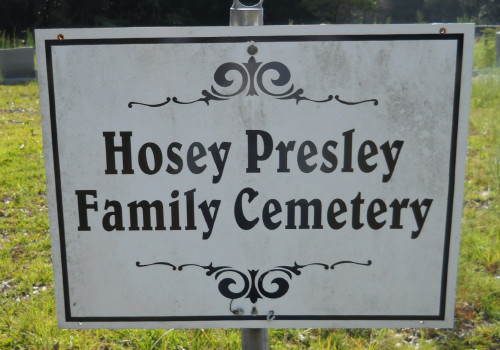
| Description | : | Hosey Presley Family Cemetery is located in the community of Nokomas, west of Atmore on Hwy-31, and within the Atmore postal zone. At/about the 35 mile marker (this marker indicates 35 miles east of Mobile). In the community will be a long loop called James Street. The first exit for James Street cuts off Hwy-31 just east of the Nokomas Church. The second exit for the James Street loop is approximately 1 mile south toward the Baldwin County line. The location on the Escambia County map is R-5-E, T-1-N, Section 32. If driving from Atmore, do... Read More |
frequently asked questions (FAQ):
-
Where is Hosey Presley Family Cemetery?
Hosey Presley Family Cemetery is located at Nokomis, Escambia County ,Alabama , 36502USA.
-
Hosey Presley Family Cemetery cemetery's updated grave count on graveviews.com?
0 memorials
-
Where are the coordinates of the Hosey Presley Family Cemetery?
Latitude: 31.0057250
Longitude: -87.5963760
Nearby Cemetories:
1. Sullivan Cemetery
Nokomis, Escambia County, USA
Coordinate: 31.0044003, -87.5955963
2. Mount Shilo Baptist Church Cemetery
Nokomis, Escambia County, USA
Coordinate: 31.0194000, -87.5856000
3. Nokomis Church Cemetery
Atmore, Escambia County, USA
Coordinate: 31.0077991, -87.5721970
4. Antioch Church Cemetery
Escambia County, USA
Coordinate: 30.9908640, -87.5704820
5. Morning Dove Cemetery
Perdido, Baldwin County, USA
Coordinate: 31.0212002, -87.6225967
6. Pine Grove Freewill Baptist Church Cemetery
Perdido, Baldwin County, USA
Coordinate: 31.0156002, -87.6278000
7. Perdido Baptist Church Cemetery
Perdido, Baldwin County, USA
Coordinate: 30.9983006, -87.6306000
8. Hollingsworth Family Cemetery
Nokomis, Escambia County, USA
Coordinate: 31.0012100, -87.5556280
9. Hollingsworth Family Cemetery
Walnut Hill, Escambia County, USA
Coordinate: 30.9730600, -87.5758900
10. Dutch Cemetery
Baldwin County, USA
Coordinate: 30.9547005, -87.6172028
11. James Cemetery
Bay Minette, Baldwin County, USA
Coordinate: 30.9542370, -87.6169270
12. Halls Fork Cemetery
Phillipsville, Baldwin County, USA
Coordinate: 30.9475600, -87.6171600
13. Bayer Cemetery
Baldwin County, USA
Coordinate: 31.0205994, -87.6663971
14. Bryars-McGill Cemetery
Perdido, Baldwin County, USA
Coordinate: 31.0206700, -87.6666400
15. Brooks Family Cemetery
Perdido, Baldwin County, USA
Coordinate: 31.0658200, -87.6193700
16. Lee Family Cemetery
Escambia County, USA
Coordinate: 30.9775670, -87.5234340
17. John Franklin Brown Memorial Cemetery
Perdido, Baldwin County, USA
Coordinate: 31.0534120, -87.6591400
18. Mothershed Cemetery
Freemanville, Escambia County, USA
Coordinate: 31.0557900, -87.5318900
19. White Cemetery
Dyas, Baldwin County, USA
Coordinate: 30.9743710, -87.6760483
20. Hubbard Cemetery
Halls Fork, Baldwin County, USA
Coordinate: 30.9266000, -87.6111100
21. Rolin Indian Cemetery
Poarch, Escambia County, USA
Coordinate: 31.0813860, -87.5629230
22. Pine Level Cemetery
Atmore, Escambia County, USA
Coordinate: 31.0465508, -87.5072174
23. Williams Station Cemetery
Escambia County, USA
Coordinate: 31.0227800, -87.4966700
24. Freemanville Church Cemetery
Escambia County, USA
Coordinate: 31.0670260, -87.5216170