
| Memorials | : | 1 |
| Location | : | Escambia County, USA |
| Coordinate | : | 31.0670260, -87.5216170 |
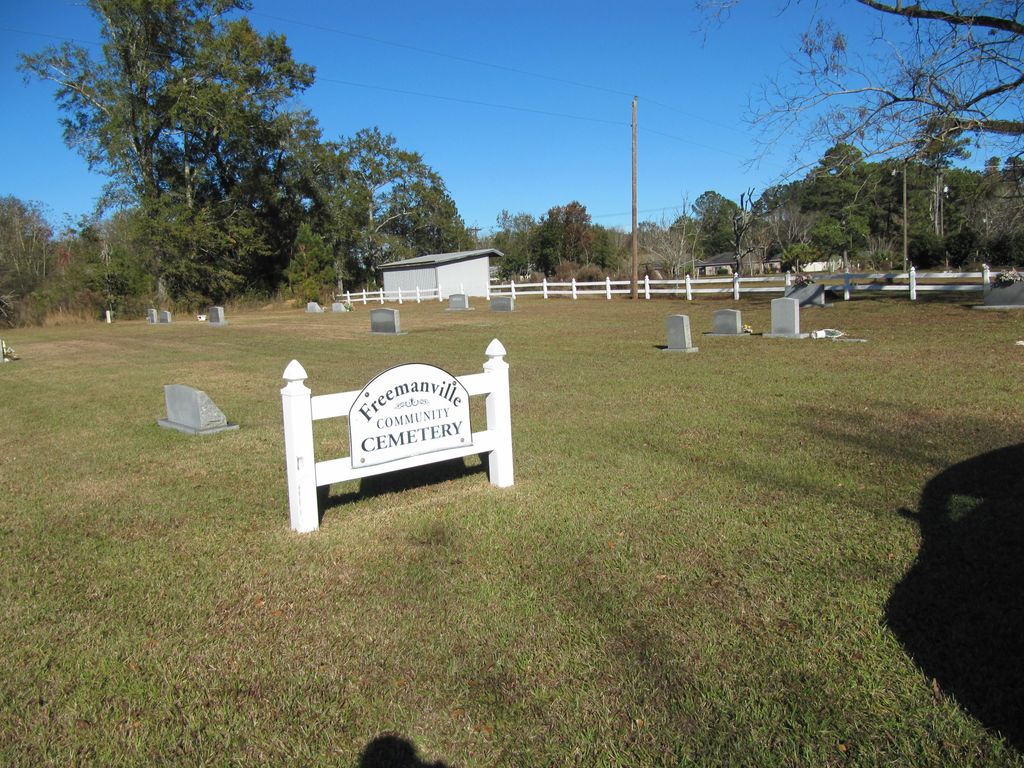
| Description | : | If driving from Atmore, take the Jack Springs Road (CR-1) northward toward I-65 and the Creek Indian Headquarters. At the community of Freemanville turn left onto Wood Road (now driving in the westward direction). The cemetery will be about 500 feet on the right. While there are few grave sites at this location, the cemetery itself is large, covering a large plot. If driving from I-65, turn south onto Jack Springs Road (CR-1) and continue for approximately 1.5 miles to Wood Road. Turn right onto Wood and the cemetery can clearly be seen on the right.... Read More |
frequently asked questions (FAQ):
-
Where is Freemanville Church Cemetery?
Freemanville Church Cemetery is located at Escambia County ,Alabama ,USA.
-
Freemanville Church Cemetery cemetery's updated grave count on graveviews.com?
1 memorials
-
Where are the coordinates of the Freemanville Church Cemetery?
Latitude: 31.0670260
Longitude: -87.5216170


Nearby Cemetories:
1. Davis Cemetery
Freemanville, Escambia County, USA
Coordinate: 31.0726766, -87.5204899
2. Mothershed Cemetery
Freemanville, Escambia County, USA
Coordinate: 31.0557900, -87.5318900
3. Pine Level Cemetery
Atmore, Escambia County, USA
Coordinate: 31.0465508, -87.5072174
4. Williams Family Cemetery
Atmore, Escambia County, USA
Coordinate: 31.0880020, -87.5424800
5. Oak Hill Cemetery
Atmore, Escambia County, USA
Coordinate: 31.0414009, -87.4955978
6. Pierce Rabb Cemetery
Atmore, Escambia County, USA
Coordinate: 31.1049060, -87.5223960
7. Rolin Indian Cemetery
Poarch, Escambia County, USA
Coordinate: 31.0813860, -87.5629230
8. Lucy Hill Cemetery Complex
Atmore, Escambia County, USA
Coordinate: 31.0413710, -87.4840580
9. Gaines Chapel AME Church Cemetery
Atmore, Escambia County, USA
Coordinate: 31.0294000, -87.4868130
10. New Home Indian Cemetery
Poarch, Escambia County, USA
Coordinate: 31.1101300, -87.4967300
11. Williams Station Cemetery
Escambia County, USA
Coordinate: 31.0227800, -87.4966700
12. Poarch Baptist Church Indian Cemetery
Poarch, Escambia County, USA
Coordinate: 31.1209110, -87.5264240
13. Poarch Mission Cemetery
Escambia County, USA
Coordinate: 31.1208000, -87.5124969
14. Judson Indian Cemetery
Escambia County, USA
Coordinate: 31.1110992, -87.5658035
15. Hollingsworth Family Cemetery
Nokomis, Escambia County, USA
Coordinate: 31.0012100, -87.5556280
16. Canoe United Methodist Church Cemetery
Robinsonville, Escambia County, USA
Coordinate: 31.0599995, -87.4377975
17. Mount Shilo Baptist Church Cemetery
Nokomis, Escambia County, USA
Coordinate: 31.0194000, -87.5856000
18. Nokomis Church Cemetery
Atmore, Escambia County, USA
Coordinate: 31.0077991, -87.5721970
19. Serenity Gardens Cemetery
Atmore, Escambia County, USA
Coordinate: 31.0244007, -87.4467010
20. Brooks Family Cemetery
Perdido, Baldwin County, USA
Coordinate: 31.0658200, -87.6193700
21. Robinsonville Church Cemetery
Atmore, Escambia County, USA
Coordinate: 31.0713997, -87.4238968
22. Antioch Church Cemetery
Escambia County, USA
Coordinate: 30.9908640, -87.5704820
23. Hosey Presley Family Cemetery
Nokomis, Escambia County, USA
Coordinate: 31.0057250, -87.5963760
24. Sullivan Cemetery
Nokomis, Escambia County, USA
Coordinate: 31.0044003, -87.5955963