
| Memorials | : | 1 |
| Location | : | Oakland, Clinton County, USA |
| Coordinate | : | 39.4854260, -83.8961610 |
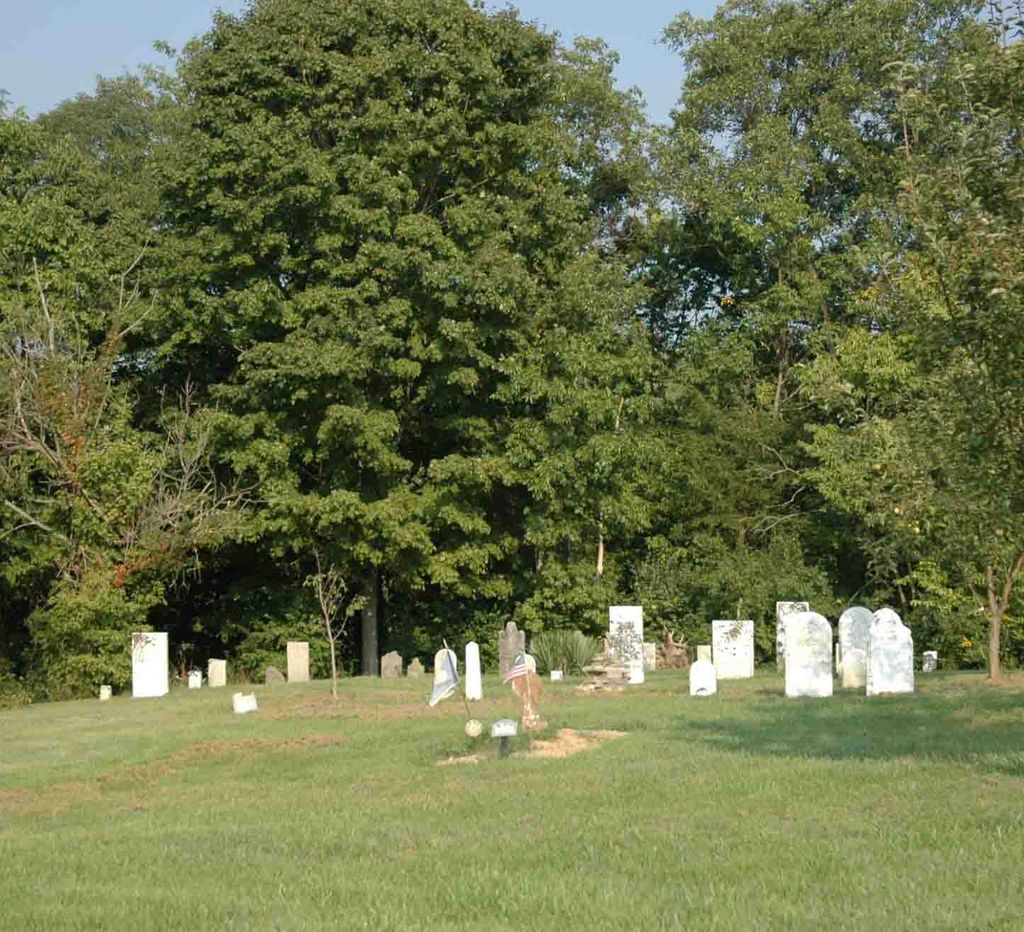
| Description | : | This cemetery is on the southeast side of Oglesbee Road about 2500 feet north of its intersection with Ohio State Route 73. The current owners of the property restored the cemetery after it had been buried for many years by floods and farming activity. They found several gravestones buried very deep. The cemetery is located in Chester Township, Clinton County, Ohio, and is # 1956 in “Ohio Cemeteries 1803-2003”, compiled by the Ohio Genealogical Society. |
frequently asked questions (FAQ):
-
Where is Howland Cemetery?
Howland Cemetery is located at 436 Oglesbee Road Oakland, Clinton County ,Ohio , 45177USA.
-
Howland Cemetery cemetery's updated grave count on graveviews.com?
1 memorials
-
Where are the coordinates of the Howland Cemetery?
Latitude: 39.4854260
Longitude: -83.8961610
Nearby Cemetories:
1. Center Friends Burying Ground
Wilmington, Clinton County, USA
Coordinate: 39.4824400, -83.8692800
2. Clinton Memory Gardens
Wilmington, Clinton County, USA
Coordinate: 39.4822000, -83.8675200
3. Sabin Cemetery
Wilmington, Clinton County, USA
Coordinate: 39.4845680, -83.9348320
4. Chester Friends Church Cemetery
Gurneyville, Clinton County, USA
Coordinate: 39.5197832, -83.8963175
5. Sharon United Methodist Church Cemetery
New Burlington, Clinton County, USA
Coordinate: 39.5047830, -83.9410410
6. Lytle Creek Cemetery
Clarksville, Clinton County, USA
Coordinate: 39.4406320, -83.8921200
7. Springfield Friends Cemetery
Adams Township, Clinton County, USA
Coordinate: 39.4512990, -83.9375810
8. Sligo Cemetery
Adams Township, Clinton County, USA
Coordinate: 39.4384850, -83.9270960
9. Jacob Jenkins Cemetery
Union Township, Clinton County, USA
Coordinate: 39.4857500, -83.8274200
10. Mount Pisgah Cemetery (Defunct)
Chester Township, Clinton County, USA
Coordinate: 39.5428640, -83.9177940
11. Mitchell Cemetery
Liberty Township, Clinton County, USA
Coordinate: 39.5346985, -83.8482971
12. Jonahs Run Cemetery
Chester Township, Clinton County, USA
Coordinate: 39.4964490, -83.9804860
13. Sugar Grove Cemetery
Wilmington, Clinton County, USA
Coordinate: 39.4408080, -83.8329850
14. Dover Friends Cemetery
Union Township, Clinton County, USA
Coordinate: 39.4971470, -83.8104230
15. Jenks Cemetery
Clarksville, Clinton County, USA
Coordinate: 39.4233322, -83.9319534
16. New Burlington-Oglesbee Cemetery
Lumberton, Clinton County, USA
Coordinate: 39.5506470, -83.8652910
17. Stanfield Cemetery
Clarksville, Clinton County, USA
Coordinate: 39.4264720, -83.9562220
18. Keiter Cemetery
Lumberton, Clinton County, USA
Coordinate: 39.5616989, -83.8814011
19. Gaddis Cemetery
Wilmington, Clinton County, USA
Coordinate: 39.4700012, -83.7966995
20. Peterson Family Cemetery
Chester Township, Clinton County, USA
Coordinate: 39.5638300, -83.9064910
21. Miller Cemetery
Lumberton, Clinton County, USA
Coordinate: 39.5499992, -83.8358002
22. Harris Cemetery
Vernon Township, Clinton County, USA
Coordinate: 39.4196170, -83.9644500
23. Branstator Farm Cemetery
Clarksville, Clinton County, USA
Coordinate: 39.4344690, -83.9833120
24. Harveysburg Hicksite Cemetery
Harveysburg, Warren County, USA
Coordinate: 39.5004610, -84.0046420