
| Memorials | : | 5 |
| Location | : | Spalding, Ralls County, USA |
| Coordinate | : | 39.6710014, -91.4680023 |
frequently asked questions (FAQ):
-
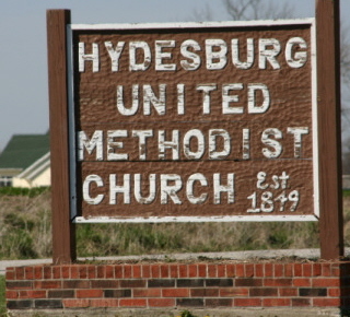
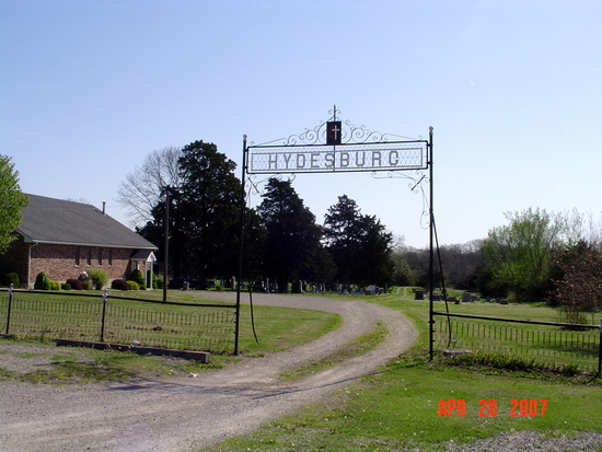
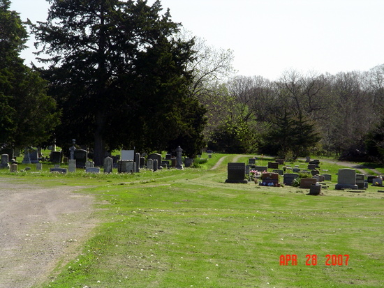
Where is Hydesburg Methodist Episcopal Church Cemetery?
Hydesburg Methodist Episcopal Church Cemetery is located at Spalding, Ralls County ,Missouri ,USA.
-
Hydesburg Methodist Episcopal Church Cemetery cemetery's updated grave count on graveviews.com?
5 memorials
-
Where are the coordinates of the Hydesburg Methodist Episcopal Church Cemetery?
Latitude: 39.6710014
Longitude: -91.4680023
Nearby Cemetories:
1. Bear Creek Cemetery
Hannibal, Marion County, USA
Coordinate: 39.6967010, -91.4456024
2. Old Turner Cemetery
Palmyra, Marion County, USA
Coordinate: 39.7040300, -91.4581800
3. Dimmitt Cemetery
Ralls County, USA
Coordinate: 39.6542015, -91.4263992
4. Providence Cemetery
Marion County, USA
Coordinate: 39.7066383, -91.4818878
5. Grand View Burial Park
Hannibal, Ralls County, USA
Coordinate: 39.6684900, -91.4153860
6. Baker Cemetery
Withers Mill, Marion County, USA
Coordinate: 39.7124200, -91.4912600
7. Big Creek Cemetery
Rensselaer, Ralls County, USA
Coordinate: 39.6669006, -91.5382996
8. Foreman Cemetery
Ralls County, USA
Coordinate: 39.6422005, -91.5338974
9. Salt Lick Cemetery
Spalding, Ralls County, USA
Coordinate: 39.6263500, -91.5192700
10. Nelson Cemetery
Marion County, USA
Coordinate: 39.7261009, -91.4257965
11. Williams Family Cemetery
Hannibal, Ralls County, USA
Coordinate: 39.6775980, -91.3819380
12. Head Cemetery
Marion County, USA
Coordinate: 39.7230988, -91.4132996
13. Minor-Sandage Cemetery
Hannibal, Marion County, USA
Coordinate: 39.7327995, -91.4336014
14. Barkley Cemetery
Hannibal, Marion County, USA
Coordinate: 39.7355995, -91.4981003
15. Mount Zion Cemetery
Hannibal, Marion County, USA
Coordinate: 39.7397003, -91.4360962
16. Hope Cemetery
Hannibal, Ralls County, USA
Coordinate: 39.6814003, -91.3705978
17. Bush Cemetery
Marion County, USA
Coordinate: 39.7486000, -91.4486008
18. Robinson Cemetery
Marion County, USA
Coordinate: 39.6903000, -91.3683014
19. West Ely Presbyterian Cemetery
West Ely, Marion County, USA
Coordinate: 39.7068860, -91.5618500
20. Hendren Family Cemetery
Marion County, USA
Coordinate: 39.7498000, -91.4408800
21. Holy Family Cemetery
Hannibal, Marion County, USA
Coordinate: 39.7243996, -91.3878021
22. McWilliams Cemetery
Marion County, USA
Coordinate: 39.7524986, -91.4542007
23. Saint Mary's Catholic Cemetery
Hannibal, Marion County, USA
Coordinate: 39.7249200, -91.3872400
24. Brinkmeier Cemetery
Ralls County, USA
Coordinate: 39.6719017, -91.3582993