
| Memorials | : | 0 |
| Location | : | Palmyra, Marion County, USA |
| Coordinate | : | 39.7040300, -91.4581800 |
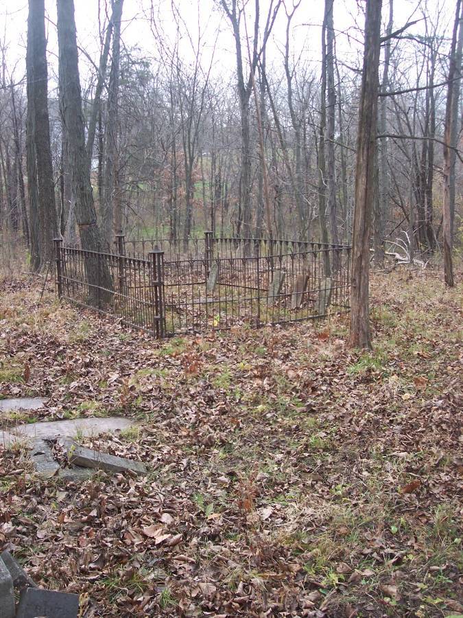
| Description | : | "Old Turner Cemetery" Marion County, MO., located on the South side of Route MM, in the West half of the SE Quarter of Section 28, Twp. 57N, R. 5. W., on property now owned by Kaser-Gallaway. A large number of bricks adjacent to the cemetery site indicate that there was once a church or dwelling right by the cemetery. In the year 1875, the 160 acres SE Quarter Section on which the cemetery is located was owned by J.P. Turner. John Turner owned the Quarter Section located to the South of J.P. Turner's place. Eunice Turner, wife of Gabriel... Read More |
frequently asked questions (FAQ):
-
Where is Old Turner Cemetery?
Old Turner Cemetery is located at Palmyra, Marion County ,Missouri ,USA.
-
Old Turner Cemetery cemetery's updated grave count on graveviews.com?
0 memorials
-
Where are the coordinates of the Old Turner Cemetery?
Latitude: 39.7040300
Longitude: -91.4581800
Nearby Cemetories:
1. Bear Creek Cemetery
Hannibal, Marion County, USA
Coordinate: 39.6967010, -91.4456024
2. Providence Cemetery
Marion County, USA
Coordinate: 39.7066383, -91.4818878
3. Baker Cemetery
Withers Mill, Marion County, USA
Coordinate: 39.7124200, -91.4912600
4. Nelson Cemetery
Marion County, USA
Coordinate: 39.7261009, -91.4257965
5. Hydesburg Methodist Episcopal Church Cemetery
Spalding, Ralls County, USA
Coordinate: 39.6710014, -91.4680023
6. Minor-Sandage Cemetery
Hannibal, Marion County, USA
Coordinate: 39.7327995, -91.4336014
7. Head Cemetery
Marion County, USA
Coordinate: 39.7230988, -91.4132996
8. Mount Zion Cemetery
Hannibal, Marion County, USA
Coordinate: 39.7397003, -91.4360962
9. Barkley Cemetery
Hannibal, Marion County, USA
Coordinate: 39.7355995, -91.4981003
10. Bush Cemetery
Marion County, USA
Coordinate: 39.7486000, -91.4486008
11. Hendren Family Cemetery
Marion County, USA
Coordinate: 39.7498000, -91.4408800
12. Grand View Burial Park
Hannibal, Ralls County, USA
Coordinate: 39.6684900, -91.4153860
13. McWilliams Cemetery
Marion County, USA
Coordinate: 39.7524986, -91.4542007
14. Whaley Cemetery
Marion County, USA
Coordinate: 39.7569008, -91.4405975
15. Dimmitt Cemetery
Ralls County, USA
Coordinate: 39.6542015, -91.4263992
16. Rush Cemetery
Hannibal, Marion County, USA
Coordinate: 39.7528161, -91.4195886
17. Rush Cemetery
Marion County, USA
Coordinate: 39.7528000, -91.4194031
18. Holy Family Cemetery
Hannibal, Marion County, USA
Coordinate: 39.7243996, -91.3878021
19. Saint Mary's Catholic Cemetery
Hannibal, Marion County, USA
Coordinate: 39.7249200, -91.3872400
20. Williams Family Cemetery
Hannibal, Ralls County, USA
Coordinate: 39.6775980, -91.3819380
21. Bates-Gash Cemetery
Gash Settlement, Marion County, USA
Coordinate: 39.7569600, -91.5095800
22. Thrasher Chapel Cemetery
Marion County, USA
Coordinate: 39.7728004, -91.4531021
23. Baskett Cemetery
Marion County, USA
Coordinate: 39.7724991, -91.4452972
24. Old Baptist Cemetery
Hannibal, Marion County, USA
Coordinate: 39.7157364, -91.3695450