| Memorials | : | 0 |
| Location | : | West Ely, Marion County, USA |
| Coordinate | : | 39.7068860, -91.5618500 |
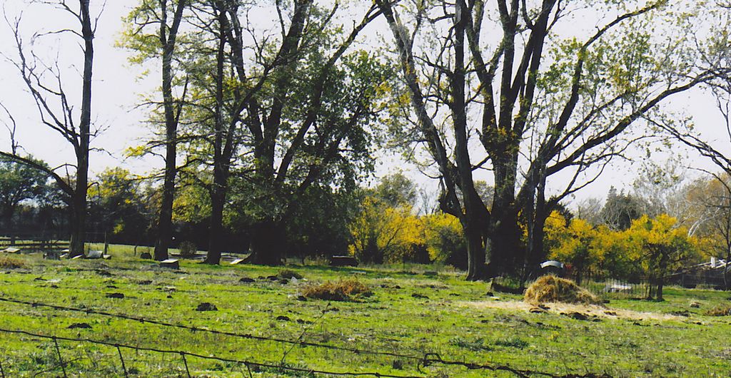
| Description | : | In a pasture South of West Ely Junction Next to 6618 County Road 263 west of Hannibal MO. One mile north of US Hwy 36. |
frequently asked questions (FAQ):
-
Where is West Ely Presbyterian Cemetery?
West Ely Presbyterian Cemetery is located at West Ely, Marion County ,Missouri ,USA.
-
West Ely Presbyterian Cemetery cemetery's updated grave count on graveviews.com?
0 memorials
-
Where are the coordinates of the West Ely Presbyterian Cemetery?
Latitude: 39.7068860
Longitude: -91.5618500
Nearby Cemetories:
1. West Ely Cemetery
West Ely, Marion County, USA
Coordinate: 39.7106018, -91.5655975
2. Finley Cemetery
Ralls County, USA
Coordinate: 39.6706009, -91.5781021
3. Big Creek Cemetery
Rensselaer, Ralls County, USA
Coordinate: 39.6669006, -91.5382996
4. Baker Cemetery
Withers Mill, Marion County, USA
Coordinate: 39.7124200, -91.4912600
5. Pleasant Hill Cemetery
Woodland, Marion County, USA
Coordinate: 39.7534200, -91.6029800
6. Barkley Cemetery
Hannibal, Marion County, USA
Coordinate: 39.7355995, -91.4981003
7. Shannon Cemetery
Woodland, Marion County, USA
Coordinate: 39.7375500, -91.6301000
8. Providence Cemetery
Marion County, USA
Coordinate: 39.7066383, -91.4818878
9. Bates-Gash Cemetery
Gash Settlement, Marion County, USA
Coordinate: 39.7569600, -91.5095800
10. Haden Cemetery
Marion County, USA
Coordinate: 39.7449500, -91.6294370
11. Foreman Cemetery
Ralls County, USA
Coordinate: 39.6422005, -91.5338974
12. Shropshire Cemetery
Marion County, USA
Coordinate: 39.7742500, -91.5201740
13. Mission Hill Baptist Church Cemetery
Palmyra, Marion County, USA
Coordinate: 39.7778600, -91.5196400
14. Old Turner Cemetery
Palmyra, Marion County, USA
Coordinate: 39.7040300, -91.4581800
15. Hydesburg Methodist Episcopal Church Cemetery
Spalding, Ralls County, USA
Coordinate: 39.6710014, -91.4680023
16. Marion County Infirmary Cemetery
Palmyra, Marion County, USA
Coordinate: 39.7870710, -91.5351030
17. Salt Lick Cemetery
Spalding, Ralls County, USA
Coordinate: 39.6263500, -91.5192700
18. Crane Cemetery
Palmyra, Marion County, USA
Coordinate: 39.7694016, -91.6406021
19. Bear Creek Cemetery
Hannibal, Marion County, USA
Coordinate: 39.6967010, -91.4456024
20. Mount Vernon United Methodist Church Cemetery
Sees Branch Settlement, Marion County, USA
Coordinate: 39.7297800, -91.6767200
21. Brush Creek Cemetery
Ralls County, USA
Coordinate: 39.6197650, -91.6040461
22. McWilliams Cemetery
Marion County, USA
Coordinate: 39.7524986, -91.4542007
23. Bush Cemetery
Marion County, USA
Coordinate: 39.7486000, -91.4486008
24. Greathouse Cemetery
Ralls County, USA
Coordinate: 39.6142006, -91.5991974

