
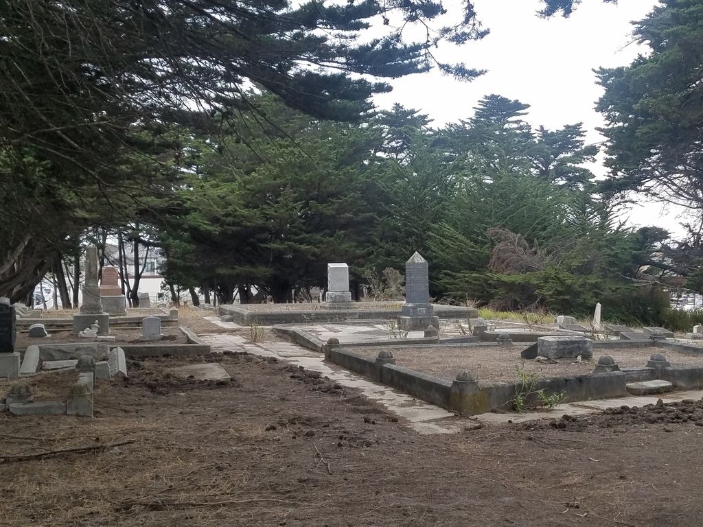
| Memorials | : | 13 |
| Location | : | Half Moon Bay, San Mateo County, USA |
| Coordinate | : | 37.4688510, -122.4274620 |
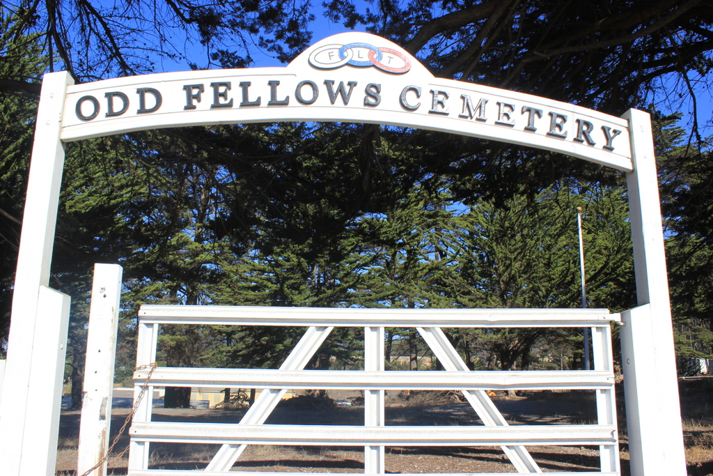
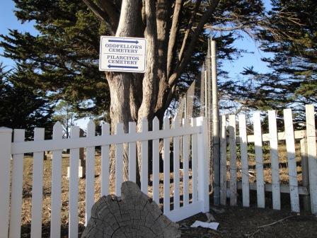
| Description | : | Traveling west on Hwy 92 towards Half Moon Bay, the cemetery is on your right or north side, immediately west of the Hilltop Mobile Home Park. Look for the row of cypress trees. This cemetery is just east of and immediately adjacent to Pilarcitos Cemetery. At present, there is no sign indicating that this is a separate cemetery, or an IOOF cemetery. The 2 cemeteries are separated only by a small fence with a dirt walkway that passes through them both. |
frequently asked questions (FAQ):
-
Where is Independent Order of Odd Fellows Cemetery?
Independent Order of Odd Fellows Cemetery is located at Main St. & Rt. 92 Half Moon Bay, San Mateo County ,California , 94019USA.
-
Independent Order of Odd Fellows Cemetery cemetery's updated grave count on graveviews.com?
12 memorials
-
Where are the coordinates of the Independent Order of Odd Fellows Cemetery?
Latitude: 37.4688510
Longitude: -122.4274620
Nearby Cemetories:
1. Pilarcitos Cemetery
Half Moon Bay, San Mateo County, USA
Coordinate: 37.4682140, -122.4292450
2. Our Lady of the Pillar Cemetery
Half Moon Bay, San Mateo County, USA
Coordinate: 37.4611610, -122.4263460
3. Skylawn Memorial Park
San Mateo, San Mateo County, USA
Coordinate: 37.4967120, -122.3697780
4. Gan Hazikaron Cemetery
San Mateo, San Mateo County, USA
Coordinate: 37.4960740, -122.3683830
5. Purissima Cemetery
Half Moon Bay, San Mateo County, USA
Coordinate: 37.4038860, -122.4150020
6. San Mateo County Poor Farm Cemetery
San Mateo, San Mateo County, USA
Coordinate: 37.5153430, -122.3350060
7. Harrington Cemetery
Belmont, San Mateo County, USA
Coordinate: 37.5032997, -122.3238983
8. Bourn Family Cemetery
Woodside, San Mateo County, USA
Coordinate: 37.4676100, -122.3124400
9. Saint John's Cemetery
San Mateo, San Mateo County, USA
Coordinate: 37.5483017, -122.3358002
10. Episcopal Church of Transfiguration Memorial Garde
San Mateo, San Mateo County, USA
Coordinate: 37.5273480, -122.3058880
11. Mathias Alfred Parkhurst Burial Site
Woodside, San Mateo County, USA
Coordinate: 37.4306710, -122.2770660
12. First Presbyterian Church Prayer Garden
Burlingame, San Mateo County, USA
Coordinate: 37.5857740, -122.3704280
13. Saint Peters Episcopal Church Columbarium
Redwood City, San Mateo County, USA
Coordinate: 37.4855750, -122.2389540
14. Union Cemetery
Redwood City, San Mateo County, USA
Coordinate: 37.4732700, -122.2231360
15. Gorilla Foundation Sanctuary
Woodside, San Mateo County, USA
Coordinate: 37.3750160, -122.2604360
16. Golden Gate National Cemetery
San Bruno, San Mateo County, USA
Coordinate: 37.6312447, -122.4348679
17. Dennis Martin Cemetery
San Mateo County, USA
Coordinate: 37.4203440, -122.2181370
18. Christ Episcopal Church Churchyard Columbarium
Portola Valley, San Mateo County, USA
Coordinate: 37.3821670, -122.2304160
19. Saint Bedes Episcopal Church Cemetery
Menlo Park, San Mateo County, USA
Coordinate: 37.4218750, -122.2075210
20. Oakwood Community Cemetery
Atherton, San Mateo County, USA
Coordinate: 37.4503120, -122.1956310
21. Orange Memorial Park (Defunct)
South San Francisco, San Mateo County, USA
Coordinate: 37.6542015, -122.4257965
22. Holy Cross Catholic Cemetery
Menlo Park, San Mateo County, USA
Coordinate: 37.4350420, -122.1978540
23. Corpus Christi Monastery
Menlo Park, San Mateo County, USA
Coordinate: 37.4589200, -122.1801900
24. Trinity Episcopal Church Memorial Garden
Menlo Park, San Mateo County, USA
Coordinate: 37.4562300, -122.1789300