
| Memorials | : | 12 |
| Location | : | Lawton, Comanche County, USA |
| Coordinate | : | 34.5823500, -98.2119500 |
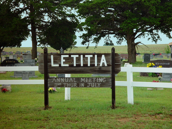
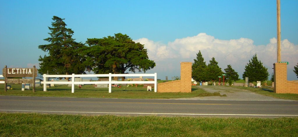
| Description | : | This cemetery was established when the daughter of Eliga and Mary Moore Haggard became ill on the way to their farm in Oklahoma. She was 19 years old, and requested that she be buried in the Northwest corner of their farm. When Annie T. (Letitia "Tessie") died, her father granted her wish, and she was buried where she asked. Later, a neighbor also died and his family asked if he could also be buried there. The request was granted and Elgah and his wife, Mary Moore Haggard (known as Elijah in some records)then gave an acre for the cemetery and... Read More |
frequently asked questions (FAQ):
-
Where is Letitia Cemetery?
Letitia Cemetery is located at Lawton, Comanche County ,Oklahoma ,USA.
-
Letitia Cemetery cemetery's updated grave count on graveviews.com?
8 memorials
-
Where are the coordinates of the Letitia Cemetery?
Latitude: 34.5823500
Longitude: -98.2119500
Nearby Cemetories:
1. Crouch Cemetery
Lawton, Comanche County, USA
Coordinate: 34.5794100, -98.1625000
2. Rock Creek Cemetery
Duncan, Stephens County, USA
Coordinate: 34.5499992, -98.1055984
3. Denton Cemetery
Marlow, Stephens County, USA
Coordinate: 34.6669006, -98.1331024
4. Flower Mound Cemetery
Lawton, Comanche County, USA
Coordinate: 34.5790100, -98.3518600
5. Eschiti Family Cemetery
Stephens County, USA
Coordinate: 34.4858100, -98.1263400
6. Devine Cemetery
Geronimo, Comanche County, USA
Coordinate: 34.4926300, -98.3131400
7. Allendale Cemetery
Comanche County, USA
Coordinate: 34.4933014, -98.3143997
8. Indian Agency Cemetery
Fort Sill, Comanche County, USA
Coordinate: 34.6423000, -98.3924100
9. Sterling Cemetery
Sterling, Comanche County, USA
Coordinate: 34.7386017, -98.1675034
10. Shackelford Cemetery
Fivemile Corner, Cotton County, USA
Coordinate: 34.4217400, -98.2429500
11. Highland Cemetery
Lawton, Comanche County, USA
Coordinate: 34.6319008, -98.4002991
12. Saint Andrews Episcopal Church Columbarium
Lawton, Comanche County, USA
Coordinate: 34.6048400, -98.4086090
13. Apache North Cemetery
Lawton, Comanche County, USA
Coordinate: 34.6958008, -98.3681030
14. Apache South Cemetery
Lawton, Comanche County, USA
Coordinate: 34.6946983, -98.3711014
15. Fort Sill Pet Cemetery Annex
Fort Sill, Comanche County, USA
Coordinate: 34.6687700, -98.3942000
16. Beef Creek Apache Cemetery
Lawton, Comanche County, USA
Coordinate: 34.6969100, -98.3704500
17. Chief Chihuahua Apache Cemetery
Elgin, Comanche County, USA
Coordinate: 34.7003350, -98.3677160
18. Fort Sill Post Cemetery
Fort Sill, Comanche County, USA
Coordinate: 34.6693760, -98.3957700
19. First United Methodist Church Columbarium
Lawton, Comanche County, USA
Coordinate: 34.6152870, -98.4261090
20. Otipoby Comanche Cemetery
Lawton, Comanche County, USA
Coordinate: 34.7132330, -98.3694950
21. Woodlawn Cemetery
Grady County, USA
Coordinate: 34.7241667, -98.0633333
22. Elgin Memorial Cemetery
Elgin, Comanche County, USA
Coordinate: 34.7813988, -98.2647018
23. Resthaven Memorial Gardens
Duncan, Stephens County, USA
Coordinate: 34.5516700, -97.9651800
24. Saint Ann's Cemetery
Elgin, Comanche County, USA
Coordinate: 34.7825012, -98.2714005