| Memorials | : | 2 |
| Location | : | Amelia, Alleghany County, USA |
| Coordinate | : | 36.5485300, -81.2084480 |
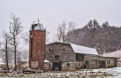
| Description | : | Home of Isaac W Landreth and wife Elizabeth "Betty" Long. He received the land from his father Dr Stevie Landreth. The property is on the old road to Piney Creek now closed. It is sided on the west by Elk Creek and Tedder Hill. The cemetery is enclosed with a cement wall and maintained by the family. Isaac was a survivor of Pickett's Charge, a legislator and a Minister of the Union Baptist Church. Pass Elk Creek Church going north, down hill at first curve, take right thru woods, pass R E Landreth home, turn and go up hill, cemetery on right at drive. |
frequently asked questions (FAQ):
-
Where is Isaac W Landreth Cemetery?
Isaac W Landreth Cemetery is located at Amelia, Alleghany County ,North Carolina ,USA.
-
Isaac W Landreth Cemetery cemetery's updated grave count on graveviews.com?
2 memorials
-
Where are the coordinates of the Isaac W Landreth Cemetery?
Latitude: 36.5485300
Longitude: -81.2084480
Nearby Cemetories:
1. Samuel Phipps Cemetery
Amelia, Alleghany County, USA
Coordinate: 36.5452610, -81.2008780
2. Dunkard Church Cemetery
Alleghany County, USA
Coordinate: 36.5575700, -81.2286520
3. W N Taylor Cemetery
Independence, Grayson County, USA
Coordinate: 36.5730810, -81.1850520
4. Coxs Chapel Cemetery
Independence, Grayson County, USA
Coordinate: 36.5792007, -81.2285995
5. Edwards Cemetery
Alleghany County, USA
Coordinate: 36.5425500, -81.2525400
6. Bob Marsh Cemetery
Independence, Grayson County, USA
Coordinate: 36.5730180, -81.2428840
7. Enoch and Kilby Reeves Cemetery
Alleghany County, USA
Coordinate: 36.5431330, -81.1625160
8. Caudill Cemetery
Independence, Grayson County, USA
Coordinate: 36.5796920, -81.1825330
9. Bethany Community Cemetery
Independence, Grayson County, USA
Coordinate: 36.5711260, -81.1704540
10. Osborne R. Anders Cemetery
Independence, Grayson County, USA
Coordinate: 36.5882890, -81.2049070
11. Ruth Howell Gravesite
Cox Mill, Grayson County, USA
Coordinate: 36.5906680, -81.2195970
12. William Ham Family Cemetery
Cox Mill, Grayson County, USA
Coordinate: 36.5920690, -81.2109530
13. Mountain View Baptist Church Cemetery
Independence, Grayson County, USA
Coordinate: 36.5922690, -81.1917250
14. Ben Taylor Cemetery
Independence, Grayson County, USA
Coordinate: 36.5938300, -81.1990000
15. Riley Ward Family Cemetery
Grayson County, USA
Coordinate: 36.5777750, -81.2564670
16. William Farmer Cemetery
Independence, Grayson County, USA
Coordinate: 36.5961890, -81.1895530
17. Cox Cemetery
Independence, Grayson County, USA
Coordinate: 36.5928001, -81.1785965
18. Hardin Cox Family Cemetery
Independence, Grayson County, USA
Coordinate: 36.5932380, -81.1790320
19. Anders Family Cemetery (Defunct)
Independence, Grayson County, USA
Coordinate: 36.5760000, -81.1550000
20. Thomas Anders Family Cemetery
Independence, Grayson County, USA
Coordinate: 36.5760100, -81.1549830
21. Andrew Jackson Haga Cemetery
Independence, Grayson County, USA
Coordinate: 36.5988000, -81.1974300
22. Gilham Cemetery
Independence, Grayson County, USA
Coordinate: 36.5907860, -81.1720840
23. Enoch W. Cox Family Cemetery
Elk Creek, Grayson County, USA
Coordinate: 36.5900000, -81.2500000
24. Hardin Reeves Family Cemetery
Independence, Grayson County, USA
Coordinate: 36.5710400, -81.1475930

