
| Memorials | : | 16 |
| Location | : | Polk County, USA |
| Coordinate | : | 35.3317700, -82.2672800 |
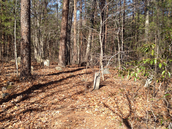
| Description | : | This cemetery is located at the end of N.C. Route 1155 (Palmer Road). It is located within the Bright's Creek Gated Community. It is on the west side of a road within the community, approximately 100 yards up a steep rise. There is no clear trail to the cemetery and it is not being maintained. |
frequently asked questions (FAQ):
-
Where is Jackson at Bright's Creek Cemetery?
Jackson at Bright's Creek Cemetery is located at Polk County ,North Carolina ,USA.
-
Jackson at Bright's Creek Cemetery cemetery's updated grave count on graveviews.com?
16 memorials
-
Where are the coordinates of the Jackson at Bright's Creek Cemetery?
Latitude: 35.3317700
Longitude: -82.2672800

Nearby Cemetories:
1. Early Cemetery
Mill Spring, Polk County, USA
Coordinate: 35.3278821, -82.2504389
2. Arledge Cemetery
Mill Spring, Polk County, USA
Coordinate: 35.3154550, -82.2534460
3. Patty Cemetery
Polk County, USA
Coordinate: 35.3041992, -82.2786026
4. Mountain View Baptist Church Cemetery
Mill Spring, Polk County, USA
Coordinate: 35.3533530, -82.2353240
5. Silver Creek Baptist Church Cemetery
Mill Spring, Polk County, USA
Coordinate: 35.3209460, -82.2270300
6. Bradley Cemetery
Polk County, USA
Coordinate: 35.2935982, -82.2857971
7. Jones-Price Cemetery
Polk County, USA
Coordinate: 35.2933006, -82.2966995
8. Reese Bradley Cemetery
Dana, Henderson County, USA
Coordinate: 35.3386500, -82.3294800
9. Indian Jack Cemetery
Edneyville, Henderson County, USA
Coordinate: 35.3762500, -82.3095556
10. Bradley Cemetery
Polk County, USA
Coordinate: 35.2793999, -82.3035965
11. Union Hill Holiness Baptist Church Cemetery
Hendersonville, Henderson County, USA
Coordinate: 35.3522000, -82.3395000
12. Jones Cemetery at Sugarloaf
Henderson County, USA
Coordinate: 35.3669014, -82.3321991
13. Stepp Cemetery
Hendersonville, Henderson County, USA
Coordinate: 35.3365000, -82.3464000
14. Stepp Round Hill Cemetery
Hendersonville, Henderson County, USA
Coordinate: 35.3367483, -82.3464429
15. John Jackson Family Cemetery
Edneyville, Henderson County, USA
Coordinate: 35.3801861, -82.3202583
16. Mountain Home Baptist Church Cemetery
Edneyville, Henderson County, USA
Coordinate: 35.3950745, -82.2884417
17. Byers Family Cemetery
Edneyville, Henderson County, USA
Coordinate: 35.3810500, -82.3298310
18. Coopers Gap Baptist Church Cemetery
Mill Spring, Polk County, USA
Coordinate: 35.3786030, -82.1986630
19. Victory in Jesus Baptist Church Cemetery
Mill Spring, Polk County, USA
Coordinate: 35.3573120, -82.1833700
20. Basiewicz Family Cemetery
Dana, Henderson County, USA
Coordinate: 35.3343700, -82.3603700
21. Collins Cemetery
Edneyville, Henderson County, USA
Coordinate: 35.4082280, -82.2849970
22. Mount Moriah Baptist Church Cemetery
Edneyville, Henderson County, USA
Coordinate: 35.3911580, -82.3324770
23. Hill Family Cemetery
Dana, Henderson County, USA
Coordinate: 35.3416300, -82.3652940
24. Holbert Cove Family Cemetery
Polk County, USA
Coordinate: 35.2554270, -82.3033690